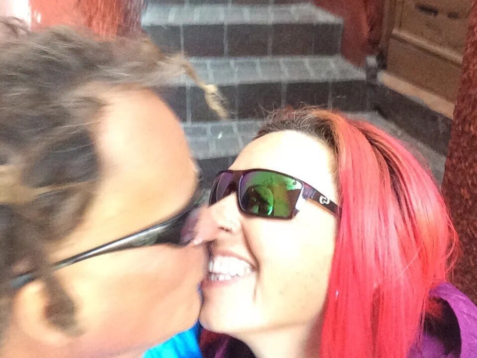
“Guanajuato to Raices” I really enjoyed my time in Guanajuato; it’s my favorite city in Mexico so far. Before leaving town we visited Callejon de Besos, and climbed a gazillion stairs to a huge sculpture, El Pípil, of a man the sits high above the city.
 [Callejon de Besos (alley of the kiss), the site of a classic love story with a tragic ending. Legend has it that if a couple kisses on the third step their love will last forever (…or they’ll avoid seven years of bad luck. There seems to be some variation in what kissing on the third step will bring).]


 ________[El Pípil, a miner who played a key role in helping to defeat the spanish during the war of independence in 1810 sits high above the city. It’s a lot of steps to get there, but there’s also a great view of Guanajuato.]


 Our route out of town took us through mining land, then to a high saddle where we found great camping nestled in a small grove of trees on the ridge.


 The next day we continued through patches of forest and open grassy hillsides before dropping down to a small town where we bought a few more supplies. We crossed over a small highway then back into open grassy hills. I was still moving a bit slow with my broken toe so we decided to stop early to camp.

 The ride into, and out of, San Miguel de Allende was on busy highways. It’s a beautiful city, but much too crowded for our tastes. We spent one night in San Miguel, and enjoyed great coffee at Cafe Buen Dia in the morning.


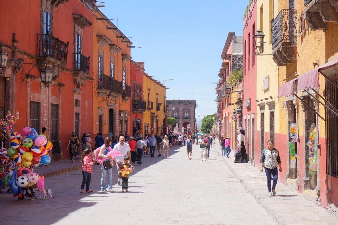

 There was a lot of traffic, and mostly paved roads, between San Miguel de Allende and Apaseo el Alto, but we still managed to find a nice campsite and enjoy a few quiet rest breaks along the way.

 [This dog hung out at our camp for quite awhile.]


 [Mudpots on our way into Apaseo el Alto. There were a lot of hot, steaming pools and mud pots for a couple of kilometers. I would have thought an area like this would be a park, but it was mostly abandoned with cris-crossing roads through it.]We found an inexpensive hotel in Apaseo el Alto that had crazy, narrow, winding stairs up to our room, and doors of a variety of sizes.
 We stopped in a little pizza place for dinner and beer. One of the owners sat down a chatted with us for a long time, sharing stories from his time in the U.S. and telling us about cool places in Mexico that we might like to visit.
 Our route took us on a paved highway through the town of Jerecuaro, then turned back into the mountains and onto a dirt road, a nice and quiet change from the last few days of noisy highway riding. We found a beautiful campsite between Chilarillo and Puruagua on a small cliff above the road. It was an enchanted little area in a beautiful pine forest dotted with a few cactus, ferns, and epiphytes. We listened to wippoorwills, owls, and other animal sounds as the sky grew dark.
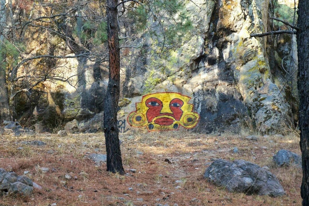 The next day we stopped for coffee in Puruagua, it was instant coffee, but we enjoyed sitting in the town square watching the locals move about their day. We rode pavement out of town until we turned onto cobble and dirt roads that led high into the mountains.


 After descending from the highpoint we detoured off the route we had been following, hoping to avoid some of its busy highways. We crossed to the other side of the mountains, then rode a quiet paved road into the town of Tetuxtepec where we found a cheap hotel for the night. We asked around for a place to eat, most places were closed, but we finally found a tiny kitchen that was open. They were hesitant when we asked about dinner, then said they had rice and beans. We smiled and said that would be great. Then the offered us a tostada. I wasn’t sure what it was; it sort of looked like pork or hamburger. Neon asked if it was meat, and they said no, they don’t eat meat on Fridays and explained that it was TVP (soy). It was delicious, made up like a ceviche tostada.
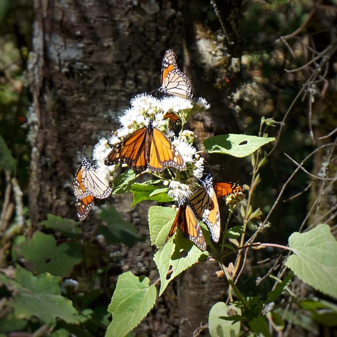
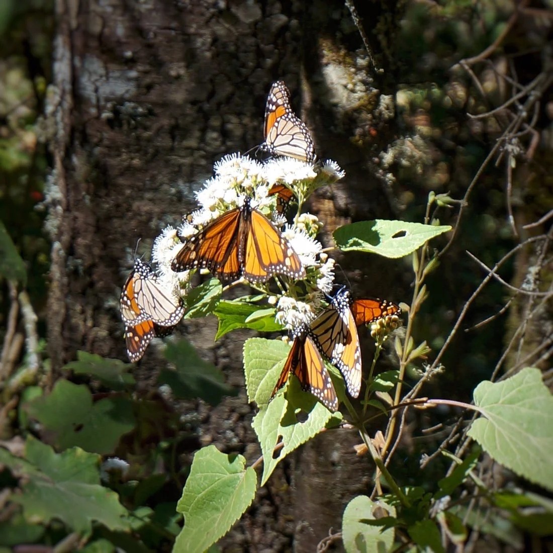
 The next day we rode high up into the mountains where the monarch butterflies spend the winters in Mexico. The lower parts of the mountains are pretty populated, but we still managed to find a place to camp out of sight in the trees.

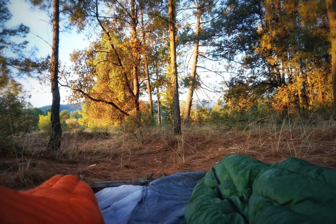 The next morning we finally made it to a high pass, Puerta de Llano, and just in time to roll into a bike race / endurance challenge. It was super fun descending down the other side of the pass with hundreds of cyclists racing by. All the road guards directing traffic just kept waving us along with the other cyclists.Twenty kilometers whizzed by in what seemed like minutes. Lots of “thumbs up” and double-takes as we rolled through the cycle route.

 We followed the cycle route down the highway, then side streets paved in cobblestones, to a dirt road that led into deep green hills before we decided that maybe it was time to look at a map to see how far off of our route we were.
 Several cyclists stopped to take photos with us. And the coolest part… …several days prior when we were riding through the small town of Jerecuaro—we were a bit flustered on our way out of town to find a place to camp; we stopped at a bank to get cash, and just then a man driving a bus stopped to say hello to us since he is also a cyclist …now back to the bike race… as we were riding down the dirt road, wondering how much longer we should follow all these cyclists into the hills for which our map didn’t show any roads … a guy stops Neon and says he met us a few days ago in Jerecuaro. It was the bus driver!
 We got back on route and found a hotel in Ocampo, the main town for access to the El Rosario monarch sanctuary. We spent the morning at the sanctuary, arriving early enough to catch the monarchs as they took flight from the trees after being warmed by the sun. Seemed not too different from our camping strategy, as we generally don’t emerge from our sleeping bags until the sun shines on them, warming everything in the process.
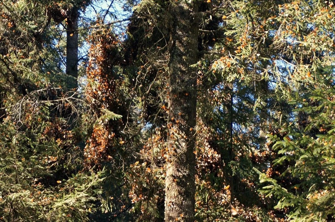


 […our guide, showing us the black spots on the lower wings. The two black dots mean it’s a male monarch.]
 The monarch sanctuary was pretty special for me; I’d always want to see all those monarchs gathered in one place, and I finally did; I only had to ride my bike 5000+ km, but I got there.


 We visited some nearby archeological ruins after leaving Ocampo, the San Felipe de Los Alzalti pyramids. Then after too much highway pedaling we finally turned onto a sweet little dirt road heading to the tiny village of Macheros.
 We were hoping to visit the monarch preserve at Cerro Pélon, but after arriving in town we were told they had already migrated north from this location. But the countryside was gorgeous and we were invited to camp in a local’s avocado orchard. A bright orange sunset, topped off with a little tequila, clear skies, and a night full of stars = perfect day


 After that our route followed busy highways, way too busy for our tastes, but we pressed on, for a couple of days, through Valle de Bravo, to just past Mesón Viejo before finally turning onto a dirt road heading to Raices (a small town at the foot of Nevado de Toluca).


 _____________________You can sign up to receive The Redheaded Nomad’s blog posts in your email inbox; sign up at the bottom of any page on my website: theredheadednomad.comFor more frequent updates, follow me on Instagram at: instagram.com/theredheadednomadYou can also find me on Facebook at: facebook.com/redheadednomad_____________________
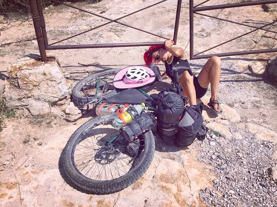
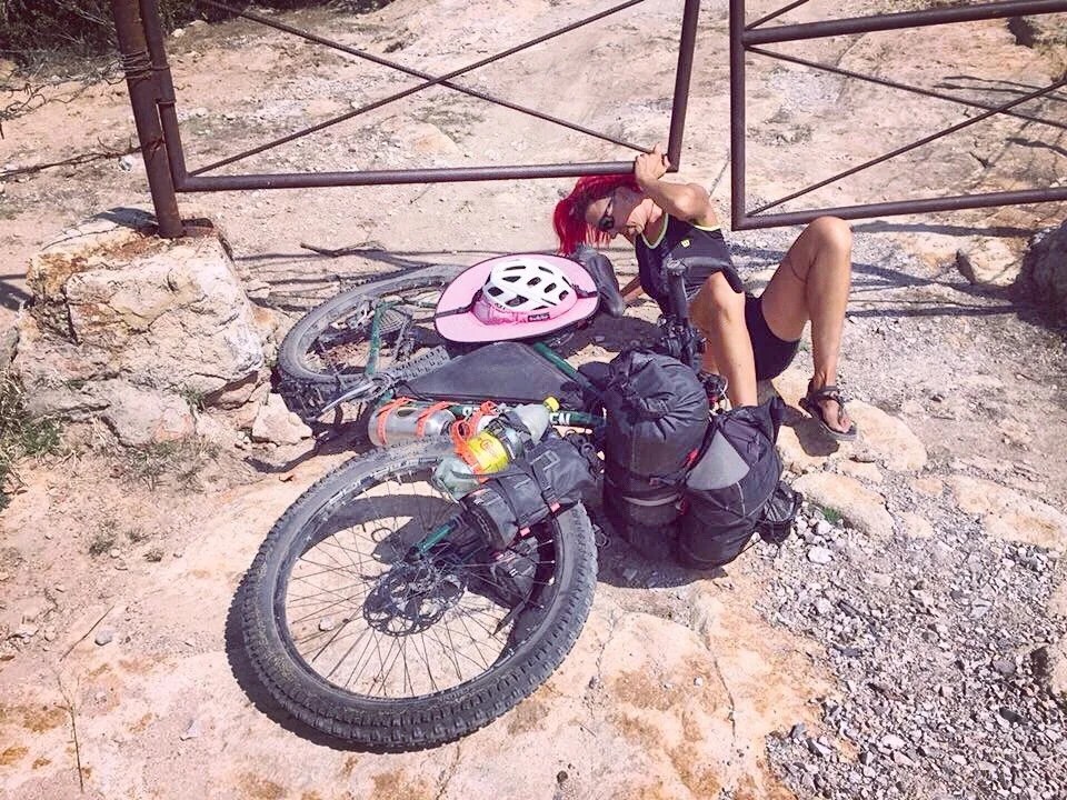
 After spending a week in Zacatecas, taking care of business, we were happy to get back on the bikes and ride into the mountains. Our day started on pavement. We left Zacatecas and rode through Guadalupe.


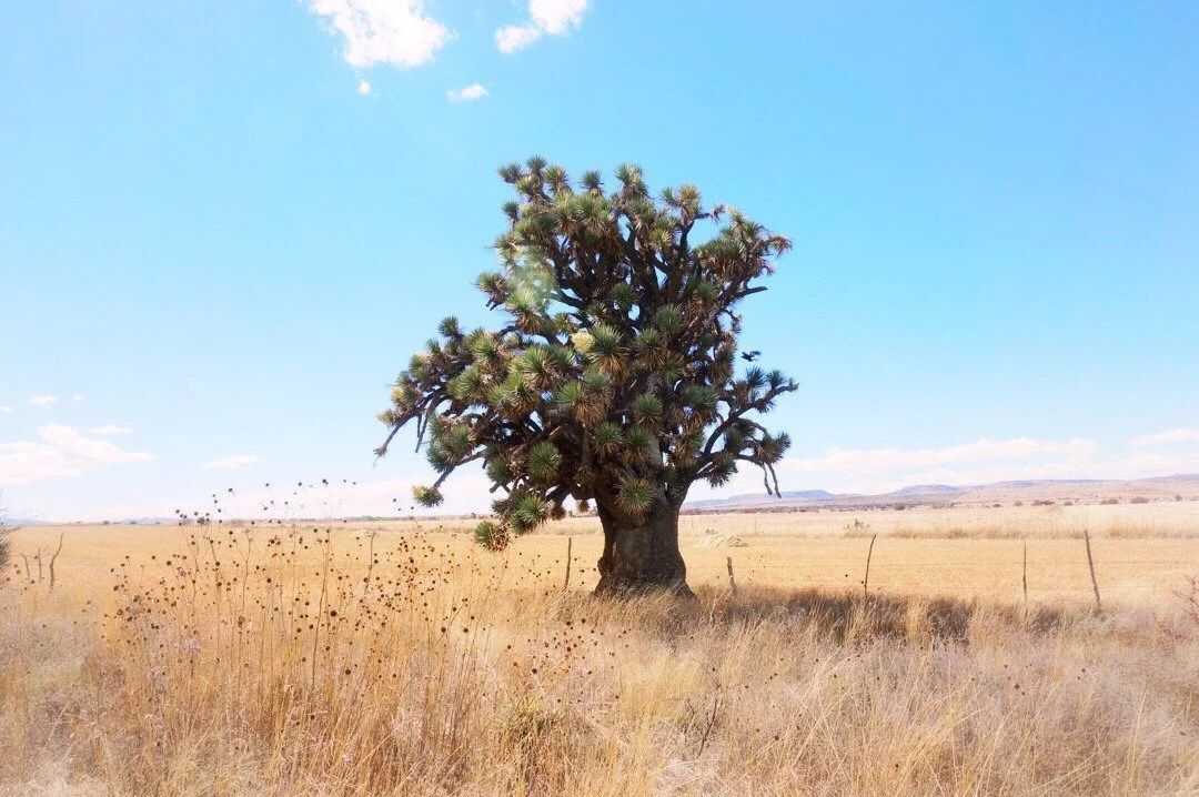 [i think this is the largest tree-like yucca I’ve seen yet. It’s trunk was the size of an old growth oak.]
 We stopped for more water and a few supplies in the town of Genaro Codina, a cute little town where we attracted a lot of attention. We pushed our bikes up a steep, rocky road, then rode more pavement until we passed through a gate and onto singletrack that led us to a dirt road and into the mountains.


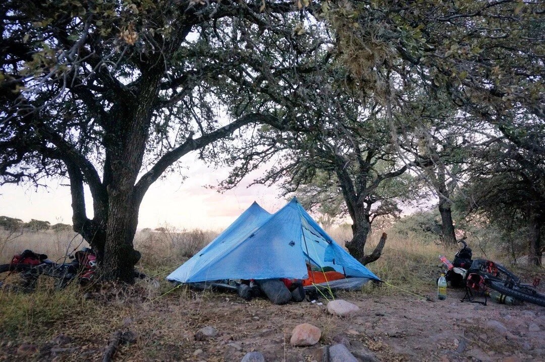
 We found suitable camping in a wash surrounded by trees. The morning brought a mix of dirt roads and pavement until we reached San Jose de Gracia, a tourist town north and a little west of Auguascalientes.
 [I’ve been seeing rock walls like these a lot. Some of them stretch for miles across the landscape.]


 We stopped at a store for supplies and were met with smiles and offers of free camping. It was still early in the afternoon so we decided to keep riding. At the southern end of town is where the fun started. The first obstacle, a giant dam.


 [The “stairs of despair”]Our gps track went over the walkway on the top of the dam, and down the “stairs of despair” (very steep stairs). But looking down into the canyon we could see a path that led all the way to the bottom, and what looked like a faint trail up the other side.
 We decided to chance going down and back up instead of removing our luggage and lowering our bikes one at a time down the steep stairs. When we reached the bottom of the canyon we found a rocky, though doable, trail leading up the other side. It was a push, but easier than descending the stairs of dispair.
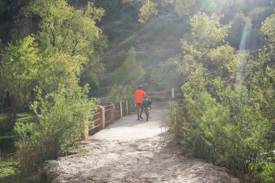


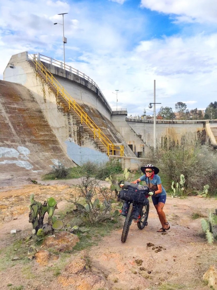
 Once back up, and on the other side of the dam, we passed through a gate and went cross-country until we picked up a faint singletrack trail, or perhaps it started as an animal path.We rode for a short ways before deciding to set up camp, between the tree-like prickly pears, in a perfect spot overlooking the reservoir and facing the sunset.


 [On the Horizon no.2]The next day brought some of the best riding we’ve had so far, high on a ridge with canyon views around every corner, surround by grasslands and deserts. The riding was a mix of dirt roads and singletrack.


 We met several mountain bikers, squeezed our bikes under gates (and lifted them over other gates), push our bikes through the rockiest sections, and rode amazing trails across the ridges.


 […gathering water, albeit a bit muddy]At one of the last gates, near the end of the day, we decided to take a detour around the gate and the rock wall. We followed the rock wall until its end, then around the corner, until we found ourselves in very rocky, and a bit steep at times, terrain, surround by prickly bushes and cactus.

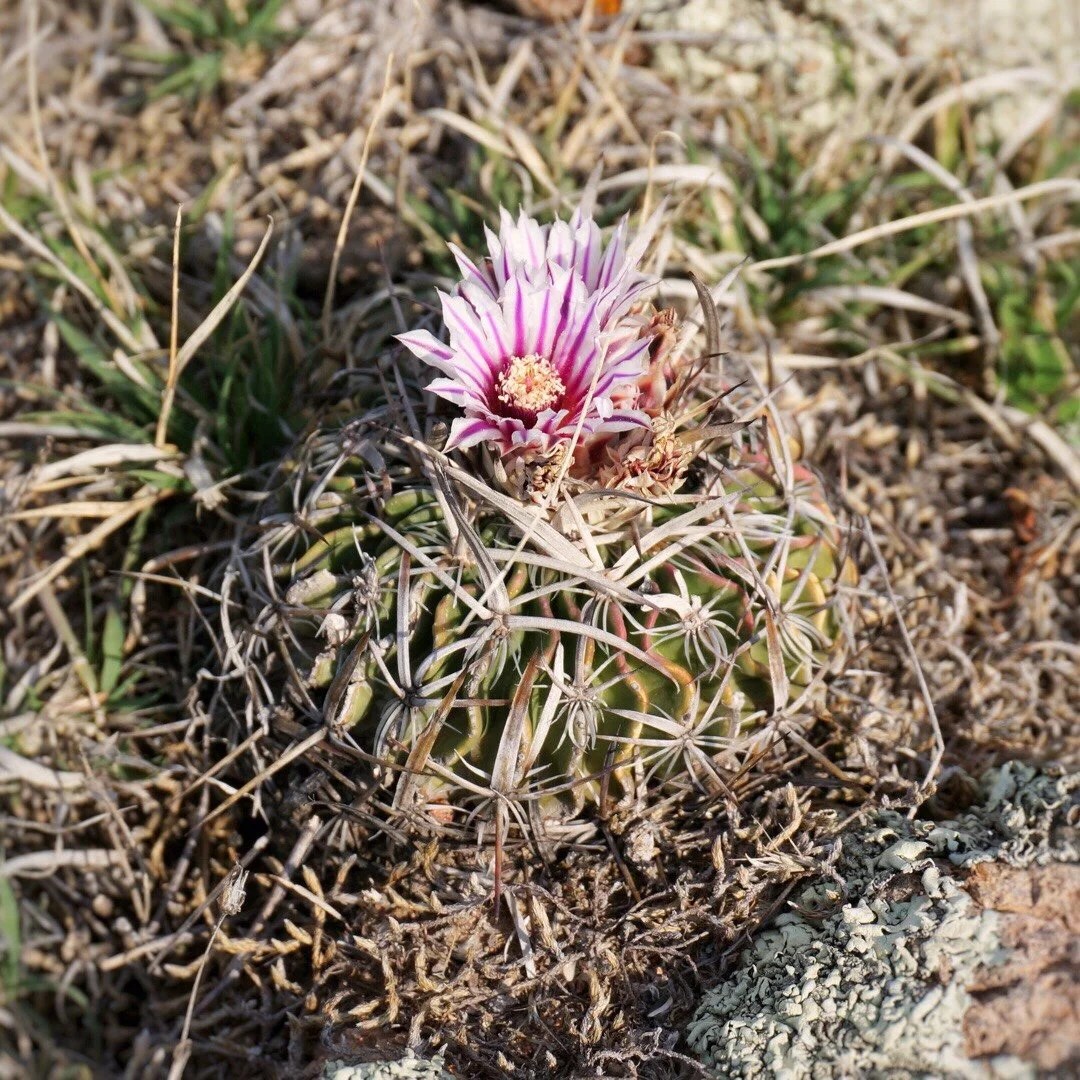
 [The water in the little puddle, was mostly clear, and tasted delicious.]
 It didn’t really go the way we had hoped, and turned out to be more difficult than just lifting our bikes over the gate, but I did find good, mostly clear water. We eventually decided to just haul our bikes over the rock wall (two walls by this point) to get back onto our track. After squeezing our bikes under another locked gate we set up camp and watched the sunset.
 We didn’t make much distance on this day, but it was a great day, and we weren’t in any hurry to be anywhere other than here.The next day brought another locked gate before we gained a good dirt road into the small town of La Tomatina. We bought water and produce and had a picnic in the park. We rode fast pavement on a couple of highways to the south of Auguascalientes where we found a cheap hotel for 250 pesos. There was no good coffee bar nearby, so we settled for hot coffee from the OXXO minimart.
 [It was actually pretty decent coffee …but now I’m thinking I need to acquire a lightweight reusable cup with a lid for when I get coffee at a minimart.]_____________________You can sign up to receive The Redheaded Nomad’s blog posts in your email inbox; sign up at the bottom of any page on my website: theredheadednomad.comFor more frequent updates, follow me on Instagram at: instagram.com/theredheadednomadYou can also find me on Facebook at: facebook.com/redheadednomad_____________________

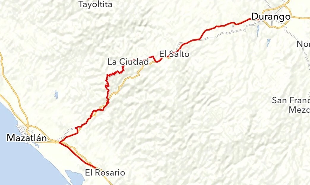 We rode to El Rosario to visit Neon’s cousin. It was out of the way from our route, but we found a nice back road route from Villa Union. Our plan was to take a curvy mountain road from El Rosario to Mesillas (see map below), then take the little highway over to Concordia that connects Mex-40D to Mex-40. But after asking around in El Rosario we were advised against traveling on the curvy road from El Rosario to Mesillas because it would be too dangerous.
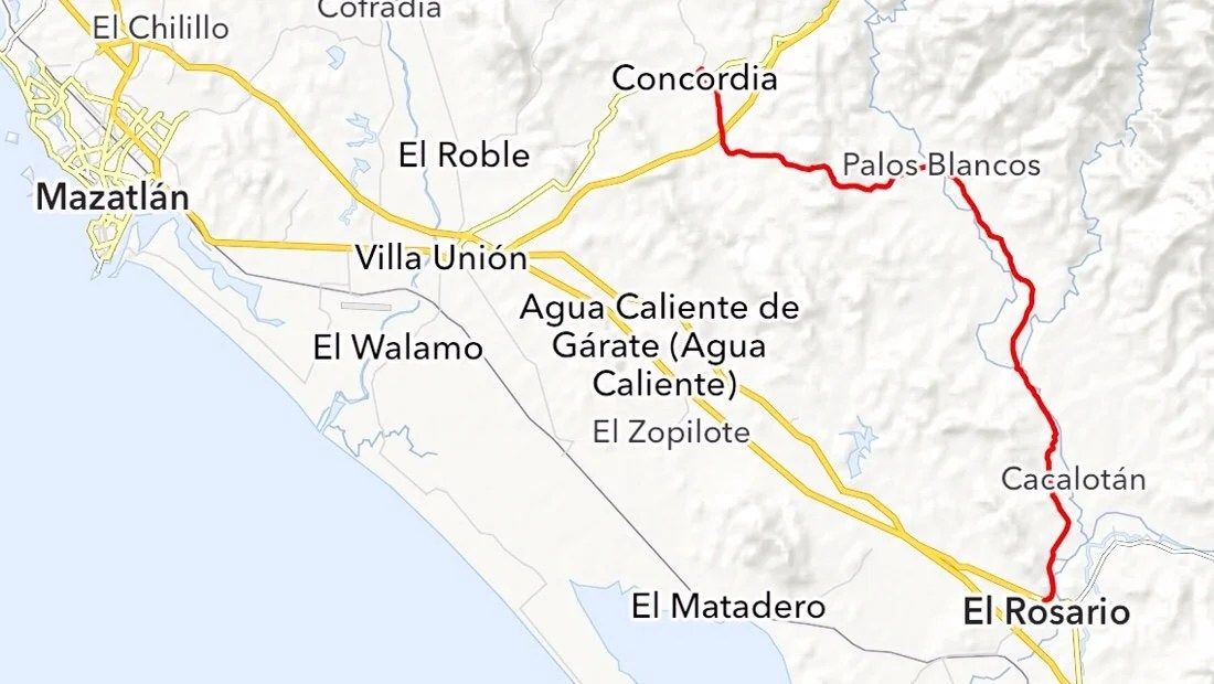 That left us with two other choices, either ride back to Villa Union the way we had come, or take Mex-15D (or Mex-15) to Villa Union to connect to Mex-40D. We chose to take Mex-15D, the Cuota (toll road), since it has a big shoulder.
 Riding paved roads is something we usually try to avoid, but it’s often what connects the dots between more awesome parts of a route. The toll road turned out to be a good alternative to get back onto our route. Technically bicycles aren’t allowed on the toll roads (see the sign to Neon’s right), but many cyclists riding in Mexico take it anyway since it has a big shoulder. We saw three locals cycling on the toll road, and one touring cyclist.

 When we exited the toll road, the guy in the pay booth walked over to move the orange cone out of the way for us, since it was blocking our way around the pay gate. While pavement may not have that wilderness riding aesthetic that we enjoy most, the kilometers do pass by quickly. We made 65 km in less than 4 hours, from El Rosario to Concordia, on a loaded bike, with A LOT of uphill riding.

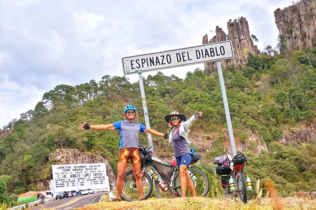
 From Concordia we took the Libre, (free road), Mex-40, so we could ride the “Espinazo del Diablo”, the spine of the devil. It is a famously curvy and spectacular road that crosses the Sierra Madre.The highway leaving Concordia started out deceptively gentle, before climbing higher and higher until we reached the turn to the town of Copala.

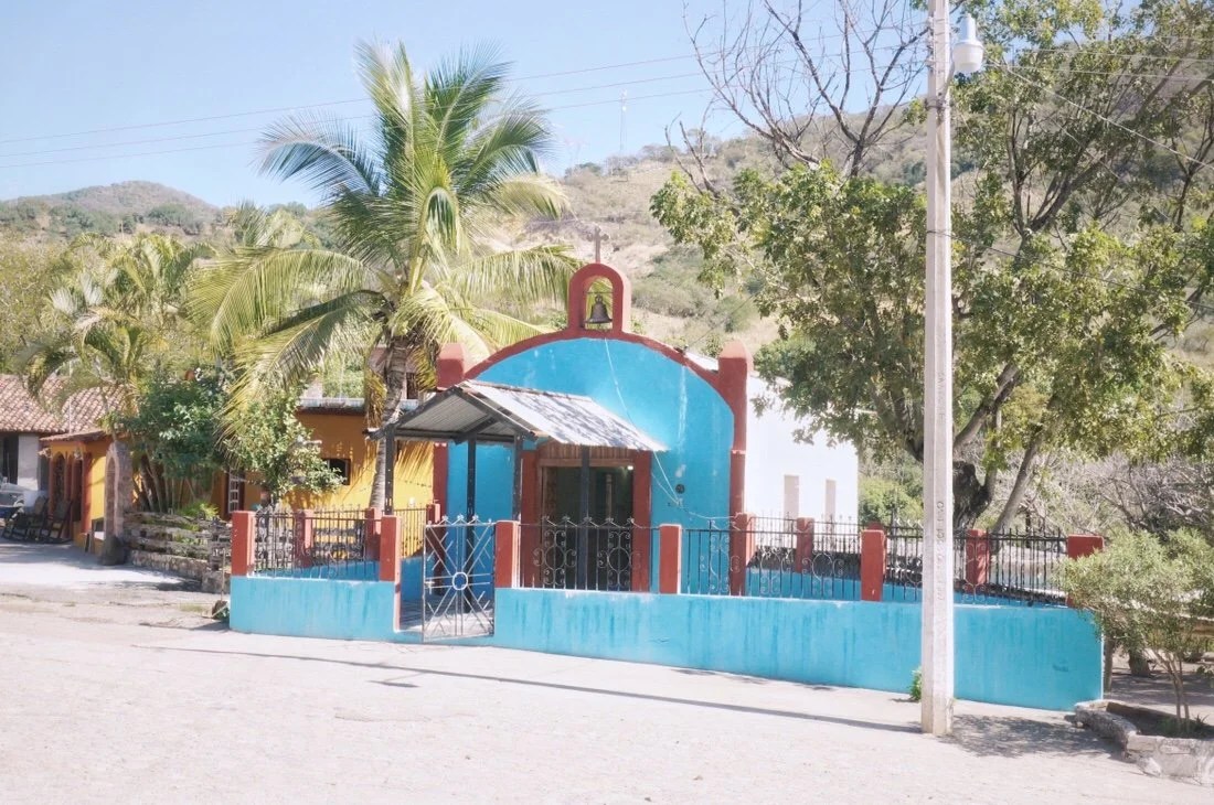 We passed through small settlements on the way to Copala. Every little village seems to have their own church.
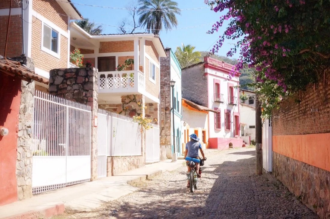 Copala turned out to be my favorite little town so far on the mainland. The streets are all cobblestone and the buildings are beautifully painted. We rode into the center of town where there was a well-stocked tienda next to a stunning church built from local rock.


 We lingered over lunch at Alejandro’s Restaurant. We drank three glasses each of agua de jamaica (hibiscus tea), thirsty from the long, hot, climb. The owner of the restaurant offered us a place to stay, but since it was still early in the afternoon we decided to ride further (a few kilometers past the little village of Guyanero) before finding a place to camp.
 ____Looking across at one of the spectacular bridges on the cuota.
 ___Sunset from our first wild camp on the mainland…
 We decided to cowboy camp, despite the stories we’ve heard about all the critters on the mainland. Though, I’m sure as we continue south we’ll start using our tent more.
 ____Early morning light glowing on the cliffs…
 ____Passing through another small settlement…
 ____There were several of these ovens just off the road through this area…
 ____
 ____Roadside shrine carved into the cliff just before the little town of Capilla…
 ____The little village of Capilla, complete with its own church…
 ____Passing under one of the spectacular bridges of the cuota.
 ____My first tarantula siting on the mainland. It was smaller than the ones I’m familiar with at home in Arizona. Perhaps it was a young one.
 ____Endless mountain views…
 ____Another crossing of the Tropic of Cancer. This is the third time we’ve crossed it. Once south of Todos Santos and again at Cabo Pulmo, both on the Baja Divide. And now here on the Espinazo del Diablo.
 ____
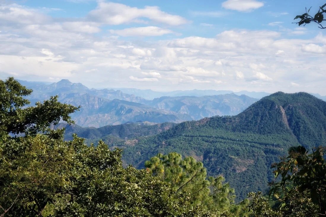 ____After a long day, with 2,940 meters of climbing, we decided to stay in a hotel in El Palmito. Lucky for us it was only 200 pesos. The room was cold, but we stayed cozy in our sleeping bags. There was also a tienda right across the street, and a 24 hour gordita stand next door.
 Gorditas have become the popular roadside stand food, instead of tacos like in Baja California. This little gordita stand in El Palmito is open 24 hours. The same ladies were preparing the gorditas the afternoon we arrived and the morning we left. We asked if they got much business in the night, and they said “yes, mostly trailers” (semi-trucks). I think they’re not usually open 24 hours, but the cuota (toll road) is currently closed because a fuel truck crashed and exploded on one of the bridges. This has been a good thing and a bad thing for us. Bad because the traffic that would normally take the cuota is now traveling on the libre (the free highway), though drivers in Mexico are extremely courteous, but good because there have been gordita stands open everywhere.

 This particular stand even had great vegan options for me …something “de flor”: some kind of grilled flower, which I think may have been “loroco” …and “rajas”: sliced and roasted (or maybe they were grilled) peppers, probably poblano. They made the gordita dough fresh, from blue corn flour, rolled the dough into a small ball in one hand, then pressed it gently onto a piece of plastic on a tortilla press, then laid a piece of plastic on top of the dough, then pulled the tortilla press down. As they placed the thick tortilla on the wood stove they pinched and pulled up the edges, then carefully placed another tortilla on top of it and pinched the two together about half way around. After both sides were grilled, they popped it open like a pita bread and filled the insides with our fixings of choice, placed it back in the stove for another minute, and then served it to us with fire roasted salsa …all for fifteen pesos each, about US$0.80. They also had peyote salve, for aches and pains, for sale on their counter, as did the tienda and every other restaurant in town.The next day we crossed into the state of Durango, and continued to climb higher into the Sierra Madre.


 We stopped for lunch in the village of Los Angelos, though all I saw were three buildings. There was a small tienda in the green house, so we bought a few supplies and chatted with the locals.

 ____You can see our road cut below the top of ridge…
 ____More endless mountain views …ridges and valleys as far as the eye can see.
 ____There is a little town down there. Can you see it?
 ____First view of the devil’s spine…
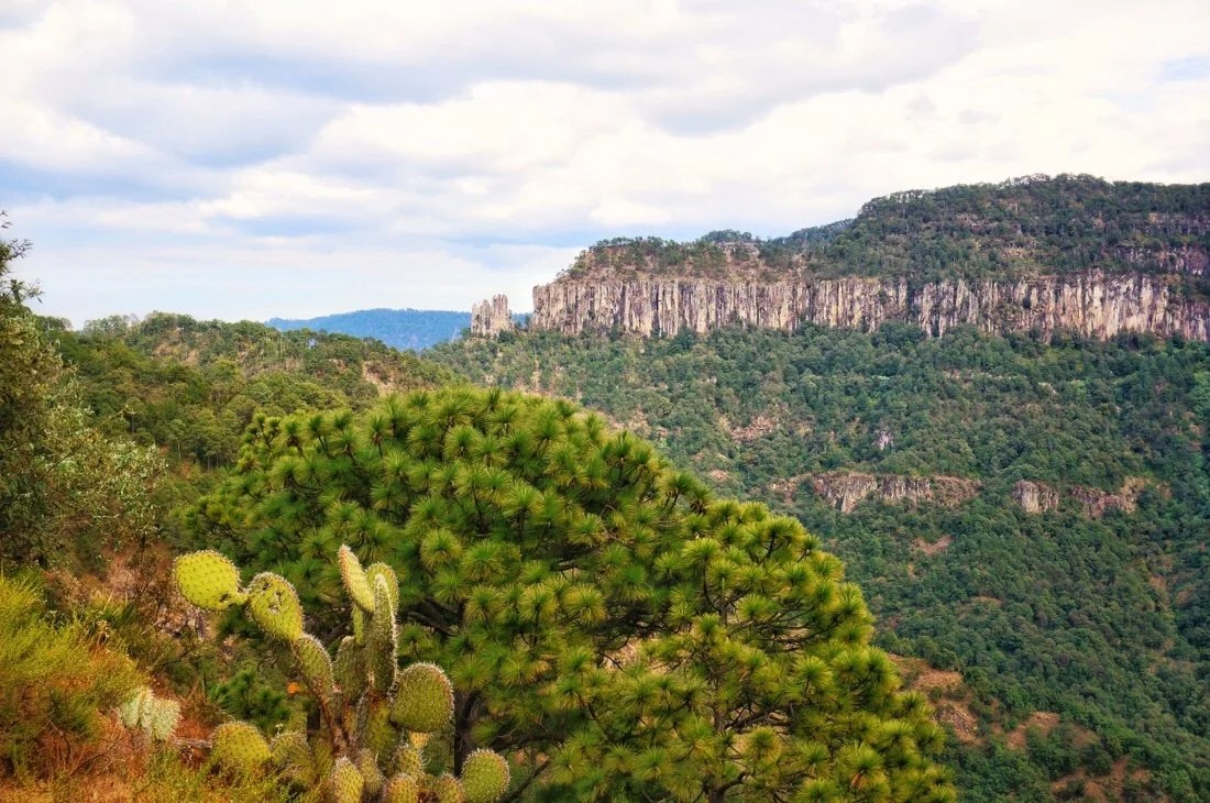 ____And we made it … the Espinazo del Diablo.


 _____More endless views…

 ____At the highest point on the Espinazo del Diablo, 2,745 meters. But when you take into account all of the downhills, we’d actually climbed over 11,000 meters in the four days we cycled from El Rosario to La Ciudad.
 We arrived in La Ciudad cold, and feeling a bit desperate. We stopped by a couple of stores for supplies, and asked around about a hotel. There’s was one right on the corner that we were told to ask about in the restaurant across the street. In the restaurant they told us someone would come out to help us. We waited for a bit, then went to check out some other nearby cabañas. Our jaw dropped when they lady quoted us 1600 pesos for a room. We were just about to ride out of town to find camping when we noticed the gate was open at the first place we’d asked about.
 The place was not charming, but it was 250 pesos. It was ice cold, and in a state of various old construction projects, but it had hot water and got us out of the weather in this very populated area. I drank entirely too much Tres Coronas, a port-like, sweet, fortified wine, trying to warm up. All in all, I had a great evening, and bonus, there was a restaurant right across the street for hot coffee (albeit instant) in the morning.
 This side of the Sierra Madre is different. The towns are more gritty. It’s cold and it’s logging country.
 It’s like cycling through central Idaho or maybe Montana. Chainsaws buzzing through the woods, logging trucks rumbling by on the highway, cowboy hats and boots everywhere. The towns are small. And anything different (like us) stands out like a spectacle. Some towns are very friendly, while others are like the first day of junior high in a new school, taking a while to break through the cold stares and into people’s warm hearts.We arrived in El Salto a little stressed from all the traffic, noise, and long cold stares from the locals. We checked into the first hotel we saw, and bonus, it had a heater! We took a long, hot, shower, and then went out in search of food.

 ____I even had to break out my Seirus wind socks for the first time since the Jacumba Mountains in southern California.
 ____Cold, wet, street in El Salto…
 Tired from all the climbing, we decided to take a day off in El Salto, which turned into taking a second day off. Our room had a heater, the shower had very hot water, and there was a market and restaurant nearby. And in the end, we did have several nice interactions with a few locals. In some strange way, the cold, gray, rain, wet on this gritty little town, had a charm all its ownOne night in El Salto turned into three nights. I think we were reluctant to leave the heater. But we finally packed up on the third morning and rode out into the cold, wet, day. When the sun came out it lit up the grass and the trees to a golden perfection.

 As we continued east, away from the Sierra Madre, the terrain began to level out. we passed deep river valleys with almost hoodoo-like rock features, before descending even further down to big open grasslands, and eventually desert vegetation.
 ____There are bicycles everywhere. Do you see it?
 ____After a couple of hours into our day we pulled into this highway minimart where I discovered I had lost my puffy jacket. Somehow I had forgotten to buckle my bag and my puffy escaped somewhere on the highway after our morning break. I rode back seven kilometers to where we took our first break, checking every ditch along the way, but I never found it.
 ____After leaving the minimart it started raining. We’re still rocking the ultrasil rain jackets I made for our 2012 thru-hike of the Pacific Crest Trail. They work great on the bike. Other than the cold shards of water hitting my face, it really wasn’t that bad.
 ____
 ____The landscape changed to grasslands and eventually more mixed desert vegetation the closer we got to Durango.

 ____
 ____As we rode into Durango, a local stopped us to ask if he could help us find anything. We told him we were looking for a cheap hotel near the Centro of Durango. He said, “follow me”. He led us to the cathedral and then walked with us for several blocks to the hotel (since it was on a pedestrian only street).
 ____
 ____
 ____…our home for the three days we spent in Durango.
 ____
 ____
 ____Durango te quiero feliz
 ____The end of our first night in Durango I sat with this margarita and mourned the loss of my favorite puffy jacket, noting that this was the first time I’d ever lost a piece of gear on an adventure.
 ____Each night people gather in the Centro for food, drinks, and street performances. As we stepped out onto a lively Saturday night street scene, we moved through the crowds, passing jugglers, young kids break dancing, and these women spinning like butterflies over the walkway as they preformed traditional Mexican dances.
 ____There are few people out early in the morning in Mexico.
 ____
 ____
 ____Visiting the local tianguis (Sunday market). The place was huge. There was clothing, outdoor gear, furniture, shoes, car parts, and produce. I found a nice hoody at a very good price that hopefully will keep me warm until I get a new puffy, and Neon bought a sweet rain jacket.
 ____
 ___Several different mezcals (its like tequila but the agave is roasted first) are made locally so later in the evening we visited a nearby bar to sample a few.
 ____
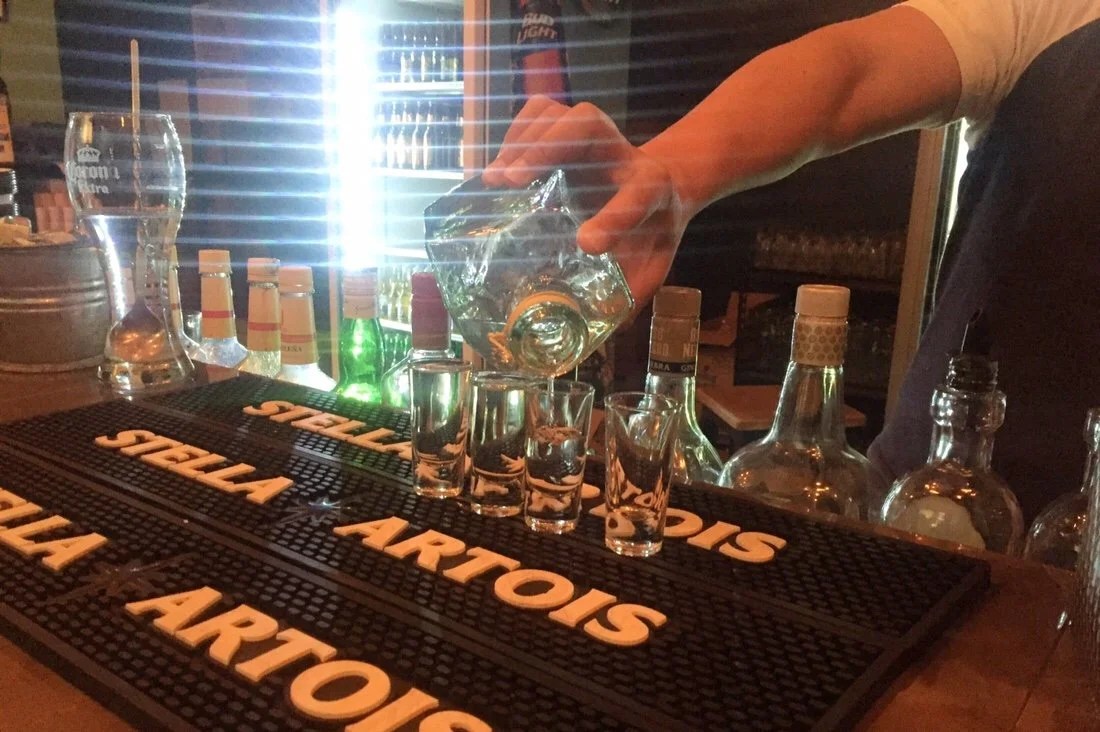 ____They served the mezcal to us with orange wedges sprinkled with tajin (Tajin is a mixed spice of chili powder, lime, and sea salt).
 ____There’s even a fresa (strawberry) mezcal
 ____Mural, inside the bar …digging up agave to roast and then make mezcal.
 ____Sunset on the pedestrian only street in Durango’s “Centro Historica”.
 ____The cathedral lit at night…
 ____
 ____
 ____There was a huge screen set up across from the cathedral showing the Super Bowl. It was such an interesting mix of modern and historic all in one space.
 ___Young males and their bicycles gathered outside the cathedral
 ____
 ____
 ____A street near the Centro. There are so many little shops here, selling clothing, cell phone cases, food, trinkets, so much stuff…
 ____
 ____Celebrating good coffee …because on the bike, all I have is instant Nescafé Classico …and this Seattle girl loves good coffee.

 _____________________You can sign up to receive The Redheaded Nomad’s blog posts in your email inbox; sign up at the bottom of any page on my website: theredheadednomad.comFor more frequent updates, follow me on Instagram at: instagram.com/theredheadednomadYou can also find me on Facebook at: facebook.com/redheadednomad_____________________


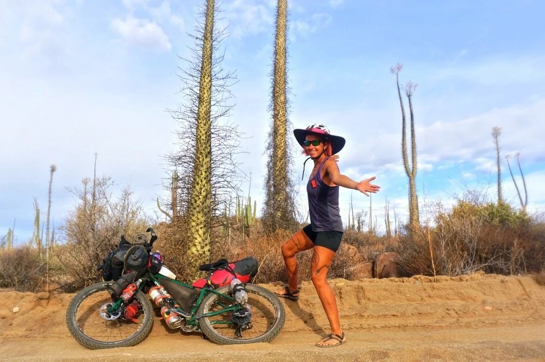


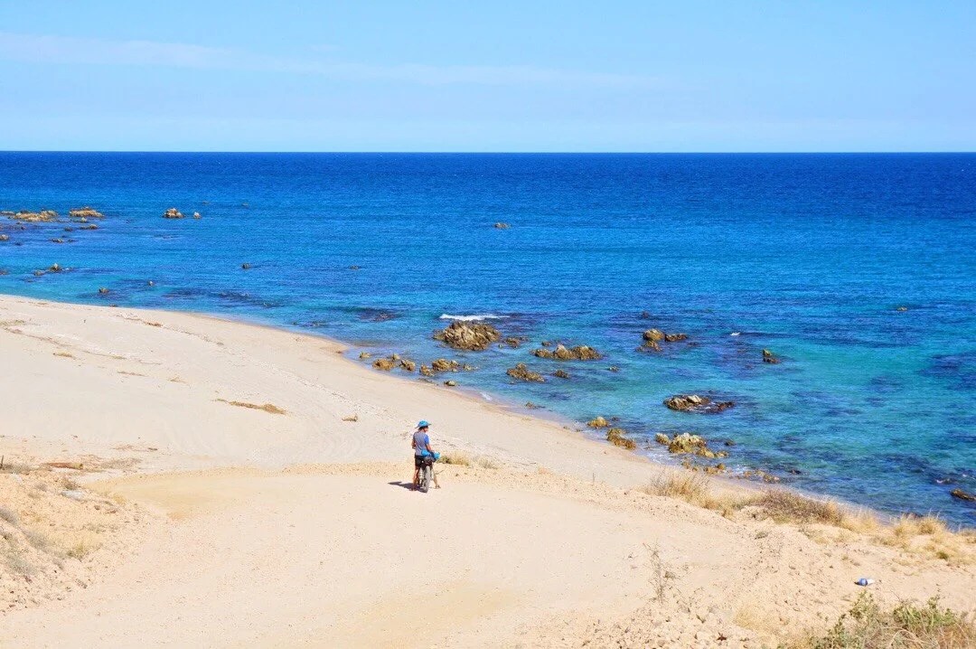 1 week: Picacho del Diablo, the Baja California Norte state highpoint. We had to wait a day in Colonet to organize a ride to the park. Travel to and from the park, plus the climb, was 4 days. After such an epic climb we took another zero in Colonet to rest.


 1 week (spread out over a month’s time): Getting a new bicycle seat for Neon. His seat rail broke south of Santa Rosalillita. He got a new one shipped via Baja Pack to Guerrero Negro, so we hitched (with our bikes) there from Rosarito. This all took several days. The seat didn’t work for his bum. So he bought a cheap one in Vizcaino that was wider and had more cushion, and then ordered another one from Amazon. Eventually, after extra days in several towns a long the way he finally got the seat he ordered from Amazon, a Brooks B17, and he loves it. If we were just riding the Baja Divide I think Neon would have just tried to get by with the cheap cushy seat he bought in Vizcaino. So I feel like this time was somewhat unrelated to riding the Baja Divide and more about riding to Argentina.
 …the seat that broke, a Selle Anatomica. It’s common for them to break, but they’re comfortable.

 …and the Brook’s B17 (the one he’s happy with)
 1 week: We took a bus (with our bikes) from Guerrero Negro to Mulege and spent an entire week there, and the nearby beaches, with family for the Thanksgiving holiday. After Thanksgiving we took the bus back to Rosarito to pick up where we’d left off on the Baja Divide route before Neon’s seat rail broke.


 1 week: We spent a whole week in Loreto hanging out with trail friends from New Mexico, and making new friends.


 4 days: We spent four whole days in La Paz sick with a sinus infection. Though I think this counts as Baja Divide trail time.
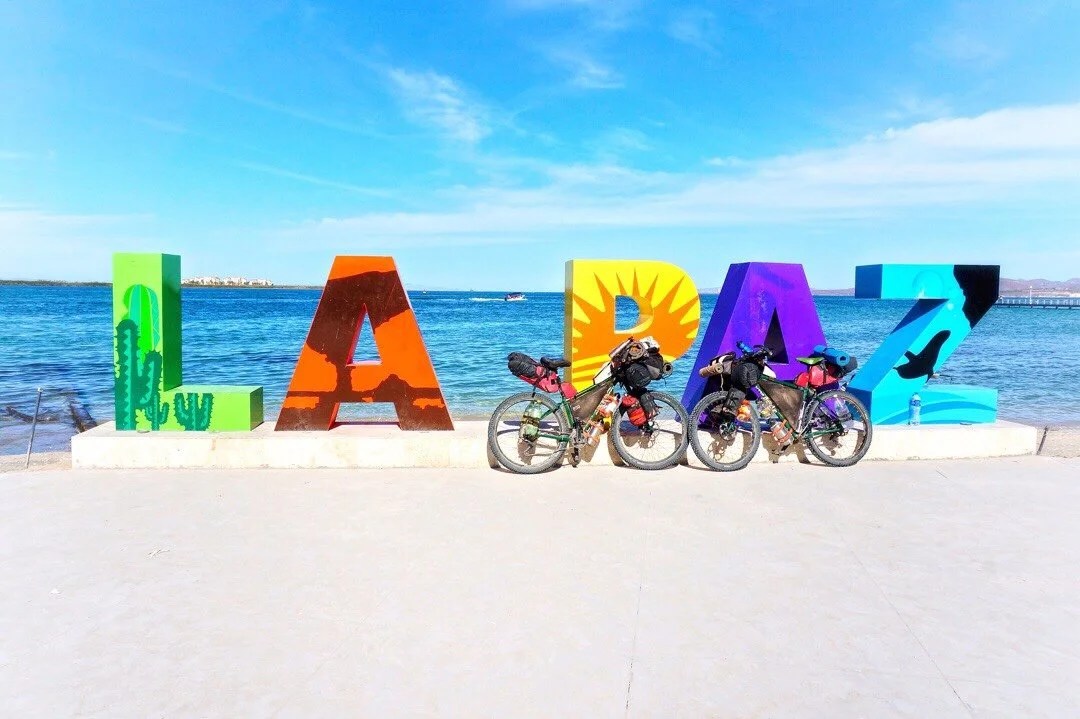

 5 days: Sierra la Laguna highpoint, the Baja California Sur state highpoint. We spent five days around Todos Santos, watching the turtle release, resupplying, climbing a couple of peaks in the Sierra la Laguna Mountains with our friends from Maryland, and resting in town afterwards.
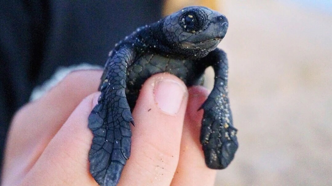
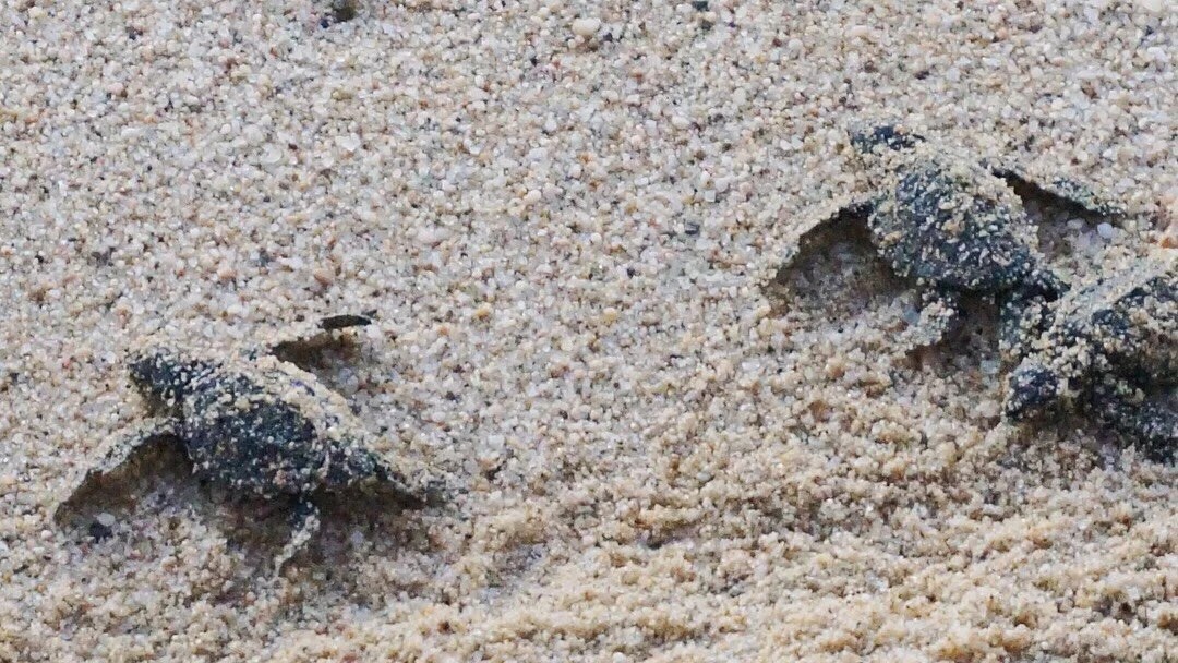
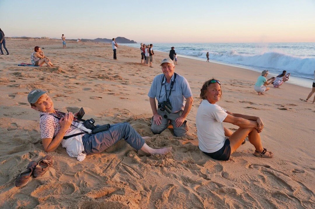
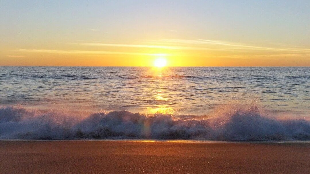


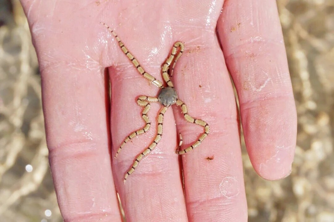
 2 days: We spent two whole days in Cabo Pulmo with our friends from Maryland, walking the nearby nature trails, looking at cool creatures in the tidal pools, snorkeling, and lingering over coffee and meals with our friends.


 FAVORITE PARTS:There are so many things that were highlights for me that’s it’s difficult to pick out just a few, but I’ll try.I had a great experience at Hotel Escondido just off route on the outskirts of Colonet in Enero, and the little market down the street from the hotel. The lady that manages the hotel was super nice, and we had a great time with her son as well. Everyone at the hotel and the little market were so friendly that I was almost sad to leave Colonet, though Colonet itself didn’t charm me as much.

 My two favorite restaurants in Baja were the little truck stop diner at El Sacrificio, and Alma y Manny’s in Todos Santos. The food was good, but of course it’s never just the food. We just had really great experiences and interactions at these places. The best espresso I had was at Parlante Restaurant in Ciudad Constitucion. And the Blue Anchor in Loreto was also a highlight, which was not so much for the food, but for the great conversation with our new friend from Colombia.


 My favorite riding and landscapes were all through Valle de Los Cirios in the areas around Cataviña. It’s just magical there and the plants are so Dr Seuss cool. I also loved everywhere the route travels along the Sea of Cortez.


 We also took the alternate (after El Datil) that goes through San Juanico, Cadeje, La Purisima, and San Isidro; perhaps it was just our timing and the people we met along the way, but it was one of my favorite sections. The towns were culturally a little different and I really enjoyed them.


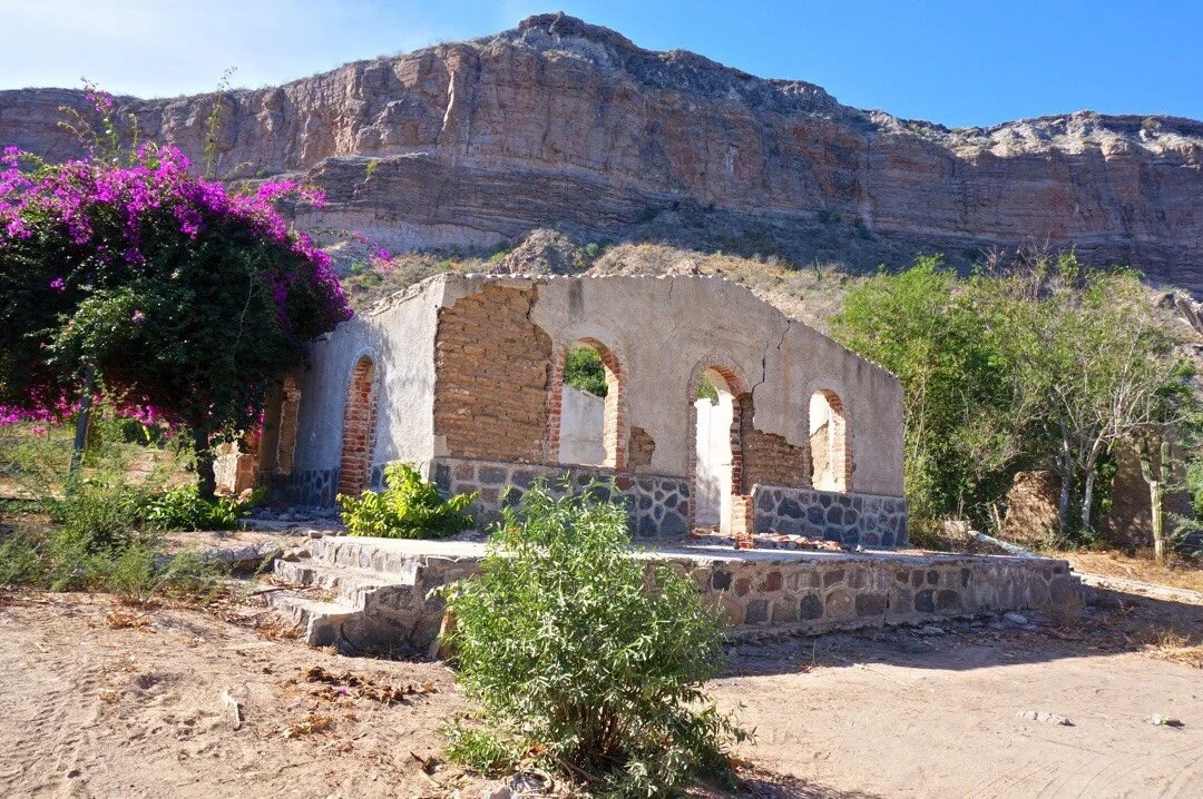

 In general, my favorite places and experiences were all in central Baja. The far north and far south just didn’t do as much for me. The northern parts are more gritty and the towns seem a little rough around the edges, and there was a lot more trash strewn about. The far southern parts of Baja (La Paz and south) are very touristy, which makes some of the towns seem a lot like visiting Jackson Hole, Sedona, or Beverly Hills; it’s just not my scene.MOST DIFFICULT SECTIONS:The two areas of riding that I found most exhausting were… ONE: a little before Rancho El Coyote, and after Rancho Meling. And TWO: about half a day after Nuevo Odisea almost all the way to the pass before you drop into Valle de Los Cirios. There were a few other discrete parts of the route that were difficult for sure, but it’s the really steep uphill hike-a-bike over eroded rocky “hard to call them roads anymore” roads that I personally find the most strenuous and tiring.


 RECOMMENDATIONS:I really only have one… ride the cape loop counterclockwise. The amount of climbing seems similar in either direction, but there are several very long sandy sections that are a downhill ride if you go counterclockwise, which would otherwise be a hike-a-bike push if you take the capeloop clockwise. And there is one super sweet sinuous downhill on the way to Cabo Pulmo that makes it worth riding the capeloop counterclockwise.
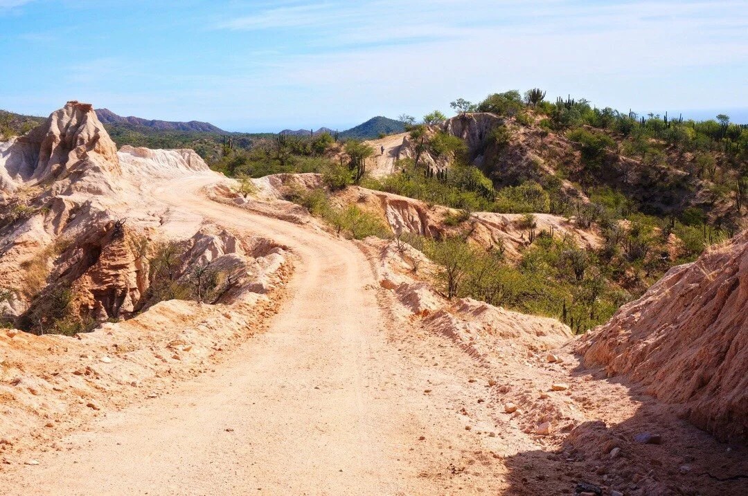 TIPS:I don’t really have any. Everyone is so different. Our home base is in southern Arizona, so Baja felt a lot like riding in our backyard …the climate, the different biomes, and all the plants and critters just seemed like an extension of home. This was our first long bikepacking trip, but we’ve thru-hiked several long trails, so we were already familiar with the the rhythm of being self sufficient for long periods of time in rugged wilderness.The weather will be pretty different depending on what month you start and how long it takes you. We started in mid-October and only had one real rain our entire time in Baja. We only slept in our tent three times; the rest of the time the weather was perfect for cowboy camping.If anything, I’d say pack light (especially if you’re only riding the Baja Divide and not continuing on a longer trip), enjoy, mix with the locals, and be patient on route. When the route gets difficult, it will change and there will be something magical on the other side.
 _____________________You can sign up to receive The Redheaded Nomad’s blog posts in your email inbox; sign up at the bottom of any page on my website: theredheadednomad.comFor more frequent updates, follow me on Instagram at: instagram.com/theredheadednomadYou can also find me on Facebook at: facebook.com/redheadednomad_____________________