Tag: hayduke

  • Hayduke – Grosvenor Arch to Willis Creek

    Hayduke – Grosvenor Arch to Willis Creek

    We definitely hit the reset button in town, taking a triple zero—so much time in bed that my muscles grew stiff. I ate too much. I think my stomach has shrunk, eating only a handful of nuts at time on my backcountry snack breaks. I’m not sure cooked food agrees with me anymore, or maybe it was all those carbs in the pizza I ate. When we made it back to our route, the heat was oppressive and my muscles were cranky. I felt sleepy in the sun, but my spirits were high. I was excited to be back out in the wild. Rest is an important part of adventuring, and I’d forgotten just how important until these last couple of weeks.

    •

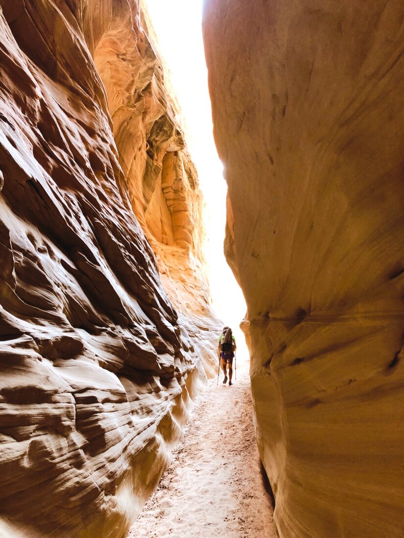
    The start of Round Valley Narrows slot canyon

    •

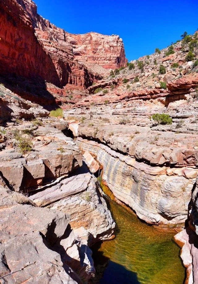
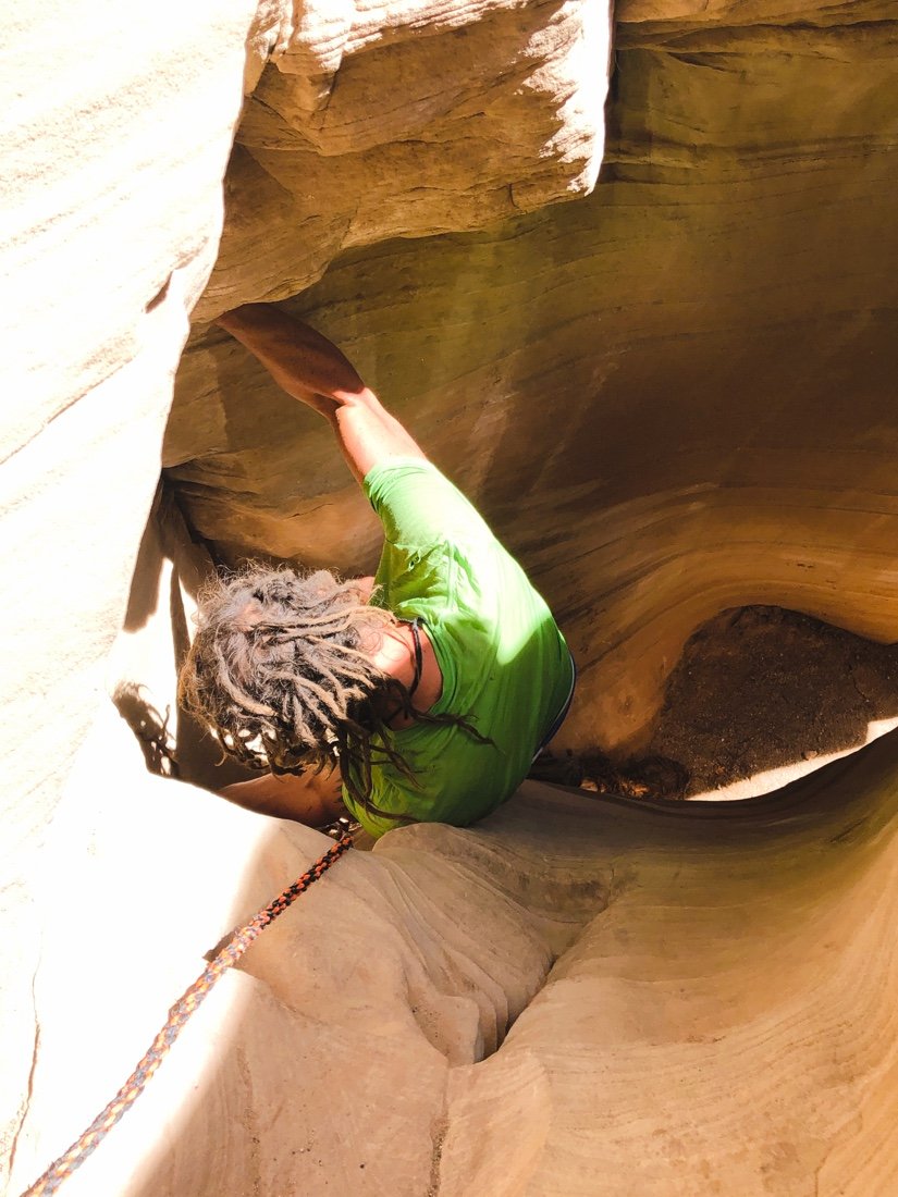
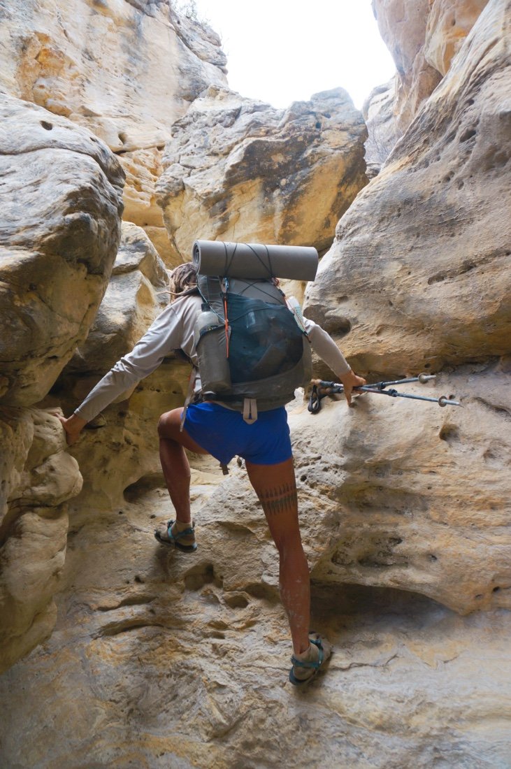
    We were heading down Round Valley Draw by early afternoon. The sun was high and hot—a perfect time to drop into a deep slot canyon. There was a rope tied to a chockstone that we used to lower our packs. Neon climbed down the chute first, then I followed behind. It was like entering another world, an underground world. The light slipped in through the narrow slot overhead, reflecting and dancing around the wavy curves of the canyon walls. Water is one of earth’s best sculptors.

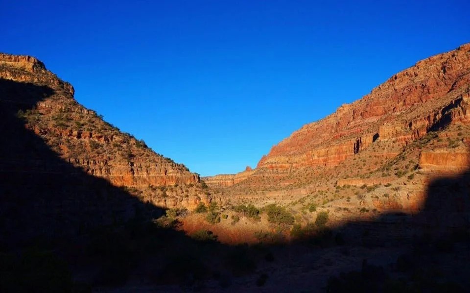
    After a couple of miles, the narrow slot opened up into Hackberry Canyon. It was still early, but I was so sleepy. We found a soft patch of sand, out of the creek bed, and set up camp. We were asleep before six o’clock. A long, deep, sleep followed, like only the backcountry can bring. I had strange dreams and woke to a sub-freezing dawn.

    •

    Pastel colored rocks in Hackberry Canyon.

    •

    •

    a bit of Alpenglow from camp •

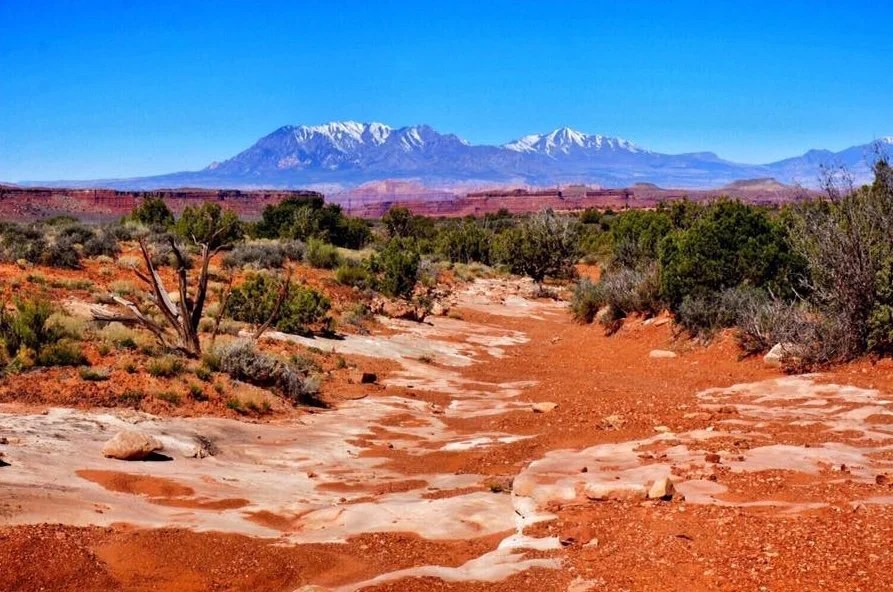
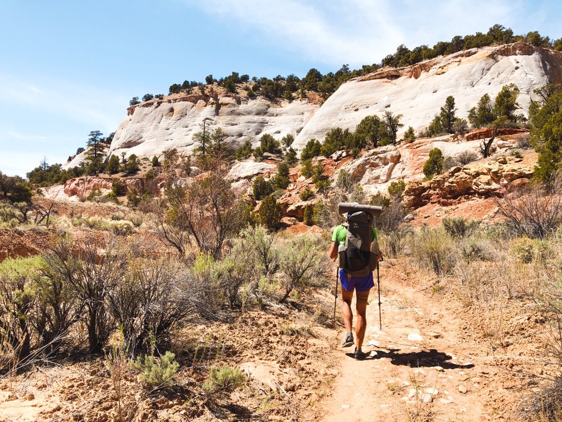
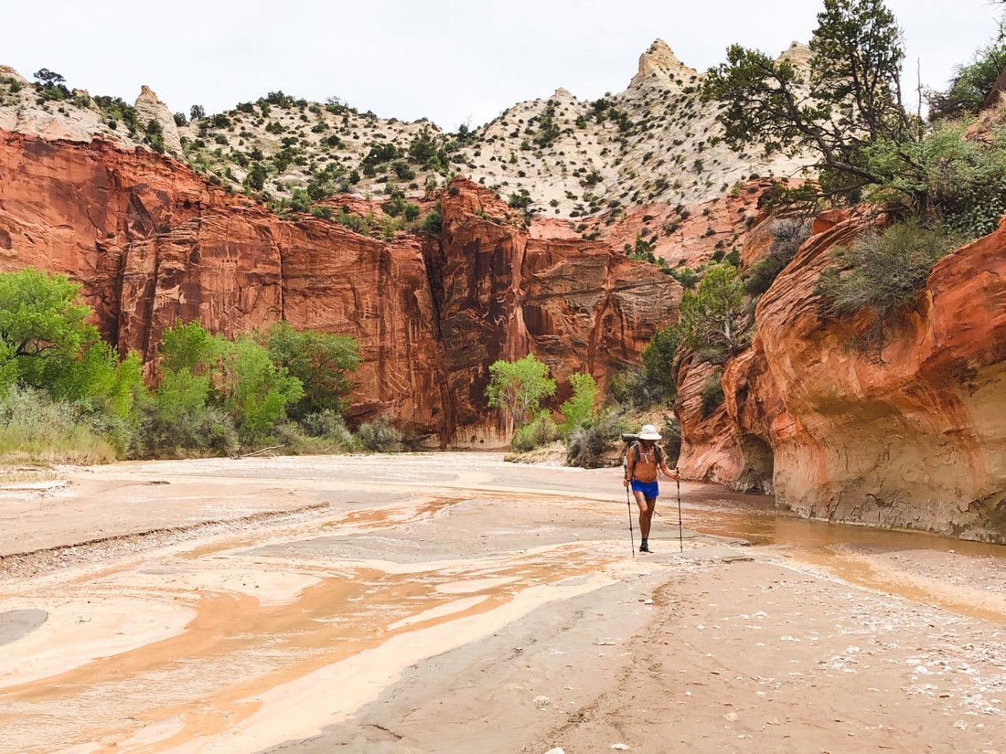
    We spent the afternoon walking through deep sand, and shallow water. The canyon walls changed from pale yellow-tans to reds. We followed cow tracks along the creek, passed an old cowboy cabin, wandered through sage and cottonwoods, and camped on red soil between cactus and sage. The ground was hard from dry clay, and lumpy from cow tracks. A bee buzzed up and down and back and forth around our camp. We wondered if perhaps we were blocking its path in some way. A chorus of frogs sang through the night.

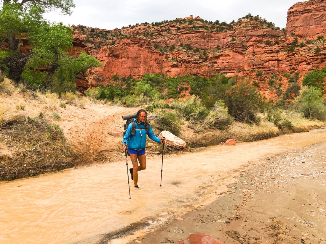
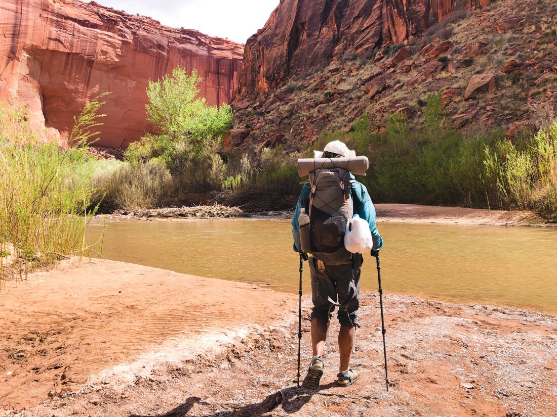
    We made our way down the creek, through cottonwoods, to the end of Hackberry Canyon and to the Paria River canyon. The wind whipped through the canyon, the cows stared at us, sounding in a low, deep, moan as we approached. Their voices echoed off the canyon walls like ghosts lost in time. The canyon sides were shades of red, and the riverbed white with thick alkaline salt crusts. We crossed back and forth over the muddy Paria River, walking its banks of mostly firm mud. The afternoon grew hot with pesky flies, occasionally swept away by the wind. Up and down cattle paths, along the river, hot winds, and cottonwoods.

    •

    entering the Paria River canyon

    •

    We collected slightly less muddy water from Kitchen Canyon Creek. It was heavily guarded by cows. They moaned at us as we approached, running upstream, turning to see if we were still there, then stopping for a stare down. I moaned back, and told them they could have all the water in the Paria, but we had to share this water. They disappeared through the brush and trees. As we made our way back to the Paria, they came out of the trees ahead of us, turning and sounding in their deep ghostly moan again, then running off up river. We found a sandy patch under the shade of some cottonwoods to camp. The frogs started early—an evening lullaby that always sends me softly off to sleep.

    •

    Kitchen Creek. You can see the cows, upstream, in the trees. •

    The morning brought more of the same—red canyon walls, river crossings, sand, firm mud, flies, and wind. We came upon the same group of cows. They would stare, and give us their deep bellowing moan, then run upstream. A little while later, we’d see them again. This repeated several times through early afternoon, before I decided to give them a “woohoo” in a soft, slightly high, feminine tone, like I was singing, instead of calling back to them in a deep moan like their own. They stared at me, shifting their feet slightly, here and there taking a step backward or sideways. But they just stood there, staring, instead of running off ahead of us. We passed, and they stayed put this time. That was the last time we saw them. I wondered, was this the end of their route, or did my woohoo mean something to them.

    We turned into Sheep Canyon, its walls smooth and a pale yellow-tan. Its creek ran orange, heavy with clay. We left the cottonwoods behind and emerged into a pine, fir, and juniper forest. The tall walls with these trees reminded me of the Sierras. A mountain lion’s tracks crossed the creek, huge prints in the mud. I felt as though I’d been transported. Each canyon can be so different out here.

    •

    the orange water is flowing in from Sheep Cr

    eek.

    The muddy brown water is the Paria River •

    We camped in the shade of a big wall, junipers to my left on the sand bank, fir and pine to my right high on the cliff walls. Beltane eve—we cheers’ed over a little gin, in this wild place, a yellow alpenglow lingering on the cliff walls. The frogs began their calls as the sky grew dark. I tossed and turned, thinking about those mountain lion tracks. When I woke to pee there were so many stars in the sky it seemed unreal, like one of those long-exposure photos. I looked up to the other side of the cliff—just then a bright white streak traced along its edge, flaring into a bright green flash. I heard myself let out a loud and astonished “Woah!” I crawled back into my sleeping bag, still tossing and turning, looking up occasionally to watch the sky. The Milky Way seemed to grow thicker and more dense through the night. Peering up through canyon walls at the night’s sky has been a real highlight on this hike, or maybe it’s just southern Utah, but one things for sure—the skies are different out here.

    •

    our camp in Sheep Canyon •

    We crossed Willis Creek first thing in the morning. Its waters flowed orange into Sheep Creek. Upstream of Willis, Sheep Creek ran clear. I wondered if Willis Creek was flowing orange from snowmelt off the cliffs in Bryce. We made it to our food cache by second breakfast. It was May Day, one of my top favorite holidays, and what better place to be than out here with all this beauty, and a fresh resupply of food!

    I find myself much more relaxed at this point in the route, ~four hundred miles from where I began. I have no worries about water, or where I will sleep. I’m comfortable squeezing a few more days out of my allotted food rations. I’ve even come to dance across scree and cross a river with little contemplation. The wilds of this earth have always been my first home. I wander from them sometimes, but I always return.

  • Hayduke – Hole in the Rock Rd to Grosvenor Arch

    Hayduke – Hole in the Rock Rd to Grosvenor Arch

    This is the third section in a row, back to back, going from one buried food cache to the next, without a town rest (and a lot of eating) in between—that’s seventeen calendar days passing by between towns. We’ve had some sweet trail magic, but man, I have veggie pizza on the mind, and coffee, I want good coffee. We are strong, but our reserves are low.

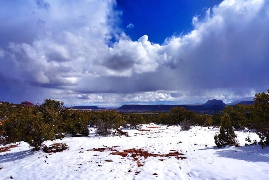
    We packed up and set off to climb up Fiftymile Mountain. The clouds were puffy, and their undersides slightly pink, reflecting the red earth below. The rain started before we reached Mudhole Spring. We filled up with six liters of water, more water than I’m comfortable carrying, especially with five and a half days of food in my pack. It started hailing. We set up camp near Monday Canyon, nestling our tent into the junipers and sage. The sun came out long enough to dry a few things before crawling into the tent.

    It rained more in the night. We weren’t feeling enthusiastic. Sticky mud, heavy packs, and we knew the hard work that lay ahead. We had hiked this section last year, and the hard day of bouldering ahead of us weighed heavy on our moods. The extra water weight in my pack was causing a pain in my right shoulder that, between it and the icy cold morning, was nauseating. I had to stop. After a short rest everything was fine and my pack felt fine. A few minutes later I found a piece of pottery, one of the coolest I’ve ever found. It was decorated with black paint. My mood lifted. How cool. I’ve found so many cool things on this hike.

    • Broken piece of pottery, decorated with a design in black. •

    • The easy part of Monday Canyon, before the intense bouldering began. •

    I came to realize, somewhere near the end of Monday Canyon, that it wasn’t so much the hard work of the bouldering, or the willows in the previous section, that was causing our bla moods and waning enjoyment, but the lack of town rests and town food we weren’t getting between route sections. Our food caches have great nutrition, a high amount of healthy fats, good protein, greens, and sufficient calories, as well as a few snacks to eat while we unpack the cache and repack our trail food. But walking all day long, day after day, is draining on a very deep level, and that’s when there’s a good trail involved. The Hayduke is rarely on a trail, and only occasionally on dirt roads—it’s a hard route, primarily all cross-country, involves a lot scrambling, and is more physically draining than any other adventure I can currently remember.

    We made it through the boulders in Monday Canyon, and the first couple of miles (and more bouldering) in Rogers Canyon before setting up camp. And now when I say boulders, I don’t mean the ones you see us hopping over in the photos. No, Monday Canyon and the first half of Rogers Canyon require incredible effort, going up, over, and around, huge boulders—sometimes with climbing effort and sometimes requiring detours around the canyon walls, or climbing up the cliff side to higher ground and following cattle trails around areas that are impassible.

    • break time, on a cliff above Monday Canyon. •

    • Starting down Rogers Canyon. We followed flowing water most of the way. •

    • Shell fossils in a rock in Rogers Canyon. •

    Rogers Canyon is an odd one. It’s really more of a giant erosion gully—piles of eroding sand and rocks and boulders, churning and tumbling in a chaos of constant change—but it’s full of life. Frogs and crickets, grouse and quail. There’s something special about it that I can’t put my finger on.

    • Tadpoles in Rogers Canyon. •

    • Our camp in Rogers Canyon. •

    We camped on the same island of earth between stream trickles that we did the previous year. We washed up in the stream. I washed my sun shirt and set it out to dry in the wind. Little flies attacked our eyes and ears. Neon wore his head-net while he ate dinner. There’s a funny magic here I find comforting. I slept hard, dreaming of my mother again. I got up to pee in the night. The stars were so bright and so thick, the milky way stretched from canyon wall to canyon wall. A chorus of frogs and crickets filled the air.

    We made it to Navajo Canyon, at the edge of the Burning Hills Wilderness, by second breakfast. Navajo Canyon is my favorite Canyon in this section. It’s moody and mysterious—filled with a rainbow of rocks, mountains of grey sand, intermittent layers of coal spilling out from the canyon walls, and occasional layers of alkaline salt crusts so thick they look like snow.

    It was hot and I was running low on water. I struggled on the climb out of Navajo Canyon. It took a lot of electrolytes and most of my water to make the last couple of miles to Surprise Valley. Thankfully, the high roads above Surprise Valley are easy, and the cool wind strong.

    We camped near Reese Canyon. It rained hard again in the night, blustery wind shaking the tent ‘til the wee hours. I wished I’d had a cup large enough to catch rainwater off the tent. I didn’t sleep well. We got an early start and made it to Last Chance Creek, and water, by second breakfast. We spent a long time drying things out, washing up, drinking and eating, and talking about pizza, before continuing with our day.

    The rain came and went, and so did our moods. Near the end of the day, the creek became muddy from all the rain. A little trickle of clear water flowed in from the side. A spring! We followed it to its source and set up camp for the night, a beautiful evening, sunset, and good water (though a bit sulphury). A perfect night.

    Everything was covered in heavy dew by morning. We plodded through the end of Last Chance Creek, by another sulphury spring, then up Paradise Canyon.

    • Frog sex? All my time in the wild, and I’ve never seen this! •

    The miles seemed to drag by. Just before we were about to get to a road, we decided to take a “shortcut”. It didn’t save any time, but it did bring a spark of fun, and a mini slot canyon, to the end of our day. We made it out and up to the road.

    We set up camp between a few junipers and sage, and watched the last rays of light fade over the horizon. I slept good, knowing the next day was an easy road walk, out to Grosvenor Arch and to our next food cache.

    I had the headphones in by second breakfast. The music made the miles pass more quickly. A few tears came and went. It’s going to take a long time to process my mother’s death. We hit fast forward at the first vehicle we encountered. A lovely French couple from Las Vegas gave us a ride to Grosvenor Arch.

    We dug up our food cache, and while repacking made the unanimous decision to go into town before the next section of the route. We were tired, in a deeply depleted way, and needed a few days of town resting and eating.

    We walked a few more miles down the road before another vehicle passed. It was the French couple again! They gave us a ride a little further until their next stop. We got out, and in less than a minute had a ride the rest of the way into town.

    We were in a hotel room eating pizza before it was even dinner time. Sometimes you just have to hit the reset button—especially after seventeen days in the backcountry, in some of the most remote places out here. Now that’s some extreme social distancing.

  • Hayduke – Burr Trail Rd to Hole in the Rock Rd

    Hayduke – Burr Trail Rd to Hole in the Rock Rd

    Reaching Burr Trail Road was a significant milestone for me. It’s hardly a quarter of the total distance of the Hayduke route, but somehow marks a transition for me. From here, I know I can walk beyond myself, wrapped in love, with an ease in my step.

    We took the Post Cut-off Trail, up and over Water Pocket Fold, to reconnect with our route in Lower Muley Twist Canyon. Like entering a dream, it made me feel like Alice in Wonderland, small and big all at the same time. Smooth tall walls and wavy rock fins transported me in time. We camped below Muley Tanks, four large pockets in the sandstone that hold water. The cliffs lit orange in the sunset, and a chorus of crickets and frogs sung lullabies to the stars. I felt totally at peace here. I wanted to show my mother this place. I wondered if she would have liked it—she wasn’t a desert person; she loved the mountains. I drifted in and out of sleep. It was hot. I slept most of the night out of my sleeping bag.

    The next day we climbed up Red Slide, out of Halls Creek, 2,400 feet, to Circle Cliffs Pass. I recognized the mesas of Circle Cliffs Pass—I had seen them the week before from our highpoint in the Henry Mountains. We dropped into Middle Moody Canyon. After a short while we came upon our next water source, completely dry. Here we go again. Ten more miles until the next water source. We searched around for a bit to see if there was a nearby pothole still holding water. We gave up and continued hiking when I saw a small hole dug in the gravel of the creek bed, perhaps by an animal. There was a few cups of slightly muddy water about ten inches down. “Woohoo!” I exclaimed. “We have water!” I hummed and chirped and sung the rest of the evening. It doesn’t take much to make a thru-hiker happy. A few cups of muddy water is precious in the desert. We hiked further into the evening than we really wanted to, but we wanted to position ourselves closer to the next water for the morning. We found a high spot out of the creek bed for the night, between a few large boulders.

    • cryptobiotic soil •

    • more petrified wood •

    The next day was uneventful. We found water early, and more water flowed, intermittently through the canyon. The large boulders gave way to a wide, more open canyon, as we approached Escalante Canyon. Our energy was growing short, after two trail sections back to back, with out a town rest. When we reached the Escalante River, still early afternoon, we decided to take a trail nero and just hang out for the rest of the day. We splashed around in the water, and I ate way too much of my food, feeling good about the progress of our miles so far for this section. We set up camp under a cottonwood tree and lounged around until the sun went down.

    • pretty sure this is the largest piece of petrified wood I’ve seen so far •

    • the Escalante River •

    The morning hours were cold, just at freezing, and we decided to wait until the sun was higher before beginning our many crossings of the Escalante River. I should remind you again that river crossings fill me with fear, at least until I’m confident that the water won’t sweep me away. The first few crossings were traumatizing for me, but they weren’t deep or swift. After a few more crossings, my fears settled, somewhat. Neon, on the other hand, is a rock in the water, and would plunge in nearly anywhere—looking cross-eyed at me every time he started to cross the river and I asked how deep it looked.

    The river crossings turned out to be the easy part of Escalante Canyon. The water was clear and we could see how deep different areas were (some were quite deep, probably over my head), and so we were able to choose our crossings easily. The difficult part turned out to be how overgrown the canyon is, with sometimes wall to wall willows, reeds, horsetails, and rabbitbrush. It was exhausting pushing through the willows, tangled with reeds. Our hands were tore up, after just a few miles. By the end of the first day we had only made it seven miles. We camped at the mouth of Scorpion Gulch, feeling a bit trapped, in a place neither of us were enjoying as much as we wanted to be. The prospects of twenty more miles of pushing a path through the brush was daunting.

    The pictures of course are of all the easy and beautiful parts. My camera is rarely out during the difficult and grueling parts. And that’s as it should be really, because the beauty out here is off the charts. Words tell a better story of the difficult sections, which are always personal and subjective anyway. And as with many other difficult things I’ve done, they often become my best and favorite memories of an adventure.

    We started bright and early the next morning, hoping to make more miles, with five crossings in the first half hour at 33°F. The brush eased up, a bit, here and there. Our moods lifted some, feeling hopeful we could make more than seven miles. This allowed me to enjoy my surroundings more. It’s a weird mental space when you’re somewhere you want to be, sort of, but you find yourself hitting mental roadblocks, not enjoying the particular circumstances of a place.

    The Escalante is a special place, difficult to get to, and so was one of the last two places to be mapped in the U.S. (the other being the Henry Mountains). I wanted to enjoy its history, and its grand orange walls, but I was having trouble getting over the tall, wispy, willows and reeds slapping me in the face and ripping up my hands. I had made friends, mostly, with the river—but in the brush, I could have been anywhere, tangled in a madness of overgrown plant life, like a beetle trying to escape an overgrown backyard.

    We made ten miles on day two. We found a super windy camp spot on a sandy beach next to the river. Really, everything is sandy here, but it was a pretty beach-like spot to spend the night. At this point my energy was fading fast, and I began to think about all that food I ate when we took the nero a couple of days before. I separated all my food, and rationed it into little piles for each day, pretty meager at this pint in the game. Two trail sections back to back with no town feasting in between. And now, taking a couple of days longer (hard days) than we had planned. Sand blew in through the tent screen all night. The stars were bright. Crickets chirped. There is magic here. A small bit of myself relaxed. My hands ached with dry cracking skin, cut up from the brush. I woke in the night and rubbed more olive oil into them.

    Day three we woke even earlier, ready to plunge into the river in freezing temps and escape this brushy canyon. I tried to soak in more of its beauty. We kept our breaks short, and the miles rolling …through brush, across steep scree, over boulders, and across the river …again and again and again. The miles seemed to be getting more difficult now instead of easier.

    • Great Blue Heron tracks (I think) •

    At river crossing 109 the banks were so overgrown, and the water only calf deep, that we just hiked down stream through the water for the next half mile, passing by the arch at the end of Steven’s Canyon. It was beautiful, but I hardly mustered the will to snap a quick image as I walked by in calf deep in water.

    The land opened up and we walked overland again. At crossing 110, and the only crossing available without a machete, we dropped waist deep into the water… that was our last crossing of the Escalante. We could see the high-water bypass shortcut ahead of us. We scrambled up through the gully to higher ground.

    The Escalante below was beautiful. A short distance later I could see down into Coyote Gulch. Waves of relief rolled over me. “We did it! We’re really out.” I called the first camp spot I saw and I declared “we’re camping here!” It was a beautiful spot, under a cottonwood tree, a gentle breeze blowing by, and the sound of a babbling creek just below. The stars shined bright between the canyon walls above.

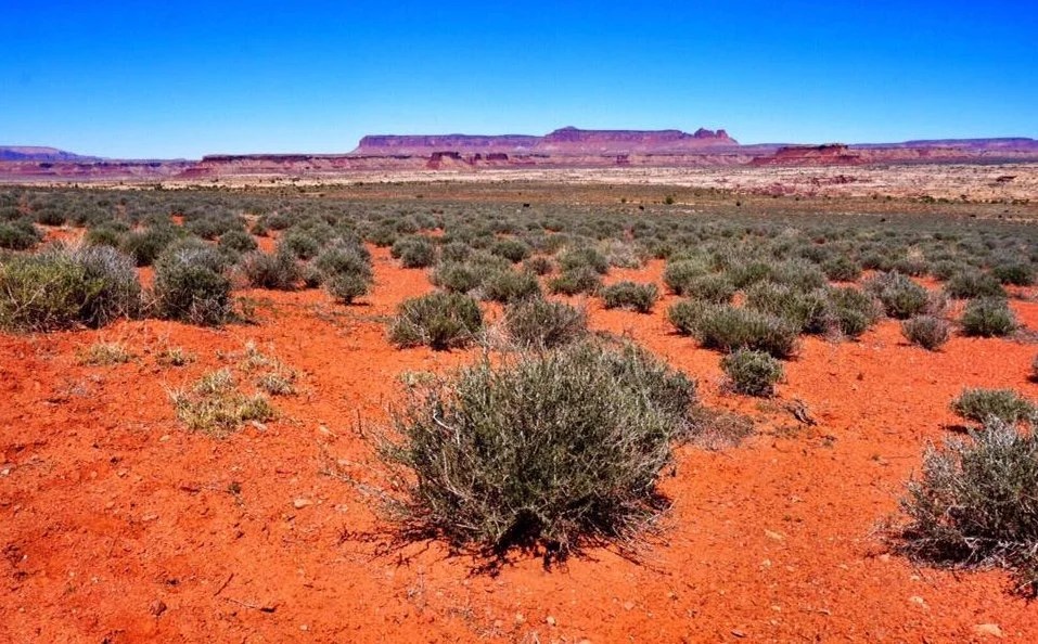
    Coyote gulch is gorgeous, high orange walls, electric green cottonwoods, a small flowing clear water creek, and easy miles. It passed by in a blur, my thoughts still back in the Escalante. We filled up at the last water when we reached Hurricane Wash, washed up, and rinsed our sandy smelly clothing. Hurricane Wash opened up into the kind of desert setting I love—open, with big vistas, and the freedom to move and flow again.

    When we reached Hole in the Rock Road, Tim was in the parking area with friends. They had brought him more food for the next section of the route. We shared our turmoil from the Escalante, and Tim shared how much he had loved it, telling us that it was his favorite section of trail so far. He said he loved the willows and the reeds, and described his experience as feeling like he was swimming through the brush. His friends offered us homemade hummus and vegetarian eggplant curry, and they offered to take our trash too. We hung out for a long time, sharing stories and trail beta. The trail magic on the Hayduke has been some of the best I’ve ever experienced.

    We’re a month into our thru-hike and it’s starting to sink in now, all the things I love about thru-hiking—all these connections …to places, to people, to nature. My ribbon stretches from horizon to horizon now, one with time. I rise and set with the sun. The water flows through me. My blood is one with the plants and the soil. My skin is dry and cracked just like the earth I walk upon. I bond instantly with the people I meet. The animals pause at my presence, eye to eye, we acknowledge our place here, together in the whirring and buzzing of the motion of life.

  • Hayduke – Poison Spring Canyon to Burr Trail Rd

    Hayduke – Poison Spring Canyon to Burr Trail Rd

    It’s amazing the healing that can take place with two days of self-care and rest. Before Hanksville, my cracking chafing everything, swollen foot, and cuts that refused to heal, were really starting to stack up. No healing was happening, or it was marginal at best. I normally heal very, very, quickly. Even doctors have been amazed how quickly I heal—removing casts from broken bones only six weeks after they had told me I’d be in them for six months.

    It was a thorn I had picked out of my index finger, on the third day out of Moab, that made me realize my body wasn’t repairing itself like it usually does. This is a difficult route, and it evidently has my body under a level of stress I haven’t experienced on other adventures. Fourteen days after I had picked out that thorn, the wound not only hadn’t healed, it had grown larger, and deeper—dry around the edges, and began cracking into a mini-sized deep gash. But after only two days of rest, showers, and eating—the gaping wound, which had started as just a tiny thorn hole, had completely closed and new skin had grown over it.

    My time in Hanksville had been good to me, providing much needed rest and repair. Everyone was super friendly, even at a six-foot distance. I wasn’t expecting that, given what I had heard from other thru-hikers. There was more veggie friendly food than I was expecting, and the supermarket had a decent selection of produce. And the artist in me appreciated the metal art across from the supermarket.

    There may not be much traffic on the highway through Hanksville, especially during these times, which requires some patience with acquiring rides to and from the Hayduke route. But in the end we had two parties engaged in tales of place, and an offer for a ride back to Poison Spring Canyon Rd. The people in these parts love where they live. It’s special country out here. And their stories are worth their weight in gold. It’s one of my top favorite things about thru-hiking—those brief encounters—where the locals share their passions of place, and personal stories, bridging a connection to my own.

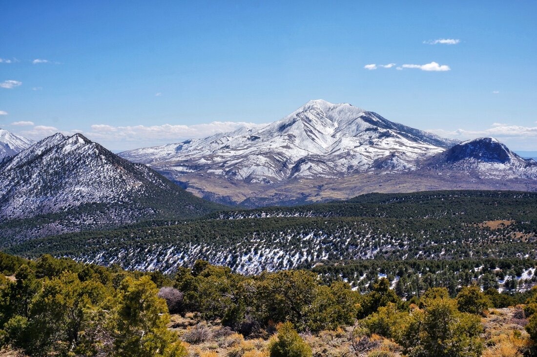
    We headed back on route, completely refreshed, and excited to be heading up into the Henry Mountains. The Henry Mountains, still covered in snow, offered quite the contrast to the canyons and red deserts layers we had been hiking through the first few weeks. From Poison Spring Canyon, we climbed up to 9000 feet, on the low-elevation route. The first day was surprisingly warm, and we hiked in shorts through mud and melting snow.

    We made it over the pass before camping for the night. The weather report was calling for heavy snow and cold temps to move in, but we woke to heavy rain in the night, and a light drizzle in the morning. A splash of fresh snow had fallen at the highest elevations. I was relieved to not have to walk through deep snow, but the road had been saturated by the rain and made for slow miles through sticky mud. Several inches of mud stuck to my sandals with every step, clumps falling off and hitting me in the back of the leg. Hours of slow miles left me restless, my mind drifting in and out of thoughts of my mother, family, and feelings of loss. My presence moved in and out of my surroundings. By afternoon the sun was out and the miles came more quickly.

    Here is where what I came to call the race, began. The day sped up. We passed a poor looking green water source, only to find the next water source dry. Now another six miles and an exhausting, thousand foot, third and fourth class descent, off of Tarantula Mesa, ensued. There was a feeling of a chase, a race, and a hint of danger. Things went smoothly. We are strong now. I had two tablespoons of water left. The afternoon grew hot.

    • Leaving Tarantula Mesa spring number two, completely dry. •

    • Roughly fashioned arrowhead, found on Tarantula Mesa before our descent. There were lots of knapping shards all through the juniper forest.

    • Working our way down the steep descent from Tarantula Mesa.•

    • Looking back up the fourth class part of the descent off of Tarantula Mesa.•

    • Strange iron rocks. •

    We made it down tarantula Mesa and into a narrow drainage littered with strange iron rocks. We felt relieved that we were down. Three miles left until water. The narrow channel opened up into Muley Creek. We kept walking. Over hill, over dale—where was the route going? Up, down, around, over …really? That way? Where are we heading? So many beautiful camp spots we passed.

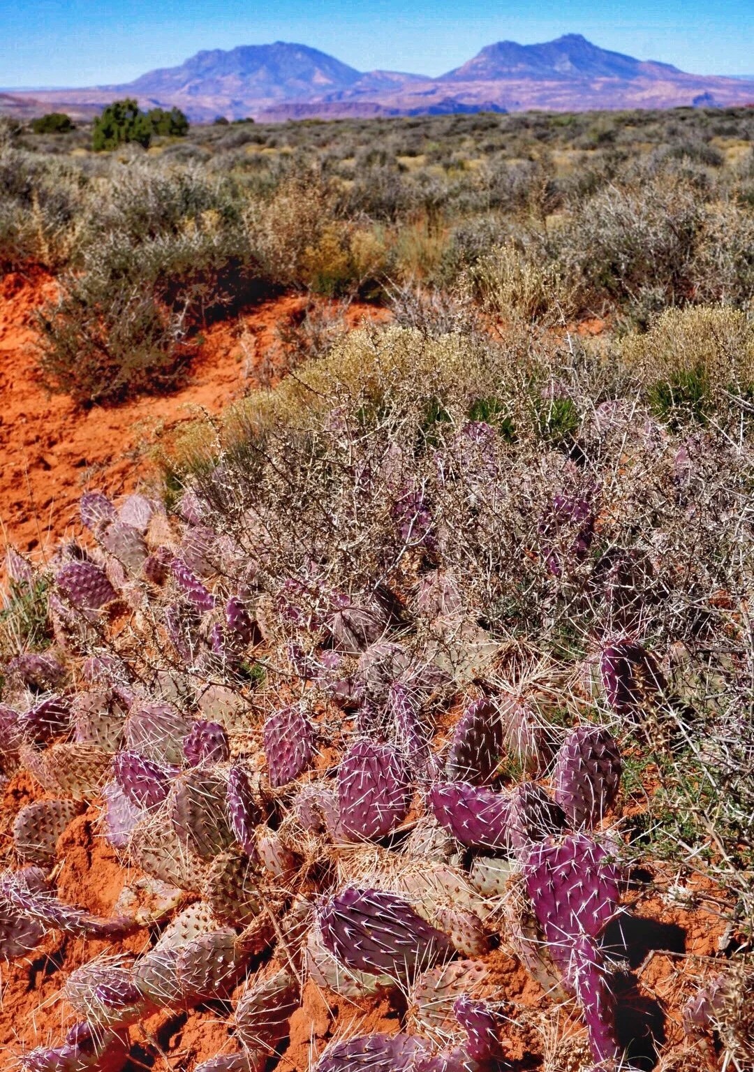
    The water was still a couple of miles away. We dropped into another narrow drainage. This was not ending. Every twist and turn and step felt like we were moving backward in time. Then the mud started, actually light quicksand. Have I mentioned that quicksand freaks me out? My hackles were raised. Chemicals of danger racing through my blood. The sun was going down quickly. We grew weary. An orange trickle ran through the quicksand. Still a mile from our next water source, there was a glimmer of hope to the end of this day. The trickle faded. More quicksand. Then another trickle, collecting into little orange puddles, deep enough to plunge a bottle into. Relief! But the drainage was narrow with no end in sight. We walked a few more steps and saw a steep ramp leading to higher ground. Up, around a corner, and up another rock shelf we found a spot just big enough for cowboy camping.

    • Recounting the day’s events. •

    My hackles lowered, and the bad chemicals settled. We toasted the crazy afternoon over a splash of gin. The sky was already dark. I ate a handful of nuts as the stars popped out. We ruminated over the crazy afternoon. This race, this crazy afternoon, sunk in as a new kind of flow I have not credited before. Like a wild animal, we went from content, to fast forwarding through lack of water, racing over the uneven landscape, feelings of danger, ready to collapse from exhaustion, and a crust on my throat so dry I knew we could not stop until we found water—to happily curled up in my sleeping bag with just enough of everything. It was a perfect rhythm to life that struck hard on my flow chords. My ribbon is taking on more complex forms now.

    I woke startled in the night. I saw my mother and brother in a dream, their faces so clear. Everything was stretched, like dreaming through a fisheye lens. It hit me in a instant, my mother and my brother’s face. I woke abruptly, startled to see their faces so clearly, so real, like I could just reach out and touch them. They were younger, around the time of my brother’s wedding. Why were they in my dream? The stars were bright, covering the sky like pin pricks in space, like the lite brite that fascinated me as a child. Memories flooded my eyes. My thoughts dizzy with disconnection, connection, flow, and a rambling chaos of colliding everything. The night had grown cold and my hips ached on the cold ground.

    We waited for the sun to reach our camp before packing up in the morning. The quicksand seemed firmer after the cold night. The narrow drainage opened up into willows and reeds. We reached our next water source, and it too was an orange trickle, heavily flavored by the taste of iron.

    • Another iron flavored orange trickle water source. •

    A few more hours of twisting and turning through the desert, landed us in Swap Canyon. More iron rocks and iron stains in the sandstone. Another orange trickle water source. Rabbitbrush, juniper and sage. Wind and sun. The afternoon was hot. We made our way out of Swap Canyon and to Notom Road, at the base of Burr Trail Road and Water Pocket Fold.

    • Break time. Resting in the shade of the Rabbitbrush. •

    • Alkaline Salt crusts. •

    We walked several miles south on Notom Road, having buried our food cache outside of the park boundaries. The best part about road walks is putting in headphones and being transported by music. These days it takes less than a minute before my tears unroll. So much to take in these last few months. And thru-hiking always peels back all the layers, of everything, maybe just like an onion. I build up all these layers over time, and weeks in the wilderness peels it all back.

    A half a mile before reaching our cache, an suv and a pickup stop, out the window a guy says, “hey you all look like thru-hikers”. “We’re thru-hiking the Hayduke”, Neon replies. The vehicles stop and the guy gets out and says he just finished the Arizona Trail, and then asked us what we needed. He offered up a list of stuff he had, and then Neon asked if they had anything fresh, like produce. The women went around to the back of her truck and brought us two apples, a carrot, a clementine, a handful of blueberries, and a hard-boiled egg. The first thing I thought of when I saw the egg was my mother. She always made hard boiled eggs when I was younger. Neon started to turn down the egg, explaining that we were vegan. I smiled at the women and said that I would love the egg. We acccepted the food with gratitude and stood in the road exchanging stories.

    Later at our food cache, I peeled the egg, and bit into it like I was fourteen years old again. I could see clearly the little aluminum pan my mother used to boil eggs in. The water bubbling away on the stove. The kitchen with the yellow cupboard doors. I had no idea then, that someday I’d be sitting in the desert, eating a hard boiled egg given to me by a stranger, thinking about my mother. Life is a funny thing, and sometimes a hard boiled egg is the best gift ever. There are no absolutes, not really, at least not for this relativist. Everything is just layers, like a peeling onion flowing across this strange landscape we call life.

  • I PROMISED THE TREES MY RELIGION (~85 miles on the Hayduke trail)

    I PROMISED THE TREES MY RELIGION (~85 miles on the Hayduke trail)

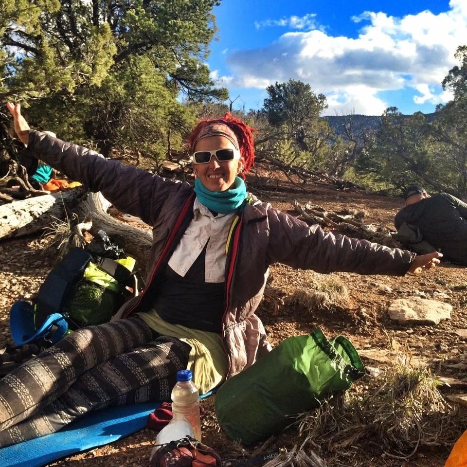
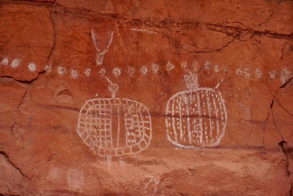
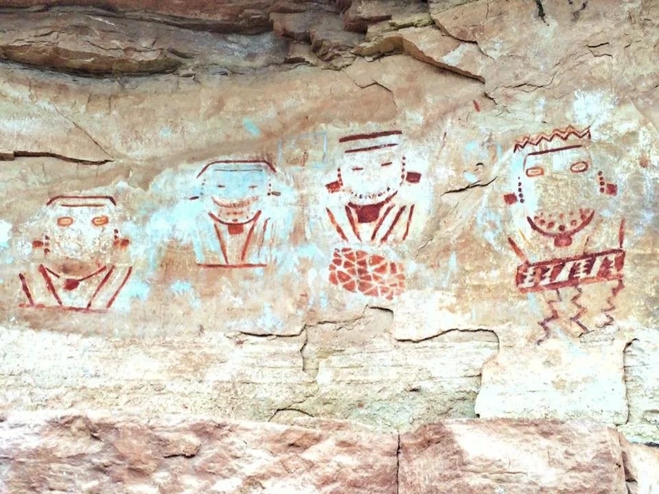
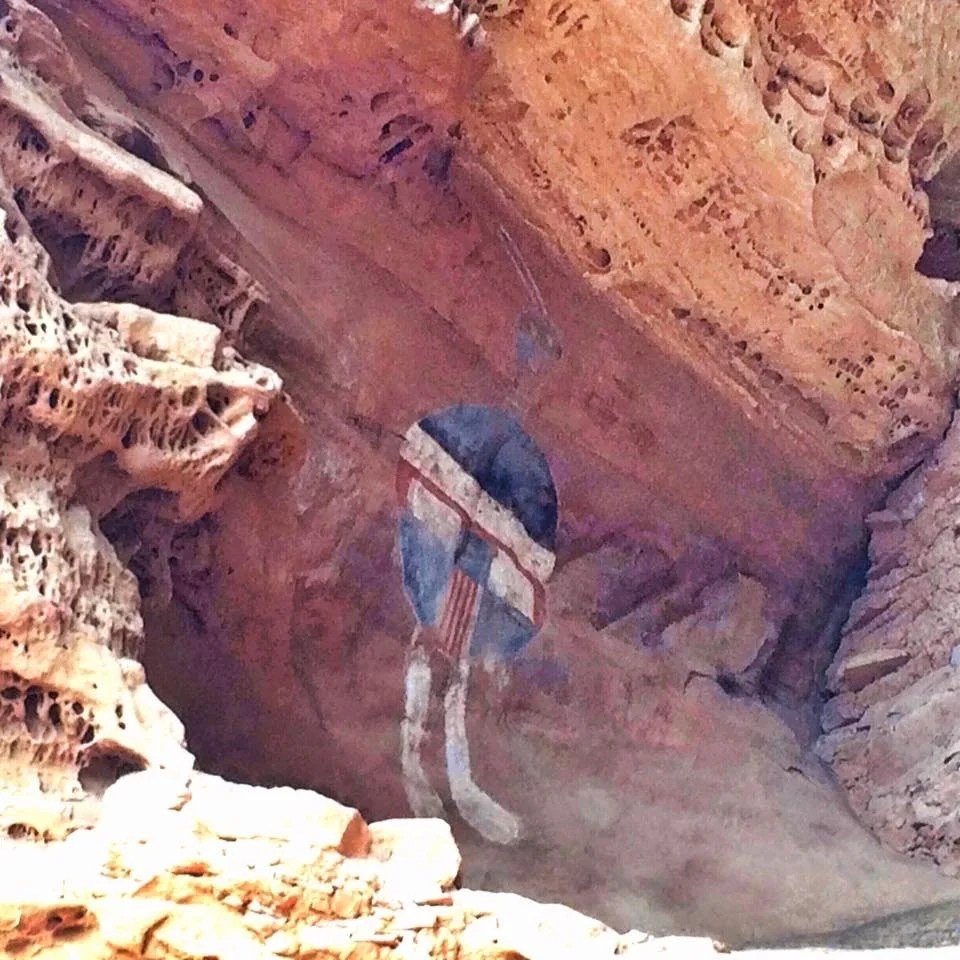
    The Hayduke is an ~800 mile route across Utah, from Moab to Zion. It goes through several national parks and wilderness areas, and has many alternates. Knowing that the Hayduke is more of a route than a trail, we conservatively planned on five days to complete ~eight-five miles. It took us six days. We began our hike at the northern end of Salt Creek Canyon in the Needles District of Canyonlands and ended near Hite Marina at Lake Powell.This is the first time I have hiked such a short section of a long trail, and in a group. I wasn’t really sure how the experience would go. There was no particular goal involved; no mountain summit, no Canadian border or state line. We didn’t even start at the beginning, or the end, of the Hayduke. Our plan was simply to hike “section 3”, about eighty-five miles of the route. For me it takes about a month on a thru-hike to reach the point that a shift of consciousness occurs, and two months to become fully grounded in the experience. I knew I would not have that experience on this hike, but I did hope to learn something new about myself as I wandered the wilds of Utah.It was an easy first day, ~twelve miles to our permitted campsite in Salt Creek Canyon. Our packs were heavy with the added weight of a bear canister, a new requirement for Salt Creek Canyon. The weather forecast called for some rain, and possible snow. As we got closer to our campsite, we hoped we might find an alcove, or overhanging cliff, nearby so we could camp without setting up the tent. The last half mile before our camp wound through overgrown willow saplings, and through what seemed like more of a recently flooded marsh than a canyon creek. Pink marking tape, tied periodically to the willows, marked the trail as we pushed the last mile through the brush to our campsite. We emerged from the thick vegetation to a signpost with the number of our campsite, and to our amazement, there was indeed an overhanging cliff, a beautiful alcove, to camp under. The evening was warm and we all hung out talking about the next day’s miles and the sites we’d see along the way.The next morning was cold and we woke to a light drizzle. The drizzle slowly turned to snow as the temperature dropped. We hiked on …more snow, then sleet, occasional hail; not exactly what we had expected, even having seen the weather forecast ahead of time. We were all beginning to feel a little desperate as we approached Four Faces, a petroglyph and ruin site, where we found a perfect overhang, up high and out of the weather. We stayed for several hours, drying out our clothes and getting warm, while we waited for a better weather window. I wondered how many others had sat here throughout time, under this same overhang, huddled out of the weather. A small twinge of connection to another time began to tug at the inner parts of myself.Bits of blue sky began to shine through the clouds, and the falling snow slowly subsided. We packed up and took a moment to greet the Four Faces petroglyph at the ruin site below, before venturing back on trail. The wind was cold, but there was promise of better weather on the horizon. Our desperation slowly turned to smiles as we approached the “All American Man” petroglyph site. We stopped for photos. Multiple layers of history filled the canyon. After a series of selfies, with this strange figure, we marched on, through the fallen snow, across the mud, and deeper into the canyon. The skies grew white and the snow, wet and heavy, fell with the furry of what felt like a full blown blizzard. Maverick, our permit holder for Salt Creek, marched ahead quickly, having brought very few bad weather layers. Neon and Marie fell behind, then Neon out of sight. Visibility became difficult. I stopped to wait for Neon. Maverick was gone. Marie passed. I hollered into the white, snowy, fog, “nEoN…”, and again, but no response, I turned back and headed down the trail in the direction we had come from …”nEoN…”, nothing… After a few minutes I thought I heard something, it was Neon. He had stopped at an overhang to rest and eat.He packed up and we headed back down the trail. After a bit we came across Marie wandering up a different trail. She had lost track of Maverick and wasn’t sure which direction, at a fork, was the trail. She followed us, and after a few minutes we came across Maverick waving at us from an alcove he had stopped to wait for us at. The snow was still falling heavy and we were all a little frazzled in the wet, cold, experience.Hiking in a group is a very different experience than hiking alone, or as a pair. There is a different feeling of responsibility, expectation, and order to the experience. For myself, when I am alone, or hiking with Neon, I feel completely grounded in the rhythm of the experience, fully competent, and with little worry about speed or obstacles in my path. But in a group, the dynamic is very different; the worries, tension, and control become paramount to the experience. And for myself, my personal speed and rhythm become compromised. I no longer feel fast, moving along with the path of the sun and the rhythm of my body. I become fully aware that these other animals posses a speed and a strength that I have never had. I begin to feel weak, and my rhythm and needs rushed. My strength has always been my perseverance, and long-term will and determination, but rarely short-term speed or brute strength. No, my strength is my will, and my ability to find a way through the obstacles in front of me, without using brute strength or speed to plow through the moment.I’m sure it is different for everyone, but I’m perfectly comfortable alone. I don’t feel lost or lonely; I feel part of my surroundings, not separate or isolated. I feel competent, grounded in the rhythm of the earth and the sun. I become the tree, run with the elk, and fly with the birds. I become as timeless as the rocks, the stars, and the wind. Something very giddy, calm, and excited overcomes me. It passes through me as if everything else is moving and I am standing still. And when I am fully grounded in the experience, I am completely transported, floating above the landscape like a dream or a vision. It is truly a gift, that as an artist, would do me wise to capitalize on this strength: my rhythm, my speed, this connection to the landscape …and to find this in my connection with a group.The day, moving toward evening now, finally broke into full blue sky. We dropped our bear canisters at the Cathedral Butte Trailhead, to retrieve at a later date, and ventured into the cross-country route to Dark Creek Canyon …over a rise, up a wash, and then steeply up loose sand and rock, seeming nearly vertical at times …and this with the weight of 4+ liters of water added to my pack. I began to feel that rushed, where the heck are we going, and is this really the best way, feeling. This can’t possibly be the “route”. There’s nothing sustainable or maintainable about multiple hikers scaling this vertical loose sand and rock. But everything was moving so fast. It felt more like being chased by a lion than being part of a migration.We reached the plateau. The sun was low on the horizon. With some discussion and pointing we settled on a campsite. I thought there, Neon there, Maverick there, Marie settled on a rock slab as to not puncture her air mattress on the prickly pear that covered the area. Neon and I finally agreed on a location for the tent. I cleared the area of rocks and pine cones, as he squished his face and said, “You want the door to go thEre?”. I said, “well, yEAh, I don’t want to climb out of the tent, uphill, and into a tree truck when I get up to pee in the night, so, yeah, then the door would face this way!” He shook his head and pulled out the tent stuff sack. He opened it, reached inside, and then some quiet, then loud, exclamations came forth. “What, is that not the tent?” I said. He looked at me. I paused. I thought about the rain last night. The cold, wet, snow today. I looked at the sky …and then said, “Well, that simplifies things then. With no tent, we can have our heads the direction you want and it will be even easier to get up to pee in the night.” We all laughed, ate, and spread out our stuff. The winds blew heavy in the night, with little snow. Our anxieties about the weather and no tent allowed for little sleep through the night, but we woke rested enough and promptly started our day to warm our bodies in the ice cold morning.The day took on a new rhythm …breaking and hiking periodically together, and sometimes in pairs. The day seemed to pass quickly, alternating between hot sun, and cold wind with dry snow flurries. Up steep ridges, down rocky ledges, through washes, overgrown sage and willows, and up again. Toward the end of the day we hiked through Ruin Canyon and up to a ridge with a ruin watchtower that looked out over the surrounding ridges and creek valleys. I began to feel again that connection to another time tug at the inner parts of myself.The night was cold with some snow. By morning my water had partially froze. Our route followed the middle of the ridge. We wound our way through the trees. It felt like a labyrinth intended to obscure the way. We broke through the trees to a view of high cliffs above, and a ramp of rocky ledges ahead of us. This was our way up.The sun was feeling warm now and my jacket hot. I started to get that rushed feeling as everyone plowed forward. I finally stopped, packed away my jacket, and took a moment to review the route. I chose a line on the rocky, fourth-class, ledge to ascend. We all climbed up different areas to the top of the ledge. Looking up, more ledges, and snow, lots of snow. It quickly turned into a race for the top, and best to just get up, and not think too much about it. Up snowy slopes, more fourth-class ledges, and through the trees.As we ascended the fourth class ledges through the snow, I told the trees that I loved them, because they held the ground together and helped make the air I breathe. They stand tall into the sky and bring my thoughts to something old, perhaps even ancient; reminding me of the cycles of nature when we were just another entity, an animal roaming the earth. I reached for a branch, testing its strength before grabbing tight. My foot slipped a little on the icy sandstone. I pulled hard on the tree limb, and whispered, “I promise you my religion, just don’t let me fall”.It was all very exhausting, and tricky in the snow. After a few more ledges and steep snow slopes we stopped for a break. It seemed we were through the worst of it …until we came to another ledge, just a little too steep to get footing on in the snow. I reached deep into the snow and grabbed tight ahold a prickly bush, pulled hard, and up I went. My hands so cold now, they hurt. I had to stop and breathe warm breath into my fingers. They were burning. But there was more rock ahead. It all started to look like a wall, and a wall of snow. There was nothing to pull on except the trees and the bushes. We moved around a corner, steep on the cliff. My foot holding on a thin ledge of snow that sloped off to the valley below. I wedged between a tree and the rock face. Neon was already up. “How’d you do that? I can’t do that!” I looked back at where we had come from, and then tried pulling up the rock. Neon said, “Use that pocket finger hold right there, then grab that dead tree branch.” “With this pack on? I don’t think so!”, I said. I tried. It wasn’t working. Maverick was right behind me and held my back as I tried again. I stepped up, pulling on the pocket hold, held from behind, I grabbed the branch and I was up! I swung around the branch, stepped up again and I was atop the rock, but quickly became tangled in the branches of the bush above. I was pulling, trying to use that brute strength I don’t possess, when I decided to catch my breath, balance, and reach back to gently remove the branches that were caught on my pack, and then I thanked the trees for holding on. I heard Maverick yelling below. It didn’t sound good. “Did you slip?” I asked. More yelling. I couldn’t tell what was going on. I broke free and moved out of the way. “Is everything ok?” “I slipped and lost one of my trekking poles”, he shouted. Finally we were all up and Marie was waiting for us. I looked ahead, hoping that was really the last of it.We moved across the slopes and finally made it to the Trail Canyon trailhead. There was still a little snow, but there was also trail. We quickly descended down the trail and into the canyon. We camped at Woodenshoe Canyon. It poured down rain through the night. We were drenched and cold, but warm enough, or at least we didn’t actually freeze rolled up in our ground sheet. The next day we made it through the rest of Dark Canyon. Across trail, through the creek, traversing the limestone ledges and the trails above the narrowest parts of the canyon. We camped at the base of the Sundance Trail, our trail out of Dark Canyon, and to the road walk back to the car. The night was warm, and thankfully dry.We woke in good spirits and climbed out of the canyon. I felt as though I’d just exited a wormhole. It took a few minutes, but I shook off the experience, looked at the map, consulted the gps and took course across the landscape. Polarized sunglasses, check! Headphones, check! I looked behind me, everyone was there, check! And off I went …transported, gliding across the landscape like a hawk hovering in the wind. It all came to life. I wondered what I had learned, and then I let go, stopped thinking, and just walked…salt-creek-canyon-2salt-creek-canyon-1haduke-hiker-trash-salt-creekbreak-timepeekaboofour-facesall-american-mansnow-day-2ruin-canyon-lookoutpottery-ruin-canyonentering-dark-canyondark-canyon-narrowshenry-mountainsroad-walk-1prickly-pear_________________________