“Lasso to Salinas – Quilatoa via the Los Tres Volcanes Route” The Quilatoa section of the Los Tres Volcanes route travels through small villages and hillsides, full of small farmed plots reminiscent of a patchwork quilt. We left the Panamerican Highway at Lasso late morning, stopping for lunch in Toacazo, before climbing back into the paramo. It started hailing as we climbed higher, and we wondered where we might find camping.
 We were surrounded by small homesteads and farmland, with very little wild land, but we eventually found a place to set up our tent, away from the road, between a few unused buildings. As the sun was setting a man whistled and said hola. We asked if it was ok for us to camp here. He replied yes, and then asked us all the usual questions: “What do you eat? Don’t you get cold? Where are you from? How do you make money? … … …” We chatted for a while, until the sun dipped below the ridge.

 The morning was cold, below freezing, but the sun was shining and the mountains were all out.
 Illaniza Norte and Sur on the left, and Cotopaxi on the right…
 Cotopaxi looking beautiful in the morning light…

 Soil profile… I still love seeing the different soil horizons.
 …back in the grass tussocks of the Paramo


 Alpaca mama and baby…

 …more patchwork-quilt farmland

 Neon making his way through a shepherd and his herd, llama, and dog…
 After winding our way through the grassy paramo and patchwork-quilt farmland we descended down into the Toachi River valley, passing small villages and more farmland along the way.
 Chochos, as the beans from these Lupine plants are called locally. I’m not sure if the plant is also called “chocho” here, but it is a species of Lupine that is a common food plant in the Andes. I believe there is another Lupine species that is cultivated for the beans in Italy as well. And as a side note for those that don’t know–don’t just go eating lupine beans, as most are extremely poisonous, and even these take special preparations of soaking and draining, but prepared properly, they are delicious!
 Neon pointing the way down the steep rutted trail where our route leads…


 I believe this part of the route was the steepest hike-a-bike descent I’ve ever done. The footing was very loose, and it was quite steep. You can see the lower part of the descent (in the photo below) where the trail is bordered by bushy grass zig-zagging down the hill slope.

 At the bottom of the valley, across the Toachi River we passed through another small village. Many of the buildings had been damaged by an earthquake and looked like they were no longer in use.
 …more chochos

 We climbed out of the river valley on a well graded dirt road. It was hot, and more desert-like than anywhere we had ridden in a long time. We saw a number of cactus and yucca-like plants.

 Chochos, glowing in the afternoon light…
 Sheep, grazing on the nearly barren hillside…
 We detoured around the first part of the steep hike-a-bike, continuing on the dirt road until we reached Shalala, a tourist lodge and trails, near the crater ridge of Quilatoa.
 We gained the crater rim on steep trails before reaching a road that led into the small town of Quilatoa, where we found a reasonably priced room in a hostal for the night.

 The next morning a fast descent on pavement led us to Zumbahua. We stopped in several of the little stores to resupply, found espresso in one of the small cafes, and got some food to go from one of the food carts in the square.

 Another coffee photo, because espresso, and I loved the tiny china cups…
 After Zumbahua we climbed back into the paramo.


 At the top of a pass we detoured down a smaller dirt road to look for camping. We found a flat spot, perched above the road, with views of the valleys on either side.


 I stared out the tent door, tucked in and cozy, as the sun grew heavy on the horizon. The air was crisp, but still. A silence rose as the sun dipped below the horizon. Fluffy clouds filled the sky, turning orange and pink with the setting sun. The wind blew gently, against the rolled up door of the tent, as I drifted off to sleep. All was calm …until I woke in the night to the slapping sound of the wind against the tent. Fwap, fwap, fwap—the tent danced around wildly. I woke several times to push back against the tent to keep it from smacking my head.By morning there were sustained winds of 50 mph, with gusts of 70 and 80 mph. There was no coffee, no pooping—only panic to pack up as quickly as we could, without loosing anything to the fury of the wind.[Have you ever climbed Mount Washington in New Hampshire in the winter? If you have then you know the kind of wind I’m talking about. It’s the kind of wind that when it pushes you over, it’s almost impossible to get back up.]
 Baby pigs, you can tell how small they are by the size of the puppy in the photo…•It was windy all day and our spirits began to wane with every push of the wind. We stopped for second breakfast in Angamarca. The lady at a little tienda knocked on the wooden window across the street to ask about breakfast for us. A women poked her head out the window to look at us, she squinted and closed the window. A moment later she opened the front doors on the corner and waved at us to come inside.She brought us hot water for coffee, and began dishing up two plates of food before even telling us what she had. I looked at Neon and said “It looks like chicken; do you want my chicken?” She sat two plates down in front of us–full of rice, lettuce, chicken, and a banana each. I was really happy about the banana. I put my chicken on Neon’s plate and happily peeled my banana, then ate a little of the rice with my lettuce. I had food on my bike, but with so much effort exerted to get through the wind, I was happy to have some extra calories to get me through, especially since we were still so far from the next, better stocked, town.


 Looking back on Angamarca and the other small villages below it…
 The wind continued through the morning and into the afternoon. We were pretty exhausted by this point, and took a short break every time we encountered a sheltered nook in the landscape.

 We grew a bit desperate by the evening hours, wondering where we might find a sheltered place to camp. We finally found a place nestled in some trees. It was still extremely windy, and even with the trees blocking a lot of wind, the wind was so strong, I had to tie the corners of the tent to our bikes and to the surrounding trees, because the wind kept pulling the stakes out of ground.


 I’m usually completely happy to forge my way through whatever difficulties present themselves, but by the time we were approaching Simiatug, not even midday yet, I turned to Neon, and said “when we get to Simiatug we either need to hire a truck to Salinas or get a room for the night because I’m done, at least for today”.
 With two solid days of wind, big wind, the kind of wind that pushes you over, the struggle had become so exhausting—being pushed over, dropping the bike, sliding backwards [uphill] while riding downhill, and nearly being swept off cliff side—when we got to Simiatug, we hired a collectivo pickup (taxi) to take us to Salinas. The collectivo took the same route (mostly) that we would have ridden on the bikes. It was beautiful terrain with interesting rock features, and our first view of Chimborazo, but I was so happy to be all done battling the wind.
 The central square in Salinas–there were always people gathered round, and kids playing volley ball.
 We were so exhausted from all that wind, we decided to take a day off in Salinas. It was a cute town with great pizza, good coffee, and a chocolate factory. I would have liked to have toured the chocolate factory, but after taking a taxi to the bigger town of Guaranda to get cash, we decided to skip the tour and just spend some time recuperating. I did however purchase some of the best dark chocolate I’d had since finding a Lindt dark chocolate bar in Baja California.••_____________________You can sign up to receive The Redheaded Nomad’s blog posts in your email inbox; sign up at the bottom of any page on my website: theredheadednomad.com•For more frequent updates, follow me on Instagram at: instagram.com/theredheadednomad•You can also find me on facebook at: facebook.com/redheadednomad•If you enjoy my posts and would like to make a contribution toward my travel expenses, or just buy me a coffee in appreciation, you can send an amount of your choosing through my paypal.me address:paypal.me/inthewildland_____________________
Tag: esker cycles
-
TEMBR 3: Quilatoa
-
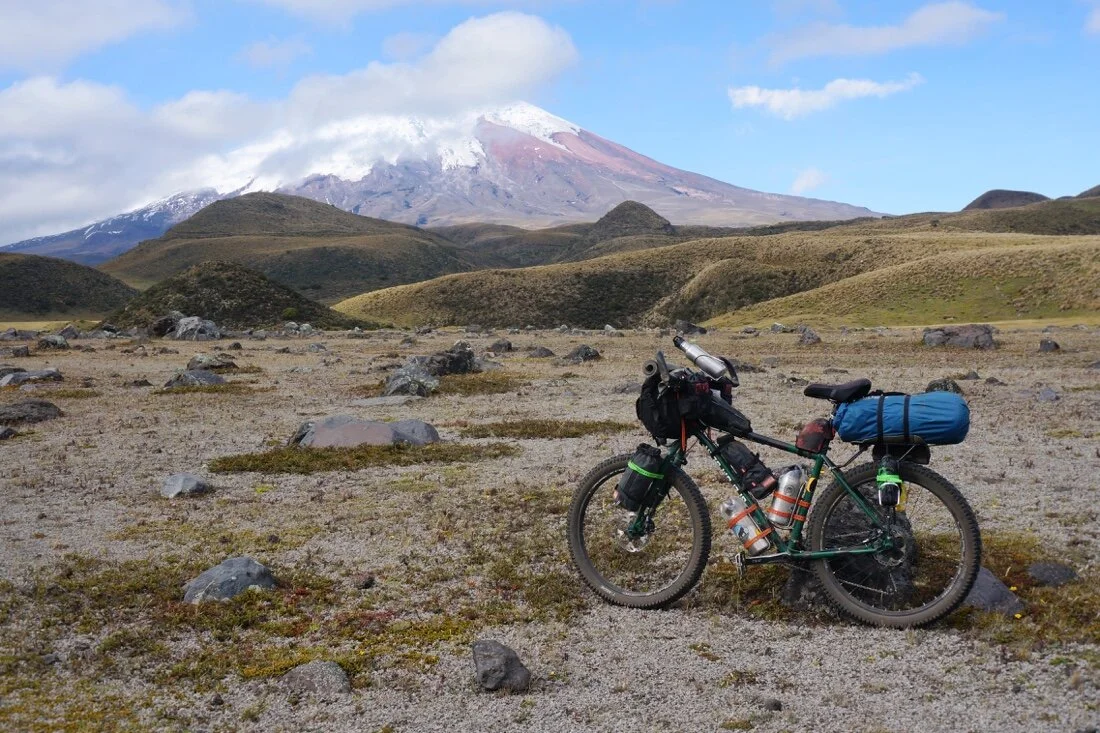
TEMBR 2: Cotopaxi

“Tumbaco to Lasso – Cotopaxi via the Los Tres Volcanes Route”
 The bikepacking.com‘s Los Tres Volcanes route goes around Cotopaxi, Quilotoa, and Chimborazo. It’s not really part of their TEMBR route (Trans Ecuador Mountain Bike Route), but it can be woven into the middle of it for an epic ride (and hike-a-bike) through some amazing volcanic landscapes.•After our major hike-a-bike up Yanaurca de Piñan on the TEMBR singletrack route, Neon decided to strip his bike down to the bare minimum for our ride on the Los Tres Volcanes route. It turns out that the local Ecuadorian postal service “Correos del Ecuador” has a service similar to our post office “general delivery” in the U.S., where they’ll hold packages for up to 30 days time*, so we shipped a rather sizable box south to Cuenca for only ~$6.
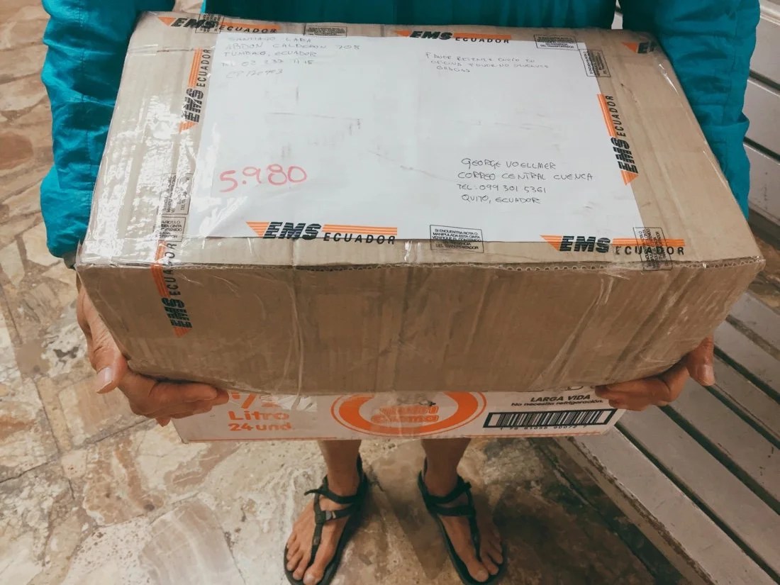 [*This is what we were told in Tumbaco, but after two weeks time we got a phone call from the PO in Cuenca telling us they would only hold our box for five more days. So we had to speed things up a bit.]We left Tumbaco on the TEMBR dirt road version, following a series of mostly cobblestone roads to Pintag where we hooked up with the Bikepacking.com Los Tres Volcanes route. We gained a dirt road shortly out of Pintag, then cobblestone roads for most of the afternoon.

 The ride from Pintag to Cotopaxi was mostly on cobblestone roads, but not your average cobblestone roads—these were soul sucking, bone shattering, energy sucking cobblestones—until we turned onto a smaller road with time polished little river rock cobbles. The smoother surface slowly lifted my mood, and my energy.


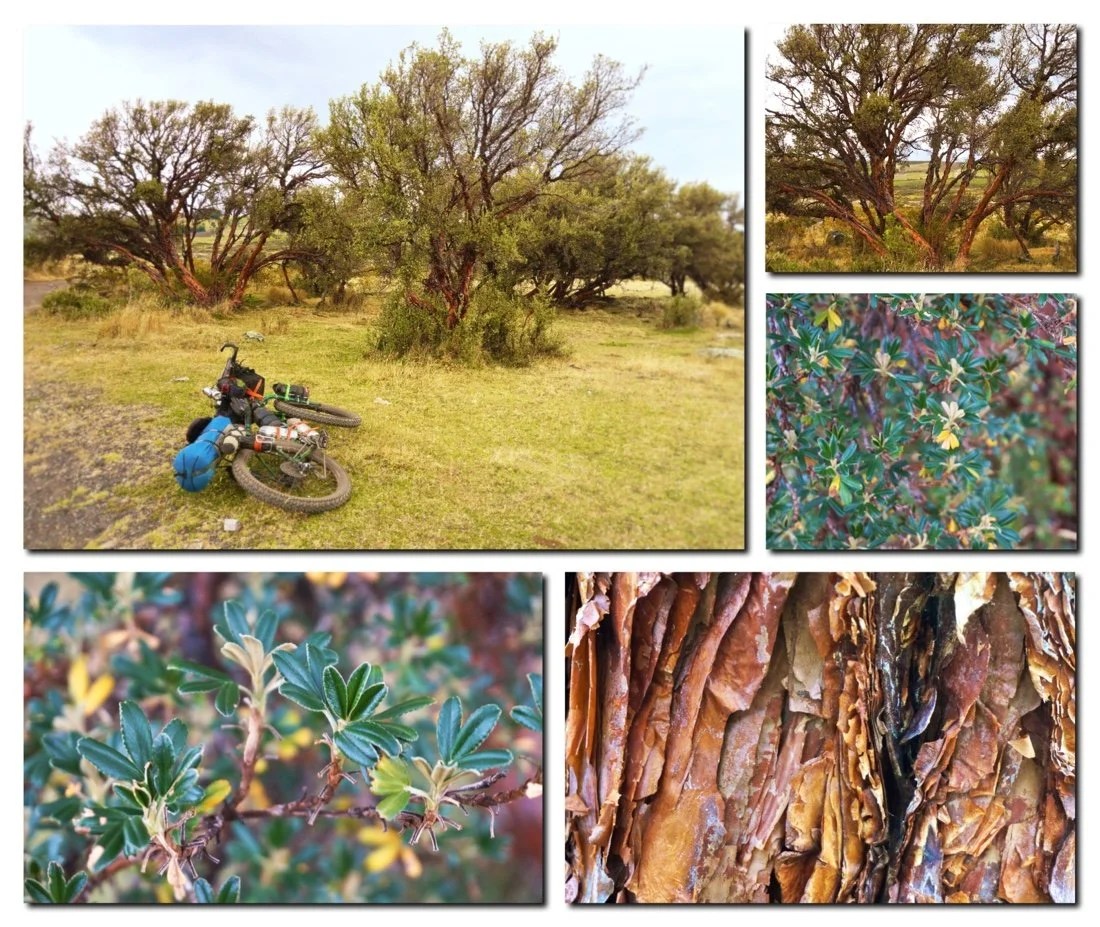 I was pretty happy to come across this mini forest of Polylepis as we rode toward Cotopaxi. Polylepis is thought to be the highest flowering tree in the world. They only grow at mid to high elevations in the tropical Andes, and there aren’t many large stands of them left.
 After a few more kilometers we turned onto a sandy dirt road. It was heaven, fast, smooth, sinuous dirt. Cotopaxi started to show itself through the cloud layer. Our moods shifted. The terrain was perfect for camping, empty and wild, with panoramic vistas. We rode a few more kilometers, along the outskirts of Cotopaxi National Park (riding on the singletrack route for a short bit to avoid going to Tambopaxi Lodge), until we had the perfect view of the mountain, before pitching our tent.


 The sky was full of stars when I woke to pee in the night. My eyes immediately focused on Pleiades (my favorite constellation), then Cassiopeia. Cotopaxi was perfectly clear, like a giant on the horizon. I stood there just staring in awe, until I was too cold and began to shiver uncontrollably, before returning to my cozy quilt.We woke to puffy clouds and blue skies. The air was crisp, near freezing, but the sun was shining, and considering we were at 3,710 meters (12,172 ft) it felt surprisingly pleasant (for how cold it was). The sun here is so intense that even on chilly crisp freezing mornings it can feel quite nice out, but when the sun dips behind a cloud, it feels instantly freezing. It had me unzipping my jacket to try to keep from sweating, then rezipping five minutes later (when it went behind a cloud) to keep from freezing.


 We followed good dirt roads for most of the day. The views from the bike were otherworldly, large and small boulders dotted the landscape, small hills/mounds rose from the flat, and Cotopaxi stood tall like a god surveying its lands. When we stopped to eat I could see that what I thought was just a carpet of grass covering the surface, was actually a variety of different plants: mosses, lichens, ferns, lycopodium, flowers, and so much more.


 Shortly after lunch we came upon a locked gate, the first of many we’d encounter on our way to Lasso. Thankfully we’d had a lot of practice getting our bikes up, over, and under locked gates during our time in Mexico, so we were able do these fairly efficiently.

 After hauling our bikes over the gate, we dropped into a big wide valley and followed nice double track along the Rio Tamboyacu.
 I’m not sure what these shallow pits were, but they reminded me of the tomb sites at Tierra Dentro in Colombia.

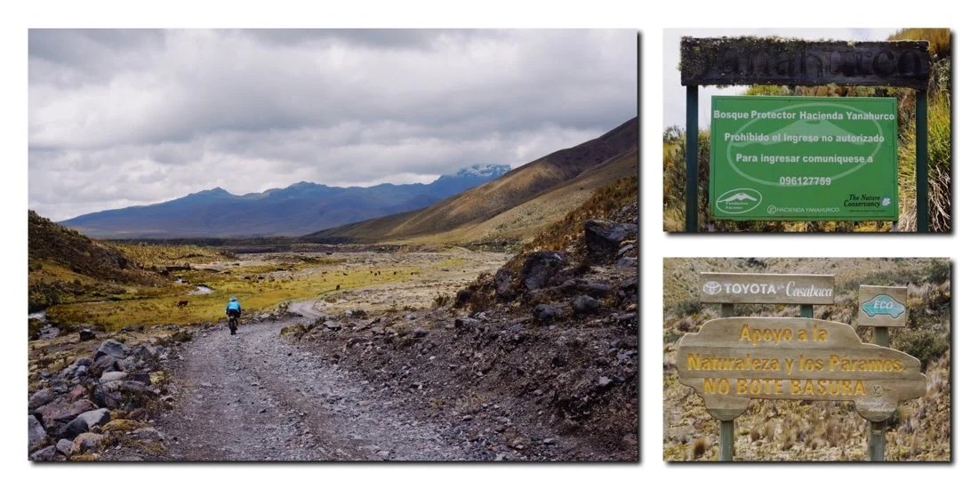 We passed several signs, after the locked gate, that suggested the area is a preserve of the local paramo. But obviously the road still sees a lot of traffic.


 Rio TamboyacuThe roads were so nice that we rode several kilometers past one of our turns before realizing it. We backtracked to where we left our route, to find another locked gate. This one was a little tricker to get the bikes around. The gate was quite tall, so we opted to take our bikes over the berm fence* beside the gate, but that was also difficult because there was a three foot deep ditch fence on either side of the gate as well.[* a lot of fences in rural Ecuador are earthen fences, where a deep ditch is dug around an area, and often in combination with a berm (utilizing the dirt that came out of the ditch).

 We made it across the gate and fence to an old, mostly unused, two-track road that eventually deteriorated into meandering cow paths.
 After a short while we came to another gate, thankfully this one was unlocked, but the cow on the other side gave us that look like he’d never seen the likes of anything like us before.

 Shortly after that we came to another gate, also unlocked. We trudged through ten inch deep sticky mud, for thirty feet, before reaching dry ground. Several dogs came running out, barking, snarling, and growling. Usually I find this annoying, but we had just entered someone’s private homestead through a closed gate–so I looked at them and said ” I know, I know, but this is where our track went. Surely you’ve seen the likes of us before”? They sniffed my ankles, growling a little under their breath (and making me a little nervous), but eventually they wandered off, in the direction we were heading.
 We passed a couple of buildings, then came to another gate where several men were working. It always amazes me here how no one seems alarmed by our presence. They do very often look at us as though we’re very strange and foreign, but not like “hey, what are you doing on my land”. Instead they smile and welcome us, ask us where we’re heading and give us directions.
 Looking back on the homestead.After looking at our map, I realized where we had missed our turn and then backtracked to the locked gate with the earthen fence, we could have just continued down the nice road and it would have taken us around to the same place to cross the Rio Tambo, without having gone through the homestead. But then we would have missed this great interaction, which now, looking back, holds a very strong memory for me.
 When we reached the tiny village of Tambo there were three gates to choose from, and our track made little circles on the map. We finally decided on one of the gates, but just in case, Neon also hailed directions from a local that was nearby. The local asked where we were heading, to which we replied “Mulaló” (a small town near the Panamerican highway). He pointed us in the right direction, adding “just follow the green”.
 The tiny settlement of Tambo.
 Neon, getting directions from the local.
 Horse corrals in the tiny settlement of Tambo.
 Quilindaña rising above the ridge.

 We continued on, following the green, for a few more kilometers before stopping to camp near a hand-dug mini-canal.


 Near sunset the clouds cleared just enough for us to get a glimpse of Antisana. The views on this route have been incredible.

 The next morning we continued on “the green”, until our route dropped down to the Rio Tambo, and then for what seemed like an unnecessary hike-a-bike along the Rio Tambo, only to climb back up a “carry your bike” style hike-a-bike back to the green. My advice to future riders here is to just follow the green and don’t drop down to the Rio Tambo after the small settlement of Tambo.
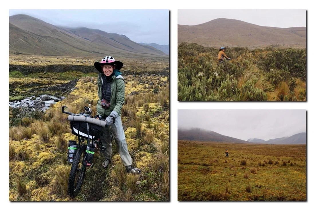
 Snack break on the soggy paramo.
 By midday we started climbing up to the pass. It was hard work, but there was the promise of a road on the other side.

 It’s steeper than it looks!

 We encountered a lot of deep mud on the “trail” from the pass to where a road began to emerge. It never looked very deep, maybe an inch or two, but my rear tire was repeatedly sucked into a muddy void all the way past the brake caliper. When we finally reached drier, less muddy, ground I gave my brakes a good hosing off with my bike bottle. Shortly after we finally reached more of a road. It was highly eroded in places, but completely ridable for two wheels.
 On the way down we encountered several more locked gates (four of them after the pass if I’m remembering correctly).
 It rained the whole day, raining harder as we went down in elevation, so this locked gate (above) was the last photo I took. From this gate the route goes on through logging land, passing through several more locked gates before dropping down into a narrow river valley for one last steep uphill, followed by a sweet descent into Mulaló, and then a short ride on dirt into Lasso.It’s pretty special to get to be in these places. I don’t always remember that at the time. Sometimes, in the moment, it feels like pure bliss, and other times I’m like “why does the route go this way”, or this would be nice “if only …”, but looking back I realize it was all magic and I wouldn’t change a single thing. I keep trying to remind myself of that as I continue forward on this journey, to just be present, and that the magic is there if I’m open to it.
_____________________
You can sign up to receive The Redheaded Nomad’s blog posts in your email inbox; sign up at the bottom of any page on my website: theredheadednomad.com•For more frequent updates, follow me on Instagram at: instagram.com/theredheadednomad
•
You can also find me on facebook at: facebook.com/redheadednomad
•
If you enjoy my posts and would like to make a contribution toward my travel expenses, or just buy me a coffee in appreciation, you can send an amount of your choosing through my paypal.me address:
_____________________
-

TEMBR 1: Dirt Roads & Epic Hike-a-Bikes
“Tulcan to Tumbaco”
 I’ve been looking forward to the bikepacking.com Trans Ecuador Mountain Bike Route (TEMBR) long before we ever began this adventure. I visited Ecuador on a mountaineering trip twelve years ago; I fell in love with its mountain landscapes then, and have wanted to come back ever since. As soon as we crossed the border into Ecuador I could feel the mountains calling me. It was immediately different than Colombia.Before beginning the TEMBR, we stopped in to see the Tulcán cemetery, a tourist attraction known for its topiary sculptures. The topiary sculptures were started by the cemetery’s gardner, Josè Maria Azael Franco, in 1936. He passed away in 1985, but his work, and the tradition of topiaries, still continues today.

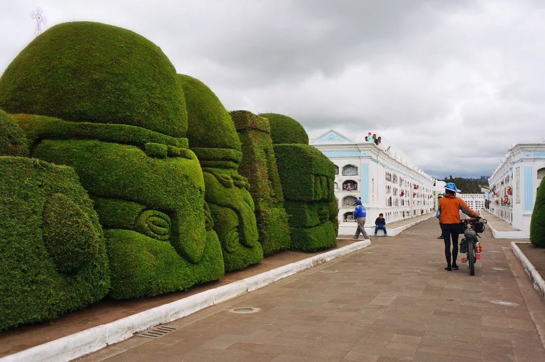


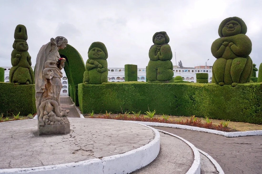

 Our plan is to follow parts of both the dirt road and singletrack versions of the TEMBR down to Peru. The TEMBR dirt road version begins in downtown Tulcán, and within just a few short hours climbs high into the Paramo on old cobblestone roads, past farmland, through tall pampas grass, and into frailejones, as far as the eye can see, in the El Angel Ecological Reserve.

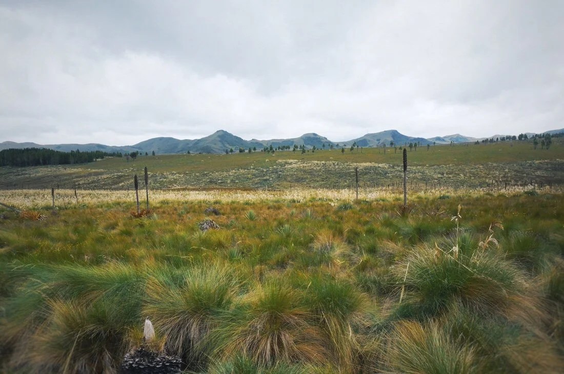


 The “paramo” is a tropical alpine zone (~3000 to ~5000 meters); it is divided into sub zones characteristic of different types of vegetation. We travelled through different zones including grasses, small and large (including pampas grass), shrubs, and frailejones.
 Frailejones (espeletia) are a perennial subshrub in the sunflower family. Their fuzzy leaves protect them from the cold and help to capture water vapor, transporting water into their trunk, down to their roots, and into the soil, making them a recognized and important part of the world water cycle.


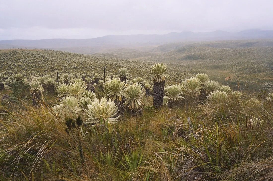
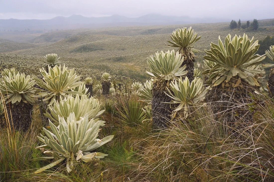 It’s pretty special to have the opportunity to travel through the paramo, and through such dense populations of frailejones. Frailejones, like many key plants around the world, are endangered due to land use history. They’re beautiful, and mysterious plants. It’s an enchanting experience to spend so much time with them.


 We arrived at the El Angel Ecological Reserve guard station in time for sunset. It was raining and the guard on duty offered to let us sleep in the picnic pavilion, a welcome offering considering the weather.
 It was still raining when we woke. The clouds were so thick we could hardly see fifty meters. We had planned to hike to the lakes, Lagunas El Voladero, but considering the visibility, and the icy rain, we decided to just pedal onward to lower, and warmer, elevations.
 …looking ridiculous in my ultrasil rain gear. I made this rain gear back in 2012 for my thru-hike of the Pacific Crest Trail, and have since used it on all my thru-hikes, mountaineering adventures, and international travels. It might not be magazine pretty but it’s kept me warm on more adventures than I can count.•

 We dropped down below the clouds, stopping to delayer, and warm up with some hot food, in the town of El Angel. The dirt road version of the TEMBR continues around through Buenas Aires, but it’s currently suggested to not go that way due to security issues related to illegal mining. We decided to leave the TEMBR dirt route at San Isidro, passing through Mira, dropping down to the Panamerican Highway, then over to Salinas to the start of the TEMBR singletrack route.

 …if my bike had wings! Because this is what it feels like to ride through the mountains.•
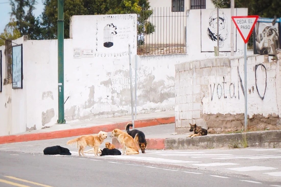 A gang of dogs in Mira. Thankfully this gang paid us little attention.•
 Dropping down to the Panamerican Highway, Imbabarra in the distance; we could see this mountain for days.•
 It got hotter, and dryer, as we dropped down to the Panamerican Highway. We started with freezing rain in the El Angel Ecological Reserve in the morning, and by midday we were in a hot desert environment surrounded by fields of sugarcane (and tiny biting flies).•
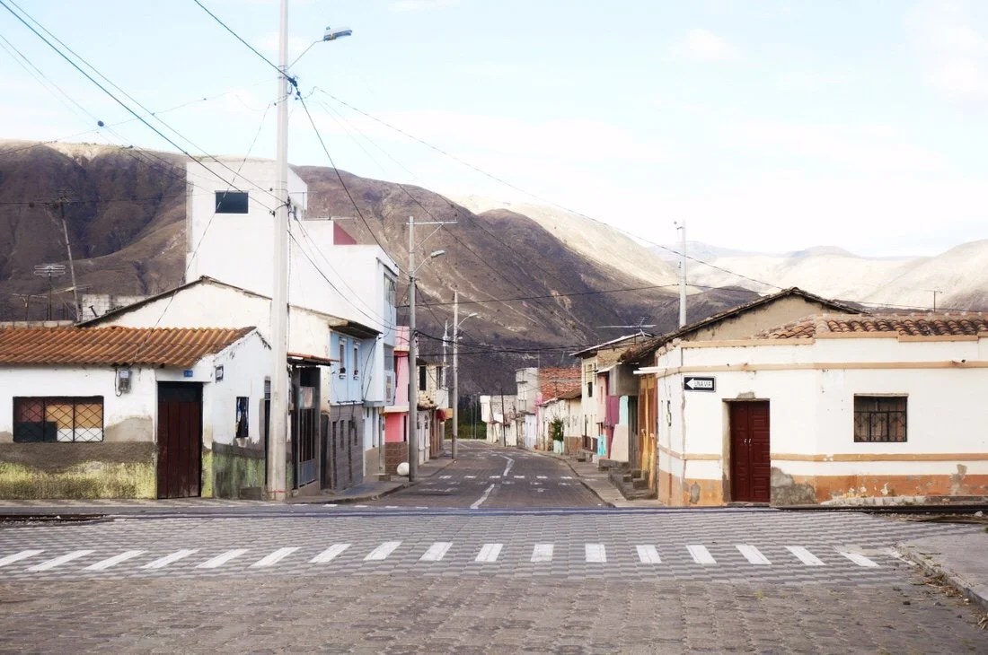 We arrived in Salinas, hot, thirsty, and tired. The town had an abandoned kind of charm, “muy tranquillo”, as locals might say, but it was a tough place to find food. The few restaurants were all closed, and the stores had little to offer more than potato chips and cookies. We did score some peaches, but I went to bed feeling hungry, and a little nauseous from the greasy sugary snacks.
 I woke sick in the night, several times, puking until dry heaves ensued. We had planned to start the singletrack route from Salinas, but with the lack of resupply, feeling sick, and the only available hostal being on the dingy side, we decided to ride south to Urcuquí. It was a hot climb to get there, I was feeling pretty ill, and the tiny biting flies kept me in a bit of a panic the whole way. I was happy when we arrived in Urcuquí, to a charming little town, and a very comfortable, clean, and cheap hostal. And best of all: tons of shops with good food, and an abundance of produce.

 I spent three days in Urcuqui, healing myself with all this produce (and more), plus lots of Lulo (naranjillo) and granadilla.
 Sunset in Urcuquí, looking up toward the mountains we would climb into.•We contemplated backtracking to the start of the singletrack route, but since it starts with an epic hike-a-bike, supposedly one of the most challenging on the route, we decided to explore and find a different route up into the Cotocachi Cayapas Ecological Reserve. Our route didn’t turn out to be any easier, and it may well have been more difficult. But I had a great time exploring, and climbing up into the mountains, which seems to be my favorite thing to do regardless of how I get there.


 After some strenuous hike-a-bike we met up with a road, which we could see continued all the way down to the valley we had just pushed, shoved, tugged, and carried our bikes up from. Neon turned to me and said, “well, now don’t I feel stupid”. By this point we were already exhausted so we altered between riding, and pushing our bikes some more. Near the end of the day we came to a gate; it was unlocked, but it had a big sign declaring it was private land and only authorized personnel could enter. It was late on a Friday and no one was around. We only had another two kilometers to the border of the ecological reserve, so we continued through the gate, up the road, to the edge of the reserve where we found a secluded spot to camp tucked away in a pine forest.
 The next morning we followed the road for a short ways before it ended. A man on a horse passed us and headed up into the bushes. We followed, finding more epic hike-a-bike trail.


 The morning faded to afternoon as we strained our way higher into the clouds. By this time Neon was cursing his heavy bike. I’d spent the last year lightening up my bike just so I could do this very thing–so while it was a lot of work, it still felt within my capabilities, and in some perverse way, I was actually enjoying it.
 If you zoom in on the above photo you can just make out a tiny Neon, on the left trail, heading up toward the notch.

 Gaining yet another rise/pass in the landscape; Neon was pretty over it by this point.
 Descending down to a small valley/meadow, we hooked up with the TEMBR singletrack route.

 As we descended into the valley/meadow a condor soared overhead. I was already pretty stoked to be here, but the condor made it feel all the more special.
 We took a break for a late lunch, watching two condors soar above the valley/meadow.
 You can just make out the white on the condor’s wings, to the left, and a little above, of the little barn.
 We climbed out of the little valley/meadow, pushing our bikes across a ridge for what was probably another hour or two before we came over another rise where we caught our first glimpse of Yanaurcu de Piñan. I was beyond stoked at this point. Not only had I been able to get my bike here, something I wasn’t sure I had the strength to do, but the condors, the mountain, and the cloud tease were pure magic.
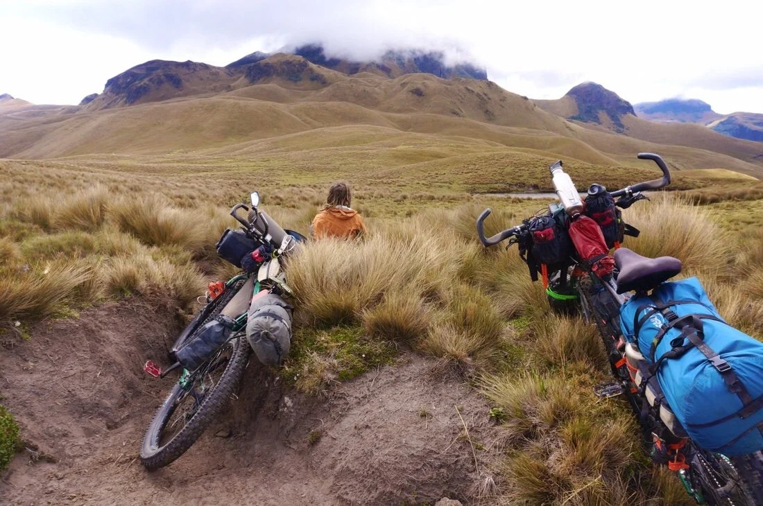 We’d only made seven and a half kilometers by three in the afternoon, but we decided to call it a day, and set up camp with the perfect view of Yanaurcu de Pińan.


 We lingered the next morning, partially because we were tired, but I also didn’t want to leave this magical place. Someday I’ll come back to climb this beautiful mountain.
 We were able to ride short parts across the paramo, but there was still more rutted “trail” to navigate, and the thick paramo grass to get through. As we crossed the open paramo three condors soared overhead. I thought condors were a pretty rare sight, but we must have had perfect timing.

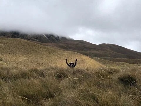 That’s me, reaching up through the tall bunches of grass. My bike is in there somewhere too!
 I was pretty jealous of Neon being able to carry his bike; I found the tall grass much more difficult than the ancient trails we had pushed our bikes up the day before. With a broken back, carrying my bike isn’t really an option for me, not for long distances anyway.
 After weaving and tugging our bikes through the tall grass, for at least an hour, probably two or three (for me anyway), the road, where the singletrack and dirt road route meet for the first time, finally came into view. A very welcome site.
 Just before gaining the road I came across these large green mounds. At first I thought they were Llaretta, azorella compacta, a plant that grows in Bolivia. Some of the llaretta mounds in Bolivia are estimated to be ~3,000 years old. But after a little internet research it seems llaretta doesn’t grow in Ecuador. But it is an azorella, I just don’t know which species.


 We finally gained the road, three hours after we left camp. We stopped for a short snack break on the side of the road; two more condors soared overhead. Maybe we were seeing the same ones; I don’t know, but I was feeling pretty lucky at this point. We headed down the road; It was great to be pedaling again. We had a fast descent down a steep dirt road, before cutting across farmer’s fields, then along a canal.


 Neon looking down into the steep, deep, gully under the canal “bridge”.
 __
 We set up camp at the edge of the canal, not wanting to rush into town after such a magical mountain experience.
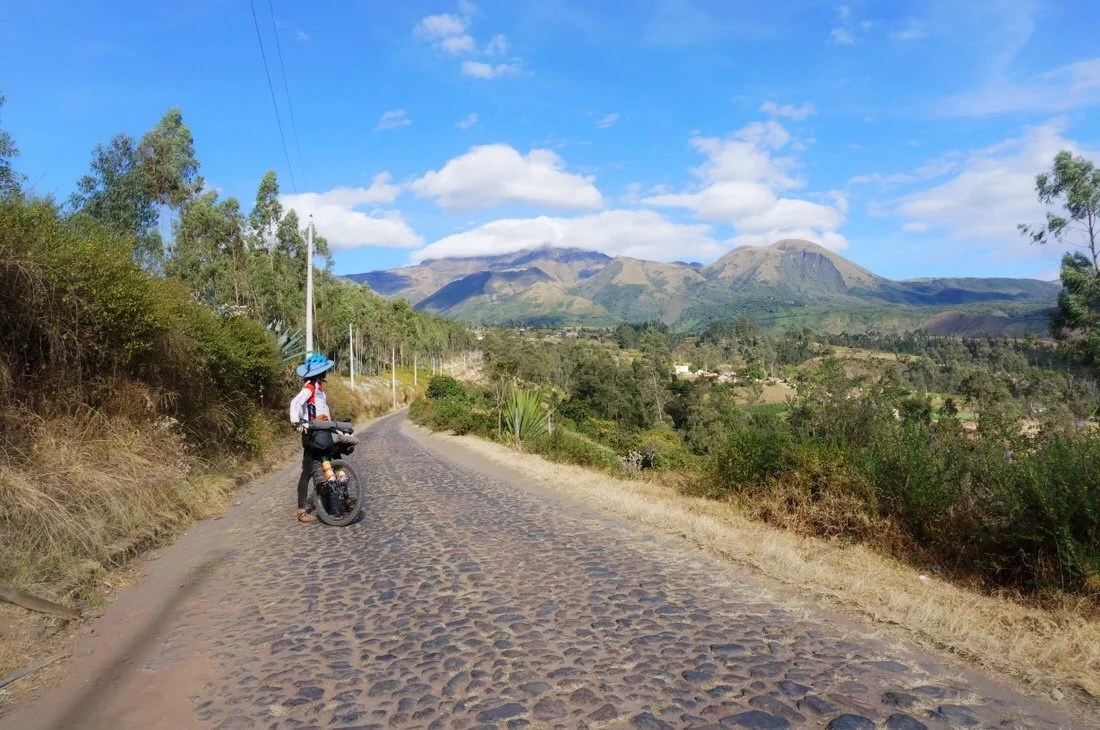 The next day we followed cobblestone roads down into the valley, stopping in the town of Cotacachi for second breakfast before continuing on to Otavalo.
 Neon asking a local in Cotacachi where we might find a place to eat. It’s interesting because when we ask people this question they always give us directions to a specific restaurant, presumably their favorite one, or perhaps a restaurant of a friend. This lady gave us directions to a place several blocks away with several turns to get there, but when I looked around the square we were surrounded by restaurants.•We spent a couple of days resting up in Otavalo. It was a bit touristy, and kind of expensive, but we were pretty exhausted from the epic hike-a-bike. We left town on a cobblestone road, following the TEMBR dirt road route, to Lagunas Mojanda.

 It wasn’t as remote as Yanaurcu de Piñan, but it was still beautiful, and by this point the whole experience was feeling a little surreal for me. What a place to be: “riding” my bike through the mountains of Ecuador.


 The next day we continued down a rough dirt road from the lakes, took a wrong turn on a horrible trail, then pushed/tugged/dragged our bikes up a ‘way too steep’ hillside to get back to our route, then continued on more dirt roads, through a few small towns, cross country when the track dead ended, through a giant metal gate, a little pavement, more dirt, then onto a big highway, where we crossed the equator!
 No special monument, but here’s us at the equator!•We arrived in Guallabamba midday, got a room in a hostal at the edge of town, and collapsed, in what to me felt like a blurry whirlwind, like looking out a window to see the landscape still zooming past, except I wasn’t moving anymore. I’m riding a pretty high buzz on this route. It’s pushing some buttons for me, perhaps it’s that I’ve been away from home for so long now, or maybe I’m already mourning the passing of this experience as it fades into yesterday.We left Guallabamba on two track, following a gentle grade to El Quinche, where the route follows an old rail line all the way into the Quito suburbs. It’s a bit rough in places, between El Quinche and where it crosses the Panamerican highway, but it’s popular with local mountain bikers. We crossed paths with several groups of mountain bikers; we got lots of waves and thumbs-ups, and questions about where we’re from and where we’re heading to. After crossing the Panamerican highway the rail line is part of the city park system; it’s well marked, groomed, and a fun way into the Quito suburbs.

 __
 After this bridge a tunnel was blocked. There are two options: a very steep trail, up, to go around the blocked tunnel, or a pretty level traverse around the blocked tunnel on a narrow “trail” across a steep, loose, cliff side. I chose the steep cliffside.

 There were several more tunnels, all clear, some short, some long and dark. Near Iguiñaro part of the rail line is blocked by a landslide, but since the “rail trail” is popular with local mountain bikers there is a partially cleared smooth track through part of it.


 The “rail trail” is perfectly groomed after crossing the Panamerican Highway. The last ~15 kilometers into Tumbaco were part of the city park system ( ruta ecological, el chacuiñan) and a real joy to ride, nothing epic, just beautiful, fast, and fun.•
 We stayed at the Casa de Ciclistas in Tumbaco. Santiago (on the right) was a great host. He does quality work and fixed my bike up good as new. There were only a few other cyclists while we were there, but it was enough to rekindle a small sense of community for me. I’ve really been missing that on this adventure, feeling connected to something… hanging out and chatting with like minded folks was just what I needed. And the timing worked out perfect to hook up again with Brad (bikehikesafari.com). He’s not only cycling from Alaska to Argentina, but he has also thru-hiked some of the same long trails that we have so we had a lot to talk about.
 •
 Giant bike sculpture–must climb! It might be too big for an epic hike-a-bike though…_NEXT UP: The Los Tres Volcanos route, a variation on the TEMBR singletrack route._____________________For more frequent updates, follow me on Instagram at: instagram.com/theredheadednomad•You can also find me on facebook at: facebook.com/redheadednomad•You can sign up to receive The Redheaded Nomad’s blog posts in your email inbox; sign up at the bottom of any page on my website: theredheadednomad.com•If you enjoy my posts and would like to make a contribution toward my travel expenses, or just buy me a coffee in appreciation, you can send an amount of your choosing through my paypal.me address:paypal.me/inthewildland_____________________
-
Colombia 6: La Frontera
“Pasto, Colombia to Tulcan, Ecuador”
 We spent several more days in Pasto than what we had planned. We installed new tires on our bikes in preparation for the Trans Ecuador Mountain Bike Route. Neon also installed a new cassette, new chain, and new chain rings on his bike, which after a series of problems, turned a couple of days into a week. He stripped a bolt on his crank, broke his mini-ratchet, bent our SteinCo Mini Cassette tool, and had to locate a seatpost adapter for a new suspension seatpost—all of which happened on a holiday weekend when most the bike shops were closed or had weird hours for several days …plenty of time to enjoy a few more espressos!
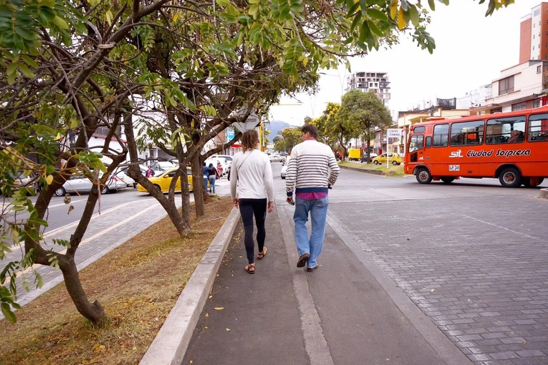
 Thankfully Pasto has a number of bike shops, and we also ran into a local who knew all the shops and the people that ran them; he walked with us around town until Neon found what he needed.
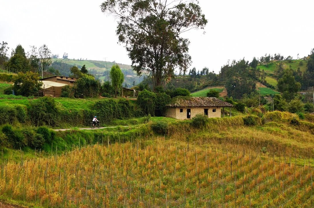
 It was a short ride to the border, full of mini adventures and surprises. We rode on a piece the Qhapac Ñan (Inca Trail), we rode on the Panamerican highway, we met Omar who let us sleep in his motorcycle shed, we took dirt roads to a beautiful church (Las Lajas) where a girl saw the Virgin Mary, we rode through beautiful farmland, we crossed the Colombia-Ecuador border, and we met up with two amazing women (Neon & Fidget of Her Odyssey) walking, kayaking, and cycling the length of the America’s.
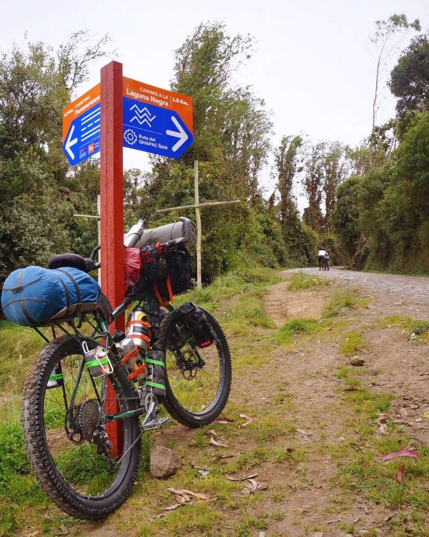 We followed dirt roads (cycle routes) out of Pasto, one of which was the Qhapaq Ñan (part of the Inca Trail network).•
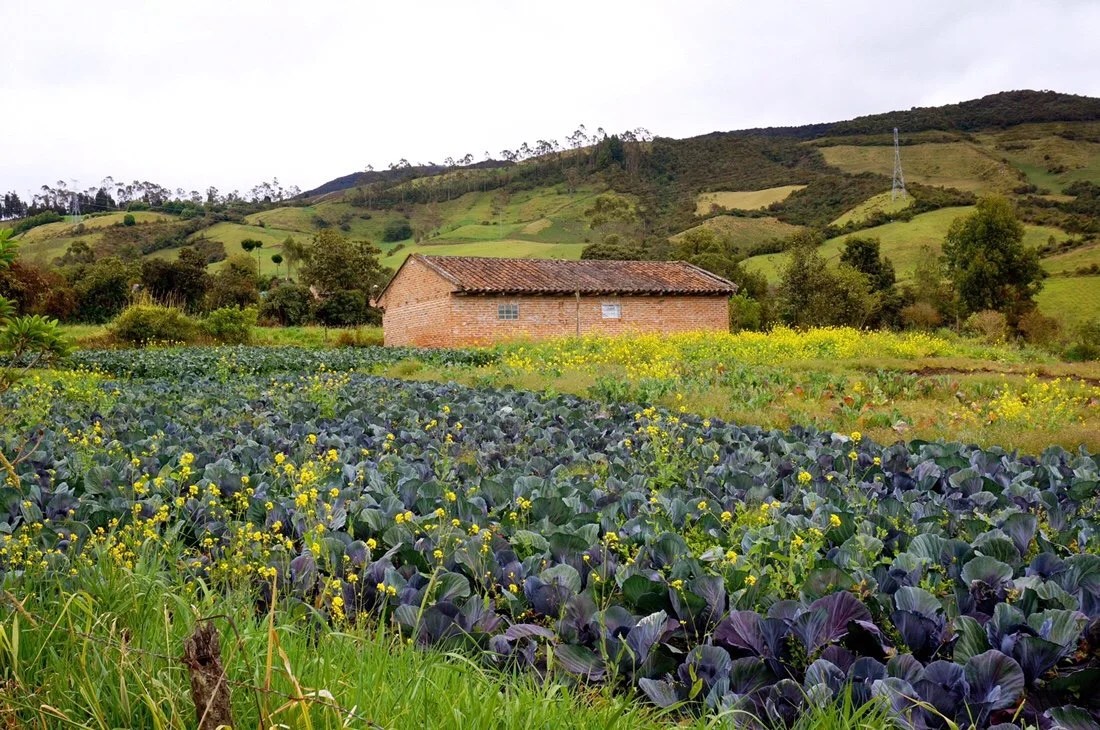 Finally… Brassicas! I’ve been seeing more cabbage, collard greens, chard, and other brassicas now that we’re riding through cooler climates.•
 A briefly quiet moment on the PanAmerican Highway.•
 We dashed down a little dirt road, off the PanAmerican Highway, to look for camping. While we were discussing where we might set up the tent, Omar rolled down the driveway on his motorcycle. He didn’t appear at all surprised by our presence. We asked if we could camp, and he said yes, then offered to let us sleep inside his motorcycle shed. He even left us with the key overnight.


 Morning view from Omar’s land.•
 We followed a beautiful dirt road the next day, through wild areas and farmland. We passed fields of tree tomato, curuba (another type of passion fruit), potatoes, lettuce, and green beans.

 The outskirts of Potosí had a lot of character and charm. The older buildings were made of adobe mud bricks and the walls were two feet thick.

 •
 The church square in Potosí.•Santuario de Las Lajas…
 Las Lajas has an history that dates back to 1754 when a local woman and her deaf mute daughter were caught in a storm at this location. Legend has it that the daughter spoke for the first time when lightning struck rock and she saw the Virgin Mary. Accounts of a shrine at this location date back to 1756. The current church was built between 1916 and 1949.
 Thousands of plaques, asking for miracles, line the walkway leading to the church.

 The church is built on a bridge a hundred meters over the Guaitara River.
 •
 Ipiales… our final stop, and town, in Colombia.
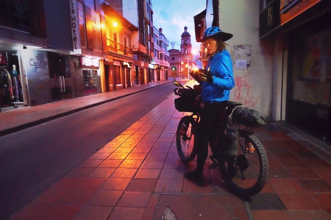 We left Ipiales at dawn, in hope of a quick exit from Colombia and entry into Ecuador. We had heard stories of it taking several hours, to all day, to get through the border due to the number of Venezuelan refugees. Our early start paid off; it took less than an hour and a half total to exit Colombia and enter Ecuador.
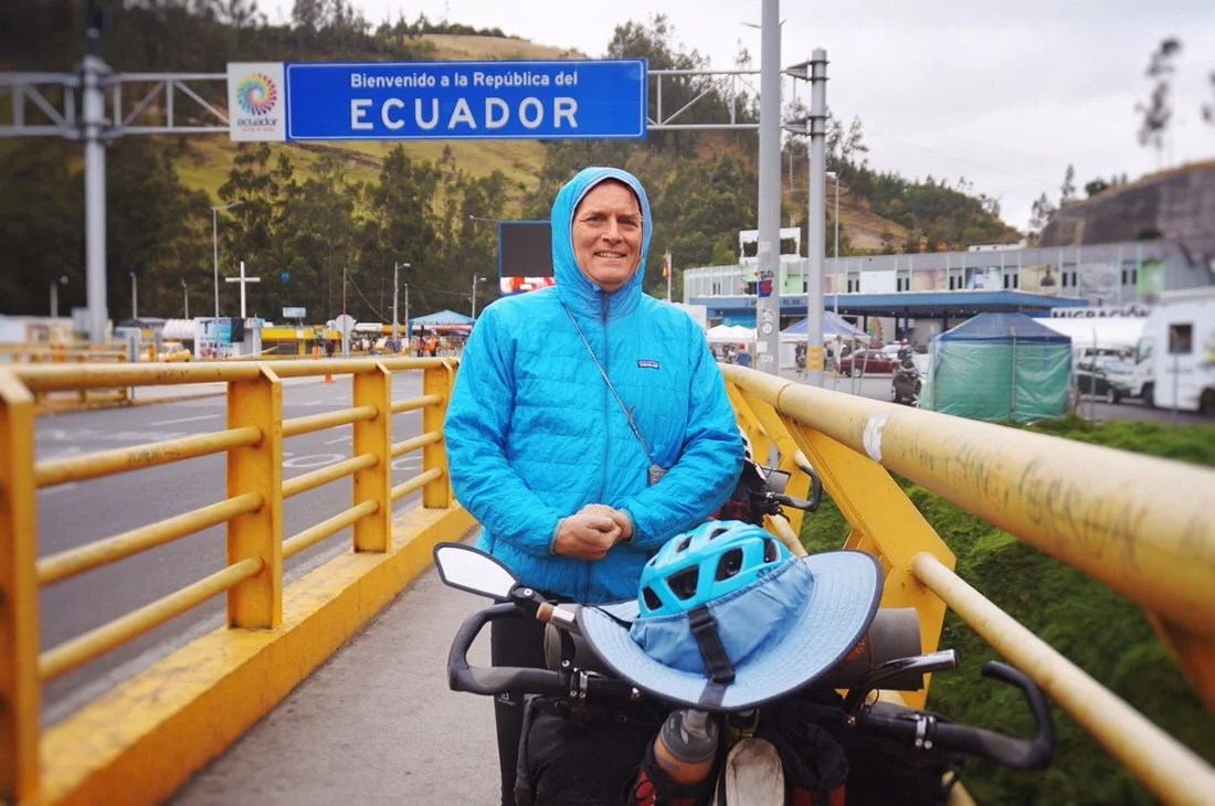
 We made it to Tulcán, Ecuador in time for coffee…
 …and that evening we met up with Her Oddysey (and we remembered to get a selfie this time, unlike when we met Brad of Bike Hike Safari (previous post)).
 •Up next: the bikepacking.com Trans Ecuador Mountain Bike Route!_____________________For more frequent updates, follow me on Instagram at: instagram.com/theredheadednomad•You can also find me on facebook at: facebook.com/redheadednomad•If you enjoy my posts and would like to make a contribution toward my travel expenses, or just buy me a coffee in appreciation, you can send an amount of your choosing through my paypal.me address:paypal.me/inthewildland•You can sign up to receive The Redheaded Nomad’s blog posts in your email inbox; sign up at the bottom of any page on my website: theredheadednomad.com_____________________
-
Colombia 4: Pre-Columbian Tombs
“Neiva to San Agustin”
 From Neiva we set off to visit a series of pre-columbian tomb sites. It’s always fun having these little tourist stops to punctuate the meandering of our ride, but to be honest, while they are interesting, it’s the small roads and backcountry surprises that are the real jewels of this adventure. Off the beaten path, the road less traveled, is where the best memories are made. That was my favorite part of climbing all the state highpoints in the U.S., don’t get me wrong, I live for mountains, but trying to string a few state highpoints together on a road trip, takes you far from the main roads, and through places most people never see. You really get to zig and zag through places no one would ever go unless they lived there. And that’s what the last two weeks have done.We wound our way out of Neiva, turning onto a small paved road, and then another road, passing through the little towns of Yaguará, Iquira, and Tesalia, before reconnecting with our friends’ route (highlux.co.nz) at Paicol. Yaguará was a quiet town near a lake, but not touristy. We stayed at a sweet little hotel where the lady made us coffee while her parrot preened Neon’s dreads. We left Yaguará in the pouring rain, assuming it would let up later in the morning, but it never did. It slowed occasionally, but not for long. The closer we got to Paicol, the harder it rained.

 It was kind of ridiculous how hard it rained; it was warm enough, but I was soaked to the bone. There was so much water on the road, even on the downhills, that it rose up and over my tires, creating a wall of water that splashed my legs as though I were riding through an irrigation canal. A stream of pink flowed from my hair—drip, drip, dripping on my thighs, then spread out like a Helen Frankenthaler painting over my thighs. I laughed and sang as I rode through the rainy wall of water. Neon didn’t find the ridiculously wet rain as amusing as I did. I think maybe he’s allergic to rain. Perhaps it’s having grown up in the Pacific Northwest, in the Seattle area, that allows me to (sometimes) find joy in the rain. Although, I was very happy when we finally made it to Paicol, and to a cozy hotel room out of the wet, wet, rain.


 Many of the trees in Paicol had orchids growing on them, and we were lucky enough to be there while they were all blooming.•After taking a day off in Paicol we made our way to La Plata and then to Tierradentro, the first of the pre-columbian tomb sites we planned to visit.

 Rio Paez, and an interesting shelf of land. •
 I had been a little hesitant to venture this far out of the way, as Tierradentro was a whole day’s riding, out and back, and uphill (seemingly in both directions; how does that work?), from the direction we were heading. But of the sites we visited, Tierradentro was my favorite, and for all those off the beaten path reasons.

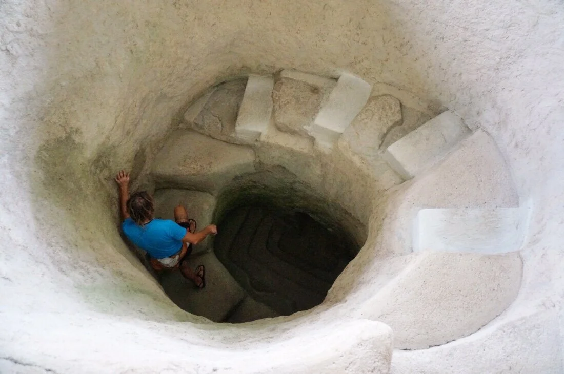
 The tombs in Tierradentro were built around the 6th century AD. The tombs that comprise the Tierradentro Archeological Park are made up of five different sites scattered around the area along a fourteen kilometer loop hike. One of the guards told us that there were primary tombs and secondary tombs, and that the bodies were left to decompose in the primary tombs for five years, then the bones were burned and put into urns in the secondary tombs.

 Some of the tombs were elaborately painted with designs. And most of the columns inside the tombs had carved faces at the top of the Column.


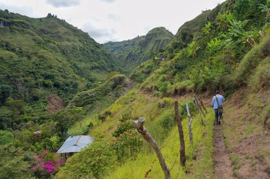
 One of the sites in Tierradentro showcased a few statues, but not as many as the archeological parks around San Agustín.•The tombs were impressive, but it was the fourteen kilometer loop hike around Tierradentro, connecting all the tomb sites, that held my interest. It was a beautiful hike through lush green hills, past coffee farms, up and over ridges, across valleys, and along narrow ridge tops. The trail isn’t just the park trail, it’s the local path, the only access to many of the farmer’s homes—it’s a local passageway between farms and homes and towns, from ridge to valley to ridge.
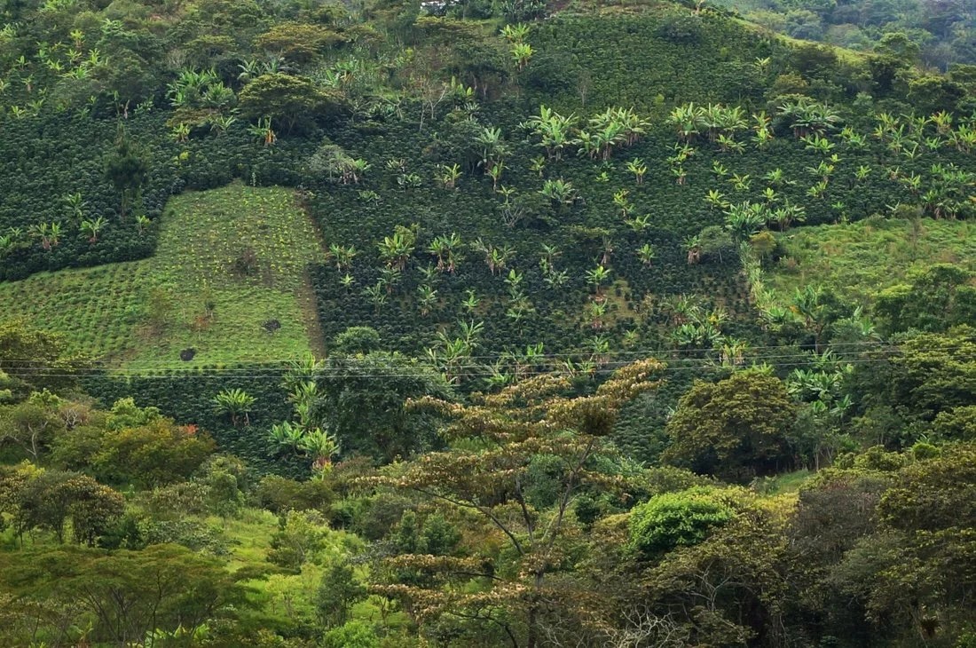 It’s common to see coffee planted together with banana plants.•
 Coffee beans still on the tree.•
 Coffee beans drying in the sun outside someone’s home.•
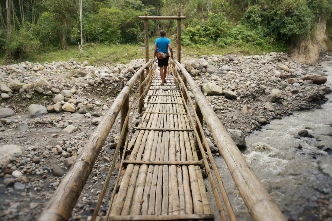 Most of the pedestrian bridges in the area are constructed from Bamboo.•
 The feathery looking plant is bamboo. It grows quite tall and is very strong. Many of the homes and buildings in the rural areas are constructed from bamboo, rocks, and mud.•We chatted with several locals during our (all day) hike. At Alto el Aguacate we met a local who was eager to show us one of the unguarded tombs; he told us that his ancestors built the tombs and at that time they were cannibals. At Alto el San Andres the guard told us that though the area is currently inhabited by the Paez (Nasa) people, they are not the people who built the tombs, and that little is known about who made the tombs, or why they left the area. And before that, at Alto el Duende, another guard told us that it was the Paez people who built the tombs. Neither our park brochure, or an online search, cleared this up. There just seems to be very little, if any, information about who built the tombs. Everything together made Tierradentro a beautiful package linking the past with the present along old footpaths.

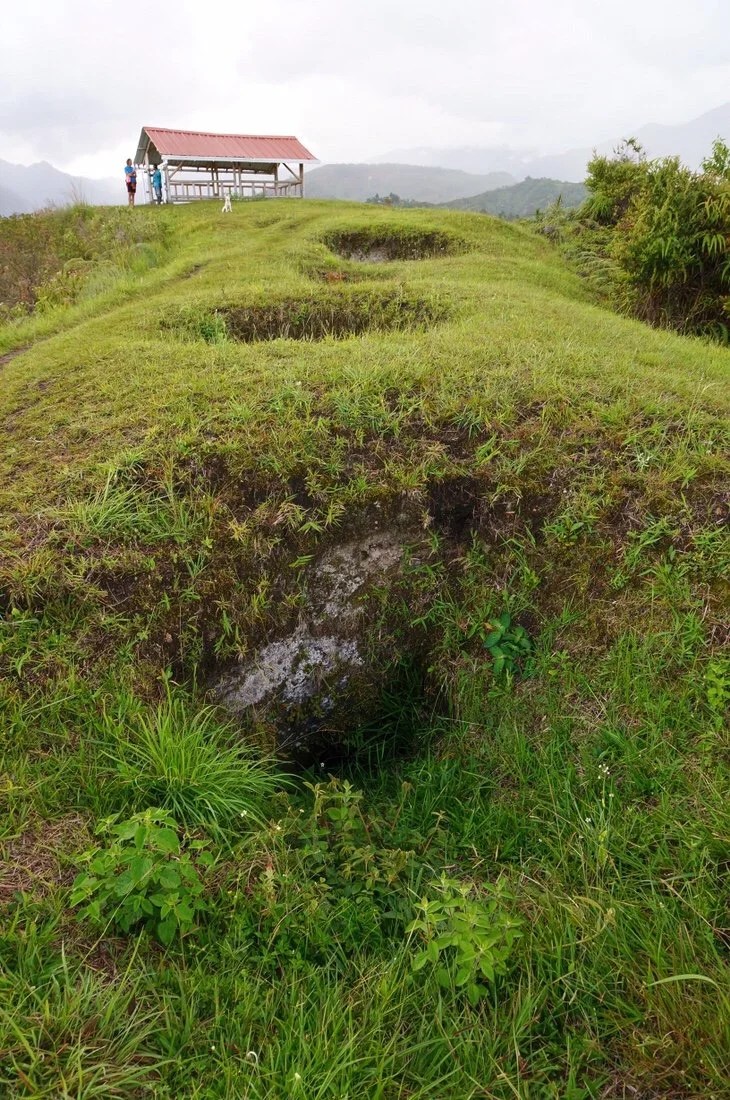 The tombs at Alto el Aguacate in Tierradentro haven’t been restored. Some of them have been covered with a shelter to keep rain out, and been cleared of debris and plants, while others just look like holes in the ground (until you peek inside to see the undulation of old steps, and further inside, columns supporting the interior).•
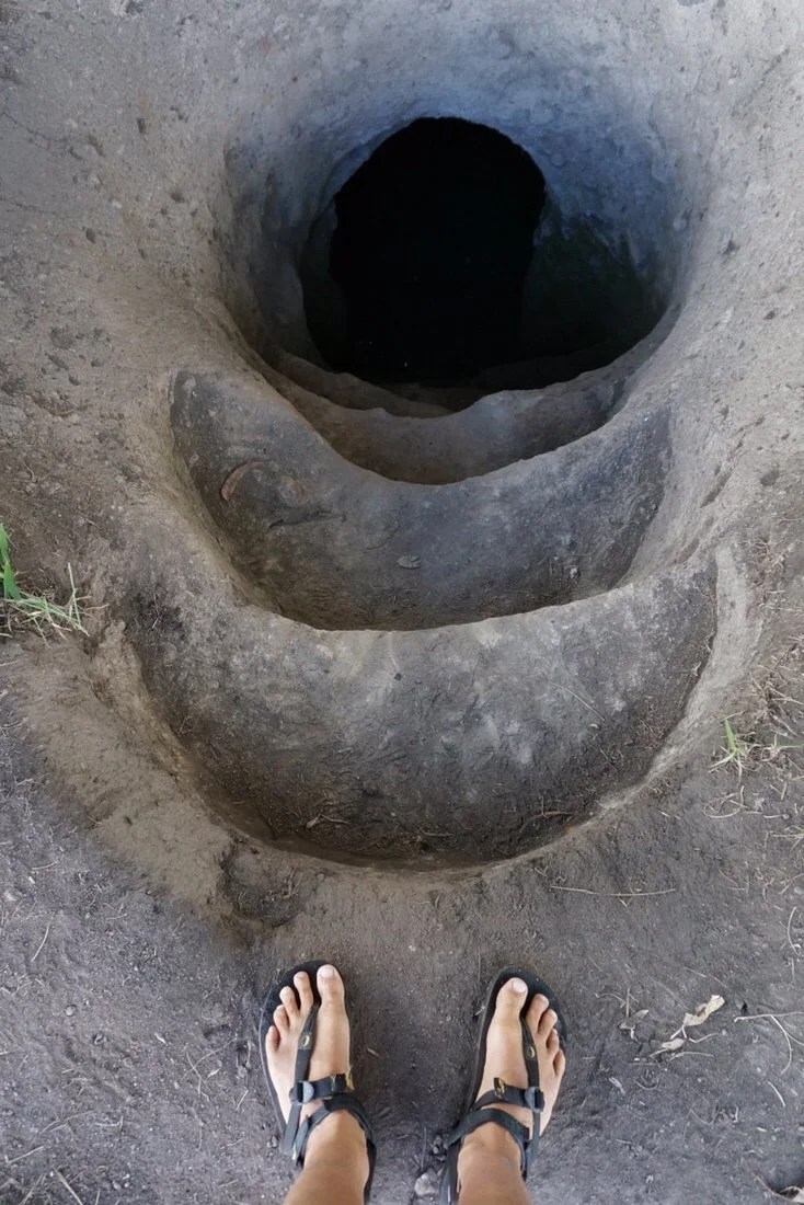 One of the cleaned up, but unrestored, tombs at Alto el Aguacate.•
 We’ve been seeing a lot of wild orchids in bloom. These were particularly beautiful, growing on tall stalks about five feet high.•
 The remainder of the hike, from Alto el Aguacate back to our hostel in the town of Tierradentro, was along a beautiful narrow ridge top.•After Tierradentro we headed back to La Plata, and then took small dirt roads, passing through La Argentina, Oporapa, Saldoblanco, Bordones, San Jose de Isnos, Obando, and into San Agustín.
 Sunday morning in La Plata: motorcycles are the most abundant form of transportation here.•
 Rio La Plata, from our ride into La Argentina.•
 An interesting looking fruit on a tree on our way into La Argentina.•We’re never sure what to expect from these backcountry routes, what our reception will be, if we’ll find camping, hotels, water, or good stores for resupply, but everything always seems to work out. We rode into La Argentina in the rain. I had seen a couple of hotels on the map, but what’s on the map doesn’t always exist when you actually get there. On the way into town we met a man on a motorcycle, Javier; he stopped to see if we needed help finding anything. We told him we were looking for a cheap hotel with wifi. He led us to a small hospedaje (hotel) not far from the main square. It was perfect: big room, good internet, and light on my budget so we decided to take a day off. We spent the next afternoon with Javier and his family sharing a meal and stories about Colombia and our other travels.

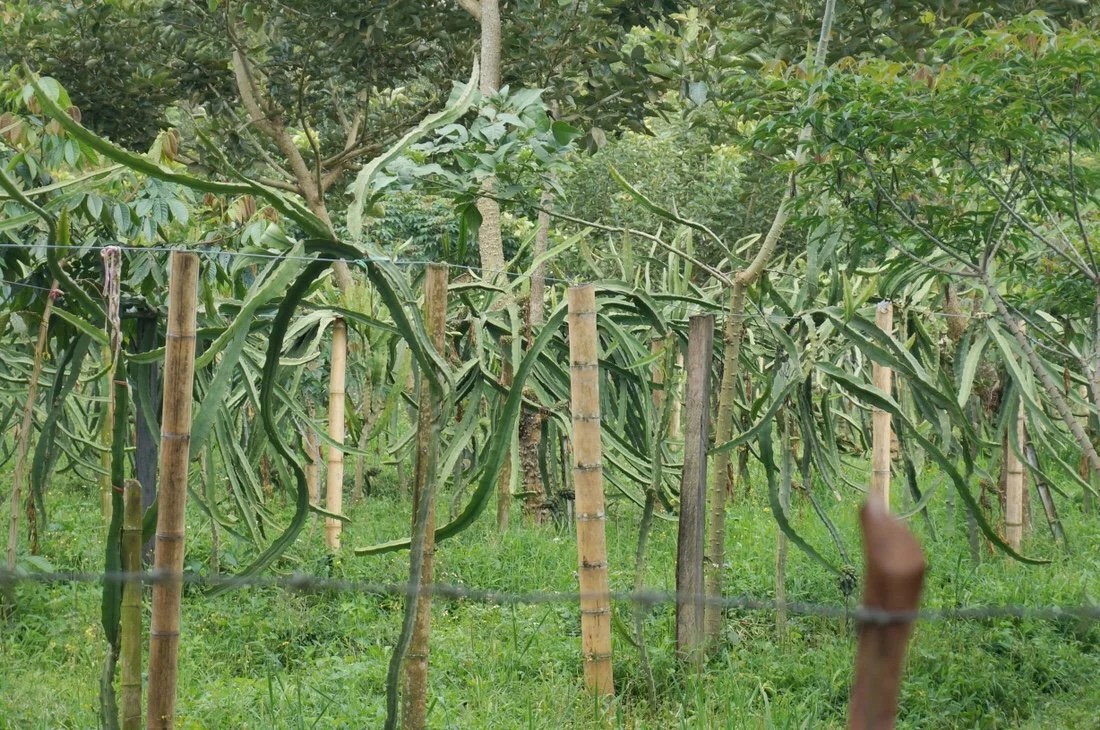 Another fruit they grow in this part of Colombia is dragonfruit. It’s a fruit that grows on a vine-like cactus. The fruit is slightly sweet, not tangy at all, and has a texture sort of like a soft kiwi.•Out of La Argentina the landscape alternated between wild land and cultivated farmland (mostly coffee) on steep mountain ridges. Along the way we encountered several road closures, some due to landslides and others where they were in the process of widening the road. At the first closure we encountered the lady radioed ahead to see if we could get through; after radioing ahead she told us that they were getting ready to do an explosion, but that we had time to ride through. I wondered how much “time” as we rode through the road block. I really had to pee, but I didn’t dare take the time to stop. Later in the day we had to wait for an hour at one of the closures. I ate lunch while we waited, and Neon passed the time helping a young boy who was eager to practice his English.


 This road wasn’t closed, but the photo illustrates some of the damage we’ve seeing from the recent rains.•
 As we got closer to San Jose de Isnos the steep mountain ridges, planted mostly with coffee, slowly shifted to rolling hills, mostly planted with sugarcane.•There was a lot of uphill climbing as we made our way to San Agustín. After La Argentina, we stopped for the night in Oporapa and San Jose de Isnos. Out of Isnos we took a short detour to visit “Alto de Los Ídolos”. Alto de Los Ídolos is a small site; it contains statues that had once guarded tombs that were buried beneath small mounds. I had a moment of shock when I found out how much it cost to get into the small park, until I learned that the cost also covers entrance into the main park in San Agustín as well as a few other sites in the area.

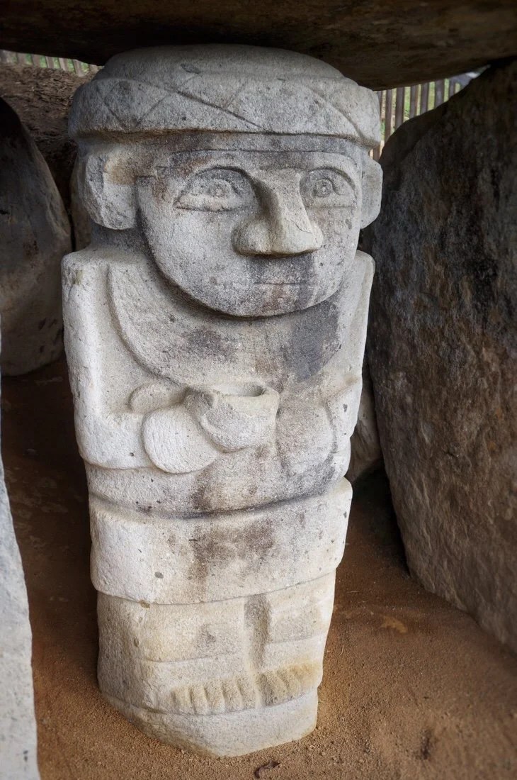

 The sign on site said the statue guarding this tomb was of a crocodile, but it looked to me like the flying dog in the movie “The Neverending Story”.•
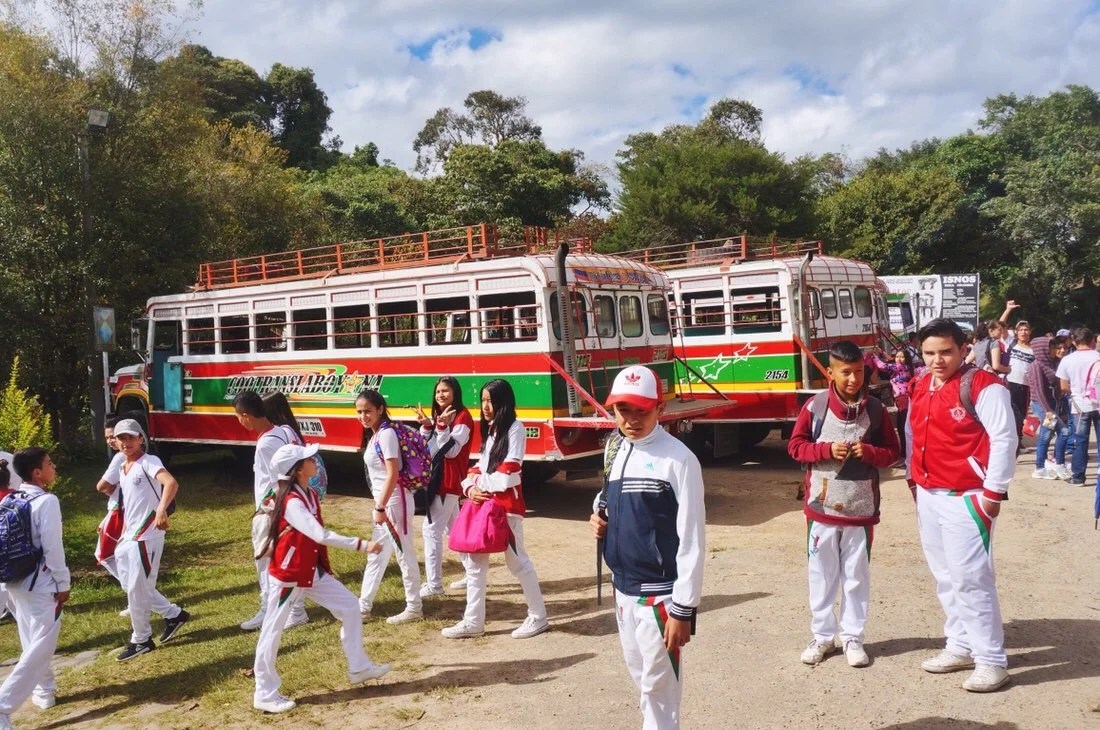 A group of school kids visiting Alto de Los Ídolos.•From Alto de Los Ídolos it was a short ride into San Agustín, with two river crossings, which meant going way down, and then climbing back up from the river valley. They weren’t our biggest climbs, but after all the climbing that we’ve done since La Plata, we were ready to take a couple of days off in San Agustín.

 On our ride into San Agustín we crossed over Estretcho del Magdalena, a narrow, deep channel of the Rio Magdalena not far from its headwaters. This was the fourth and final time we crossed the Rio Magdalena since we left Bogota. •
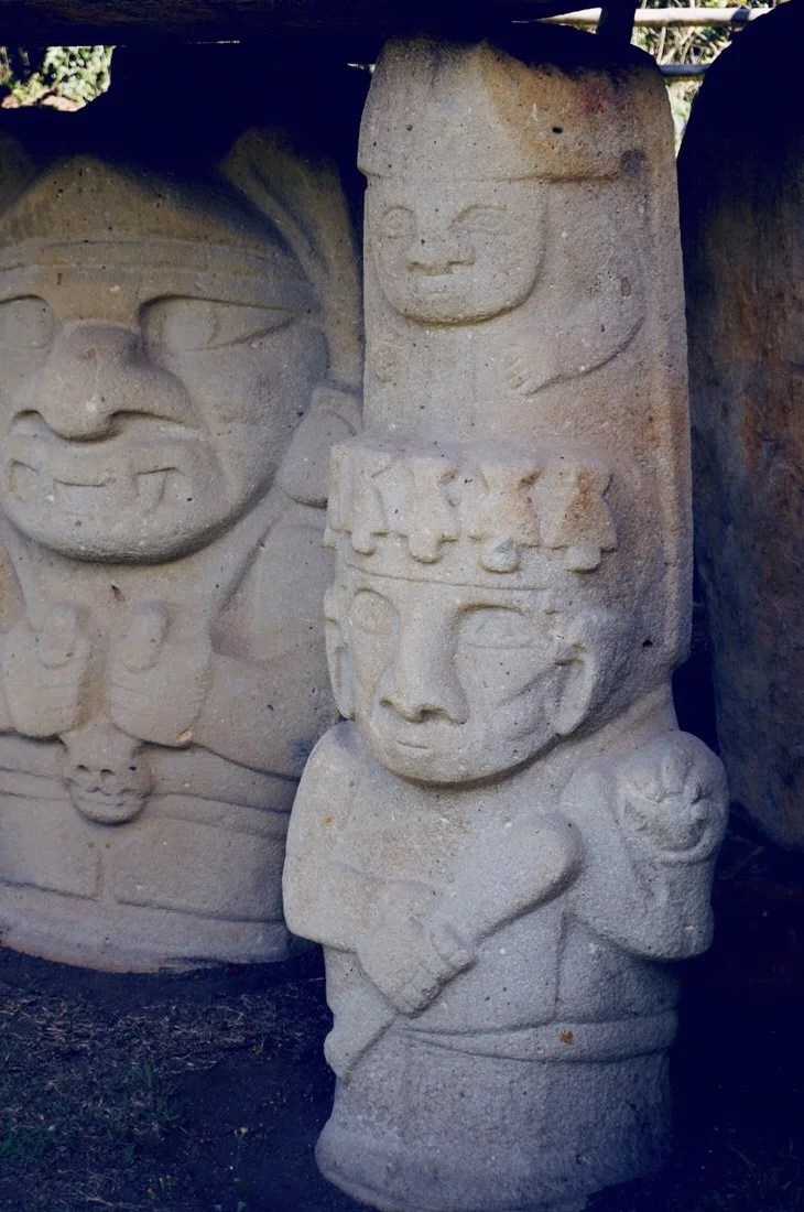
 Rainbow over the church in the main square in San Agustín.•We took a couple of days off in San Agustín, resting, eating ice cream, and visiting the San Agustín archeological park and the much smaller site at El Tablón. According to the sign on site at San Agustín, the burial mounds and funerary structures were built about two thousand years ago, and that interpretations of the purpose of the statues ranged from serving as guardians of the tombs to links between the human world and the animal world.

 The hike through the San Agustín archeological park was only a couple of kilometers, but I think it was our favorite part of the visit.

 Some of the statues at San Agustín are almost comical while others appear more serious–some are caricatures of humans while others are caricatures of animals.




 •
 The best “sundae” I think I’ve ever had: ice cream, thick cream, and fresh fruit, garnished with wafer cookies. I’m only ~90% vegan these days; eating mostly vegan meals, but with the occasional ice cream in town, the occasional can of sardines while we’re riding in the backcountry, and on an even rarer occasion a little cheese. Canned beans are gross in Colombia; they have chunks of bacon fat in them. I’ve tried picking out the fat chunks and rinsing the beans, but I can still taste the pig.•NEXT UP: The infamous narrow and curvy dirt road of southern Colombia: The Trampolin de la Muerte._____________________If you enjoy my posts and would like to make a contribution toward my travel expenses, or just buy me a coffee in appreciation, you can send an amount of your choosing through my paypal.me address:paypal.me/inthewildland•You can sign up to receive The Redheaded Nomad’s blog posts in your email inbox; sign up at the bottom of any page on my website: theredheadednomad.com•For more frequent updates, follow me on Instagram at: instagram.com/theredheadednomad•You can also find me on Facebook at: facebook.com/redheadednomad_____________________
-

Colombia 3: Crossing the Tatacoa Desert
“~Ibagué to Neiva”
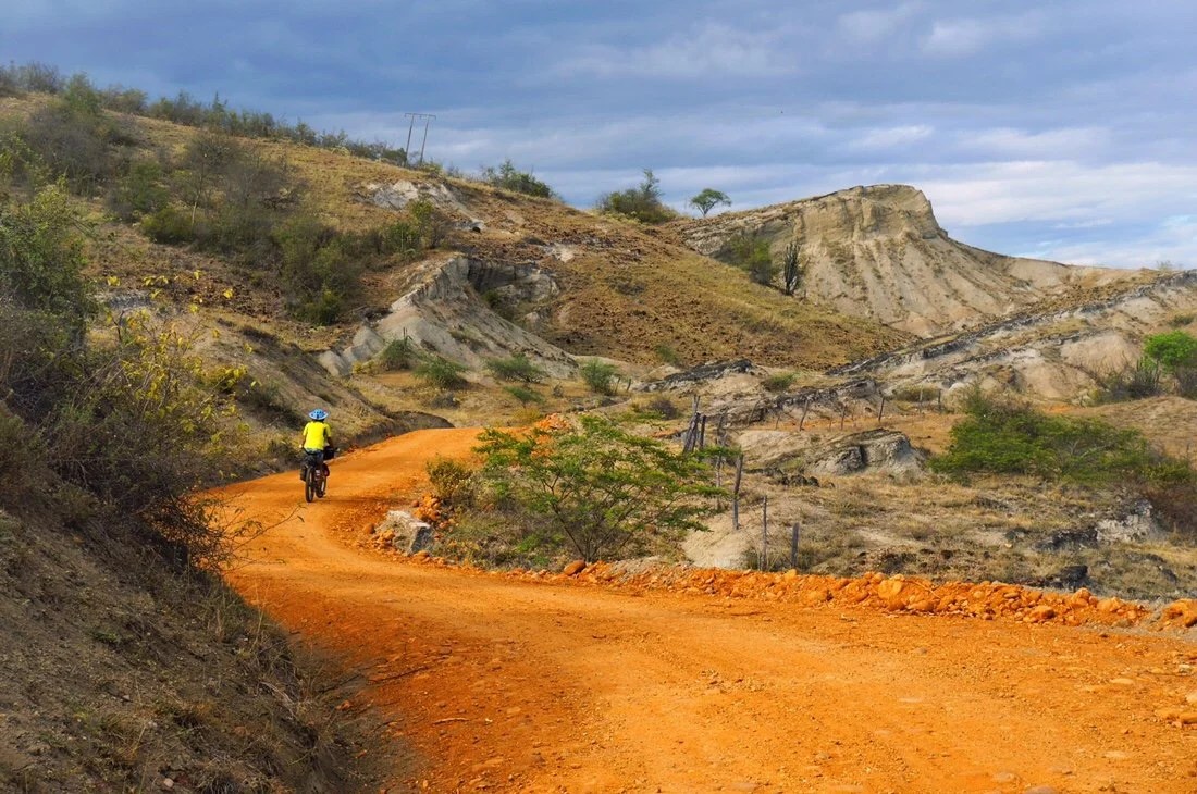
 Leaving the outskirts of Ibagué we took the big highway for the morning before turning onto a smaller paved road. I’m not a fan of riding big highways, or paved roads in general, but this highway turned out to be a nice surprise. It was almost park like with its tree-lined shoulders and cut grass. There was even a two-lane bike path on the other side of the highway. Twenty-five kilometers, almost all downhill, flew by in under an hour.
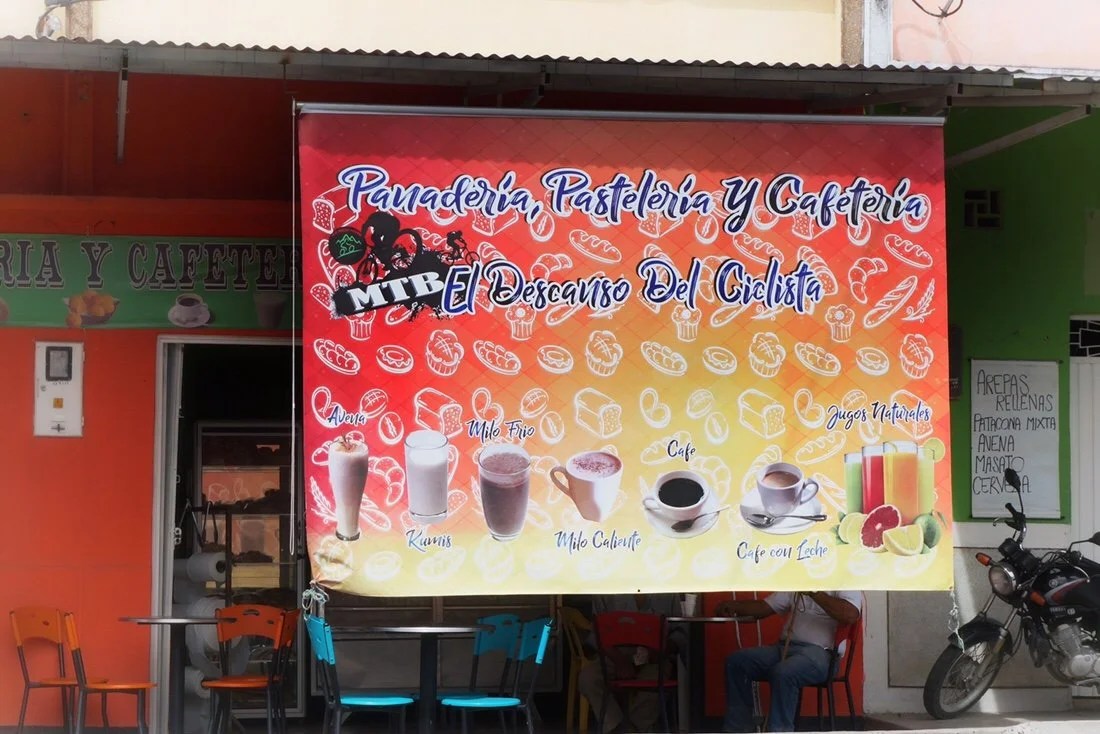
 We turned onto a smaller paved road, passing through the small towns of Payandé, La Flor, and San Luis. We saw a lot of other cyclists through the morning hours. It must be a popular route for local riders. The little cafe in Payandé even had a big sign out front that says it’s the “el descanso del ciclista” (the cyclist’s rest).
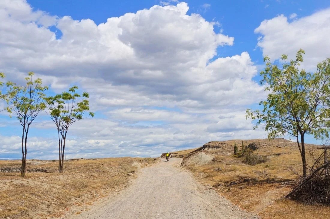
 By midday we had already dropped quite a bit in elevation–the air was much hotter, and the landscape was slowly changing to a dry grassland interspersed with tropical vegetation, and dry rugged mountains at the edges of the valley. Shortly after San Luis we took a dirt road into Saldaña where we got a room for the night.

 We had planned to make it to the outskirts of the Tatacoa Desert the next day, but after stopping on the side of the road for lunch Neon’s tire decided it no longer wanted to hold air. It seemed to be leaking from the valve stem, or the spokes, or both. After a few road side repairs, with no success, we walked the bike back to the small town of Natagaima and got a room for the night. Thankfully Neon had a roll of “gorilla tape” with him and was able to replace the rim tape on his rear wheel, which had rumpled up and come loose (probably because the rim tape was reused off a previous rim that had gotten bent, that he eventually had replaced in Toluca, Mexico).
 The landscaped became even more arid after Natagaima. We passed large expanses planted with cotton. It was all very familiar to me, similar enough that I could have been riding somewhere back home in Arizona.
 Later in the morning hours we turned onto a small dirt road, near Pueblo Nuevo, marked with a big sign that read “ruta el desierto de la tatacoa”, though we were still on the outskirts of the main desert area.
 The road winds around through farmland and ranches, crossing several small creeks, before crossing the Rio Magdalena on an old train route, passing through a couple of tunnels along the way.


 Despite the arid nature of the surrounding ridges and hills, there seems to be enough water locally to support growing rice, bananas, and other crops that I think of as being in a tropical landscape. The road continues on an old railroad grade, lined with tall arching trees, passing through Potosí and La Victoria, both receiving enough passerby’s to support several very small tiendas, restaurants, and panaderias. La Victoria even had a couple of signs for hostels.
 Shortly before Villavieja the landscape becomes even more arid and we passed another road that turned east into the Tatacoa Desert. In retrospect that road may have been a better route for us, possibly being less touristy than the main road out of Villavieja that we took east across the desert.We stopped in Villavieja for more supplies before heading into Tatacoa. It was a bit of a surprise how many people and tour buses there were, compared to the tiny quiet dirt road we had arrived on. I think it was at this point that we wished we had done a bit more research and planned better, with more supplies, so that we could have taken the other road to cross the Tatacoa (which might be less touristy than the main road), but it was still a stunning landscape nonetheless.
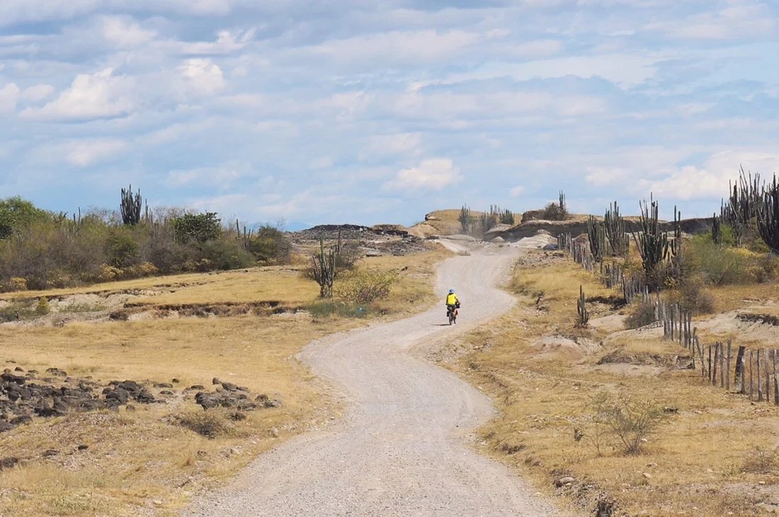
 I realize now, looking at my photos, that they give the impression of a completely deserted desert, and for the most part it was, except for along the main road. If you look closely in the photo below you can see a few hikers, but most folks stuck close to road, taking selfies with the desert in the background, not straying too far from the restaurants and hostels. It was actually quite a sweet spectacle, reminiscent of a scene from the south rim of Grand Canyon in the U.S., except here in Tatacoa it was primarily Colombian tourists out enjoying their homeland, rather than international tourists.
 …and our obligatory selfie with the desert in the background.
 The Tatacoa Desert is actually quite small, and we had planned to wild camp at least once, if not twice, but it wasn’t to be… Cutting our day short the previous day to deal with Neon’s tire completely changed our timing through Tatacoa, and there was a big sign at the entrance explicitly forbidding camping outside of established businesses. If our timing, and knowledge of the area, had been a little different, stealth wild camping would have been possible before and after the main tourist area, or possibly from the other road through the Tatacoa.We continued a few kilometers past the main touristy area where we found a quiet hostel, a little off the main road, that offered camping. Camping was in a big open area, so we set up away from the main establishment near a few welcoming cactus and an old church building. It was the weekend, so we did share the sunset with a dozen or so other tourists, with music playing into the wee hours, but I slept perfectly sound, feeling almost like I was home again.

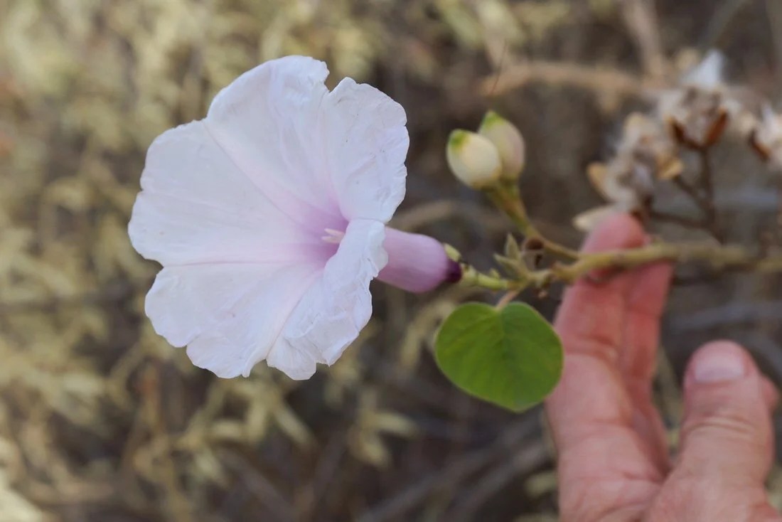
 The ride out of Tatacoa alternated between blond sands and bright red sands contrasted by stormy gray-blue skies, making for surreal color palette in the morning light.


 The landscape quickly shifted from desert to grassland to foresty overgrown jungle where the dirt road hit pavement at Baraya. The road was mostly paved all the way into Neiva, passing through several small towns along the way. The traffic got crazier the closer we got to Neiva, until we found our selves riding in a string of motorcyclists weaving their way in and between cars and trucks. I’m pretty sure the motorcyclists outnumbered the cars as we made our way to the center of town. It was a relief to check into a hotel, leaving the fast pace of traffic behind.
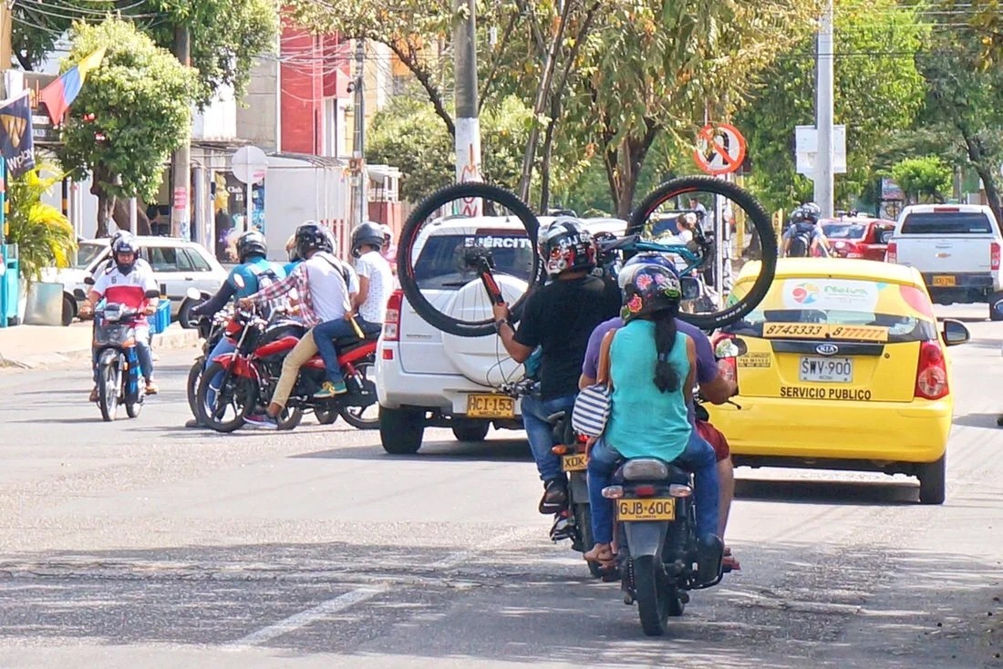

 We spent took a day off in Neiva, resting up, and visiting the local panaderias in search of the best cafe tinto.
 _____________________You can sign up to receive The Redheaded Nomad’s blog posts in your email inbox; sign up at the bottom of any page on my website: theredheadednomad.comFor more frequent updates, follow me on Instagram at: instagram.com/theredheadednomadYou can also find me on Facebook at: facebook.com/redheadednomad_____________________