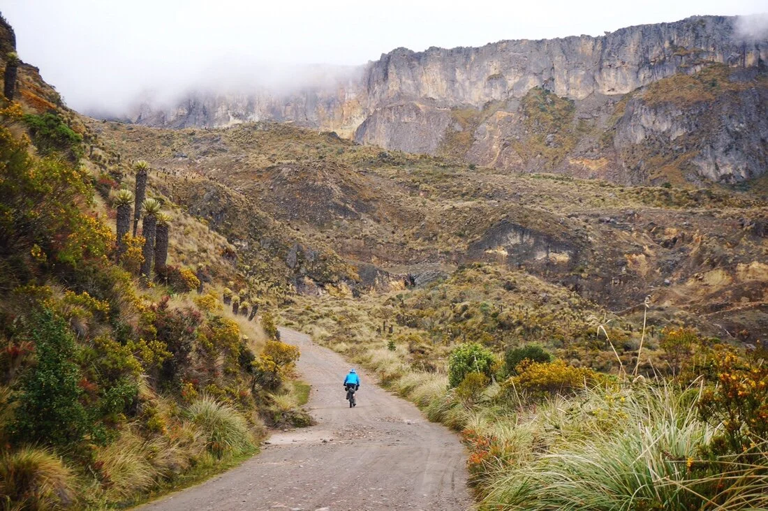
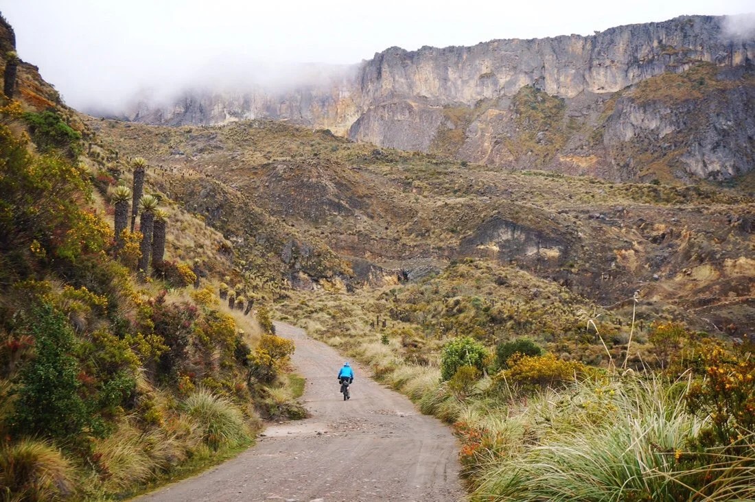
“Murillo to ~Ibague” When we bought tickets to Bogota I really had no idea just how big Colombia was–we landed nearly in the middle of the country, but with more to the north and east of Bogota than to the south and west. Even still, it took us several days of heading west (and a little north) to cross over to the western Colombian Andes. And it wasn’t until we started heading south that I realized just how much of Colombia we’re missing–and even with all that we’re missing out on, by the time we leave, we will have ridden more kilometers in Colombia than what we have planned for transecting Ecuador.Experiencing places, beyond the memorized locations on a map, feeling their distances and expanse with your whole body, crossing all the borders, tasting their food, withering in their heat, having numb fingers from their (specific kind of) cold, dripping red/pink (from my hair) like a watercolor painting in their rain… It’s BEYOND PLACE …as a name, a map location, or a written history.You might think that’s obvious, but it’s really not …until you travel, and experience all of that, enough times, that the whole world, and everything you thought you knew, unravels …to the point that it hits you–you know nothing, it’s all relative! Or, perhaps that is just me, as I already identify with being a relativist.Having transported from Mexico to Colombia has just struck me so much, everything that’s different, more comfortable, less comfortable, the words I choose to describe it, my feelings about these places, about myself, and all the things I miss about home. Everything is kind of getting muddled together in my thoughts, my expectations and disappointments–they’re losing ground. I’m having such a great time, and yet sometimes I remember …I used to laugh more. When did that fade–when did I lose my laugh? I think, maybe, it was when my guard got raised. But that didn’t happen on this adventure. That happened years ago when I first left home, and let go of everything I thought I knew. Or maybe it’s just time, more questions, more quest for meaning… …but right now, my quest is for mountains. And Nevado Ruiz wins the medal for the best mountain landscape I’ve seen in a very long time.It was a long climb up from Murillo, but I was feeling great. I always feel better at altitude than I do in the lowlands. The road started out paved, but quickly turned to dirt…

 We rode past endless potato fields. I’ve never seen such pink flowers on potato plants before. They look a bit purple-ish in the photos, but they were bubblegum-pink in person.
 Red-roofed farm-houses dotted the landscape surrounded by grazing land for cattle and patches of trees.
 ___It’s a bunuelo! …kind of like an unsweet donut hole. Yes, it’s deep-fried. Yes, it’s made with white flour. Yes, sometimes they’re made with cheese (but not everywhere). Food is my greatest challenge on this adventure (and dogs that chase my ankles, and drunks, and… maybe everything). But ignoring all of that, bunuelos are so tasty!
 It might be just a donut hole, but it’s got my thoughts in a whirl… … …Who are you–when you strip away everything you know? Away from all the familiarity, and conveniences, of the place/places you call home? — I’ve come to find myself in a constant argument/debate/negotiation with myself, as I move through new places (and try to meet my needs)—about who I am and want to be in this world. It’s very easy when I stay in one place, when I’m home, to define all the things I think are good or bad, for me, for this world, for the future of gaia, for humanity, for the lizards that flit about in front of my art studio, for the bunnies that roam in the morning hours, for the sun that sets over my mountain (Baboquivari) …though of course I never really have any actual answers about the fate of the world, or what is really good or bad. But when I move, or travel, it becomes even more difficult to be “me” (without the familiarities and consistencies of “place”). Who are you—when you strip away the conveniences of everything you know?
 Riding up Nevado Ruiz was definitely a highlight of this trip so far. I’ve always loved mountains …even as a tiny little girl, the hill behind our house was “my mountain”. I spent my formative years growing up in the shadow of Mount Rainier in Washington State. For years I dreamed of climbing it, and eventually did. It was my “home” beacon, and became my definition of “mountain”. Mountains, in so many ways, have shaped my life, and my definition of “self”. I’ll never be a “mountaineer”, in the way so many claim, but I’m made of mountains. They’re a deep part of everything about me: my dreams, my past, my goals. They’re giants in the sky, and I’d love to stand on every single one them.


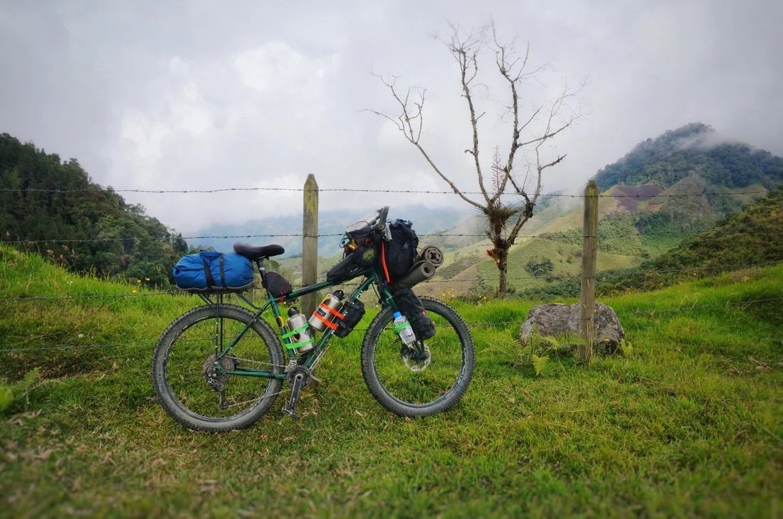
 …but while climbing Nevado Ruiz didn’t play into our plans on this trip, I immensely enjoyed its landscape. The tall, strange, frailejones were especially mysterious in the misty afternoon clouds.


 The wild landscapes of Nevado Ruiz, embraced by the white sky of low hanging clouds, struck me in many of the same ways an abstract painting does: my mind dove in and my imagination went wild.


 It was an incredible day riding through the surreal landscapes of Nevado Ruiz. Near the highpoint of this amazing mountain road, we made a brief stop at El Sifon, a small tienda, to chat with the locals and a few passing tourists before riding off into the sunset to look for camping.


 We nestled into a sweet spot, through a fence, next to a small storage building. Nevado Ruiz (above the building) came out to say hello just as the sun was setting. It was a magical night filled with stars, silhouettes of frailejones, and cold crisp air.
 I woke to a cold blue light, and clouds rising up from the valley below. By the time we were all packed up my fingers felt like popsicles. I rode for at least a half an hour before I stopped to take in another view.
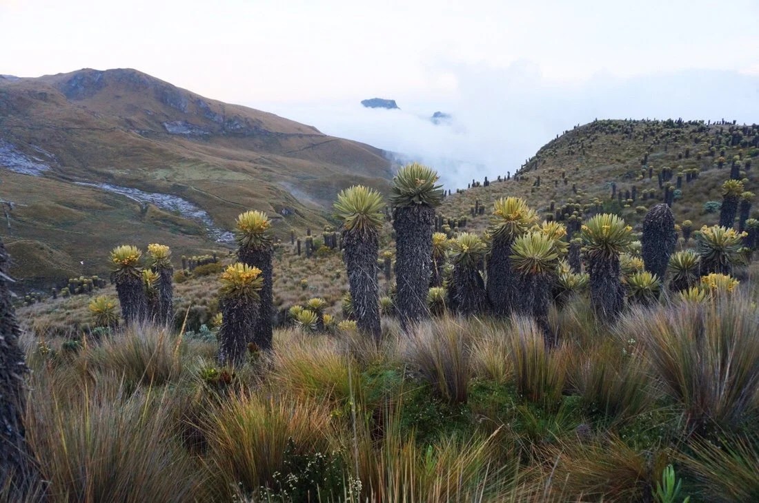

 Unfortunately a portion of the road through the park is still closed, so we headed down the mountain towards Manizales. We contemplated coming back up another road to meet up with the road where it’s open on the other end of the park, but there are so many things we want to see while in Colombia, so we decided to continue on to Salento to see the wax palms of Cocora Valley instead.
 …looking down the valley towards Manizales.
 That’s just the outskirts of Manizales (behind Neon). Thankfully we chose a route that skirted around the city to the south passing through several smaller towns. Villamaria was a crazy knot of traffic, but there didn’t seem to be a way around it since there were only a couple of roads that headed south that would get us to Salento.
 After Villamaria our route turned into a beautiful small dirt road.
 We passed through a couple of very small villages on our route between Villamaria and Chinchina.
 Chinchina was a bit of a shock after all the small towns we’d been to since we left Bogota. It wasn’t actually very big, but it was loud, and bustling with a lot of activity. We found a cheap motel and rested up from our long ride and the ~10,000 foot descent from Nevado Ruiz.
 We took a small paved highway out of Chichina, making it to Santa Rosa de Cabal before lunch. Somewhere I thought I’d heard nice things about it, but it was another very loud, bustling city that I failed to see the charm in. The main road through town had so much traffic that we cut over one block hoping for something quieter. But in that one block it went from a busy highway to the backwater slums; shacks made of bamboo, tarps, plastic, and rusty scraps of metal for the roofs. The street was narrow, with puddles of murky water, dog poop, and trash strewn about. We rode the length of it until it exited out the other side, probably a few blocks in length total. We’ve ridden through a lot of places like that on this adventure, but the proximity and contrast to the main road into town, only one block over, really caught me off guard. The photo below is looking back on the “street” from where we exited. I didn’t feel like it was appropriate to take a photo when we were in the middle of riding past the people’s homes.
 We made a couple of short stops in Santa Rosa to resupply, riding across the length of the crowded city, before turning onto a small dirt road. The road faded from the outskirts of the city, to farms, to what I might describe as shanty towns and shacks, a bit scrapped together, but cleaner and with little to no trash. They went on for miles. We drew a lot of stares as we rode through. I said hello (hola), or good afternoon (buenas tardes) to everyone I passed, and most everyone returned the greeting (unlike the street we had ridden down in Santa Rosa, where the only response I got in return there was a cold stare with the words “gringo negro”).

 Eventually the shack lined road turned more to a forestry jungle that felt more like wilderness.
 It has been easy to get water through this stretch since there are small waterfalls at almost every tight bend in the road.

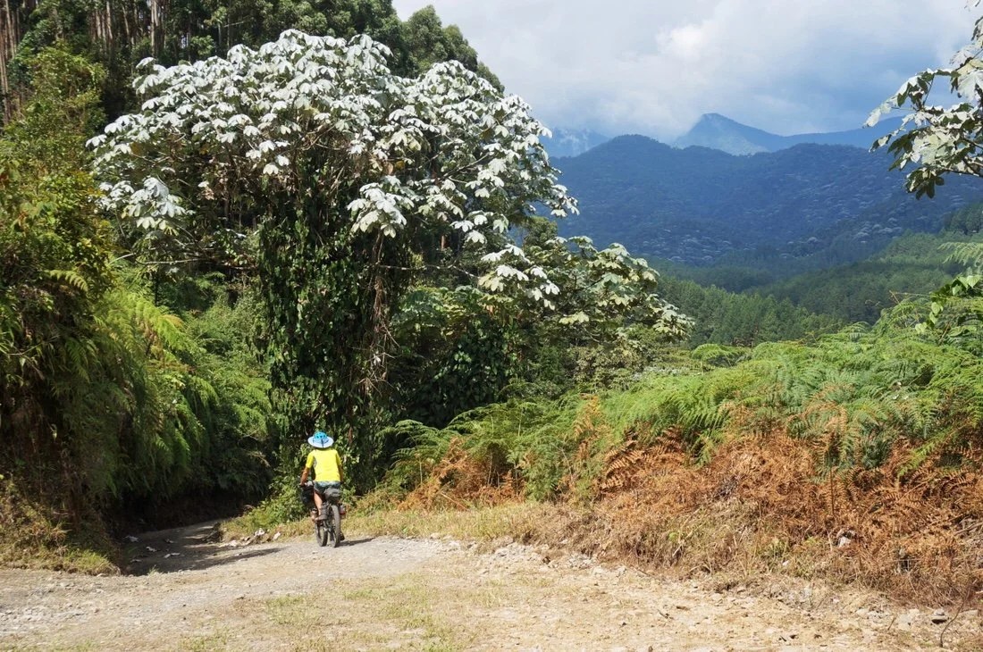 …even the steep slopes are planted with crops, often coffee, but everything else too.
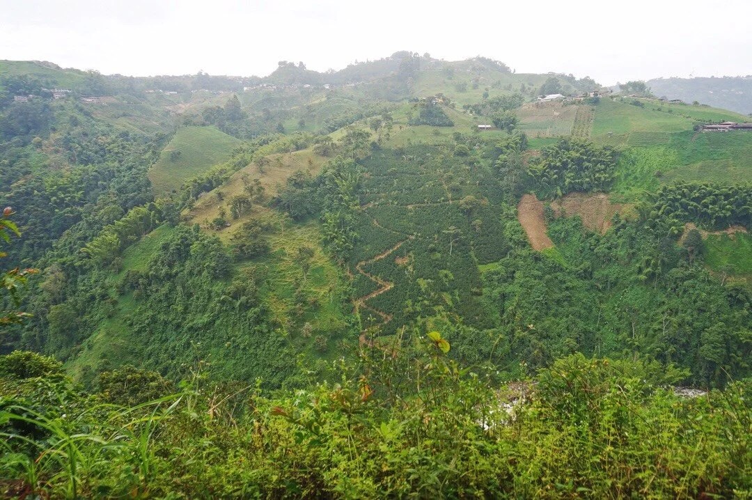
 We had hoped there would be a hotel in La Florida, and though there were a number of juices bars, cafes, and restaurants, there were no hotels. It’s a very agricultural area so there wasn’t much camping to be had, so we pushed on to Salento. It was a long day, and completely dark our last few kilometers into Salento. The batteries in my headlight were dead, but thankfully my rear blinky light was still in working order for the uphill, narrow, winding road into town and all its traffic.We were exhausted and a bit frazzled from the dark ascent into town. The center was bustling with a touristy nightlife when we arrived. It took awhile to find a hotel. The first place we checked had a beautiful room, but they wouldn’t let us take our bikes in the room. Other places were all booked up, even more expensive, or the rooms were too small for our bikes. We eventually found a suitable hostel for our first two nights.__The central square in Salento, early in the morning, before it gets bustling with tourists.
 We were so exhausted from our previous couple of days that we spent the first day in Salento just resting up and hanging around town. But since we were at a hostel, I decided to make full use of their kitchen.
 The next day we moved our bikes to Hotel Colonial, then headed off to Valle del Cocora to hike up into the jungle and back down to see the wax palms.
 The hike up was a lot of fun with all its old rickety ridges.
 The humming bird preserve, about half way through the hike, was a perfect place for a rest, and the entry fee comes with hot chocolate. Hummingbirds were buzzing about all the flowering trees and shrubs, but the only place they sat still long enough for me to get a photo was at the feeder.


 After a little more up we dropped down into the wax palms. They had a tall slender beauty that was captivating, though seemingly a bit out of place amidst the chewed down bright green cattle-grazed slopes.
 Wax palms are the tallest palms in the world, growing up to two hundred feet tall.

 We took an old Camino out of town. It’s popular with other mountain bikers, and we saw a lot of cyclists during the morning and early afternoon hours.


 Late in the afternoon we dropped down into a beautiful valley filled with wax palms. The land was still used for cattle grazing, but the palms were dense and lush, and where they came together into a forest they nearly crowded out the shorter, leafy, trees.

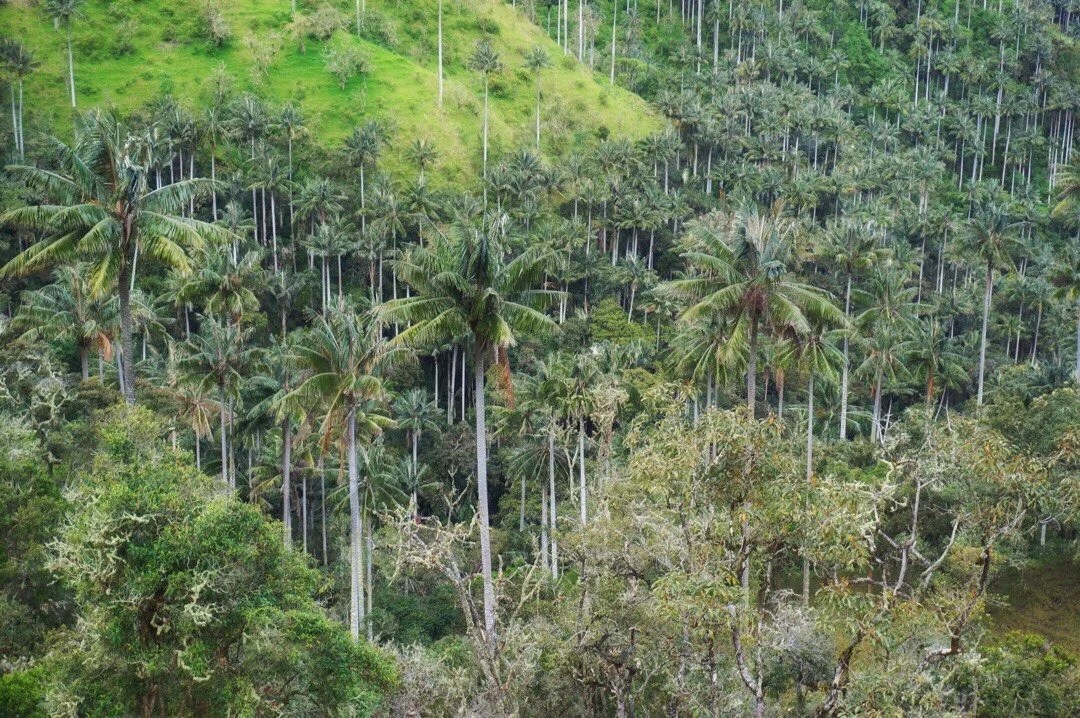
 The slopes were steep, but after a little hike-a-bike, past a gate, and up a steep, muddy hill, we found a perch to pitch our tent for the night.
 We woke to clouds rising over the ridges and up through the valleys.


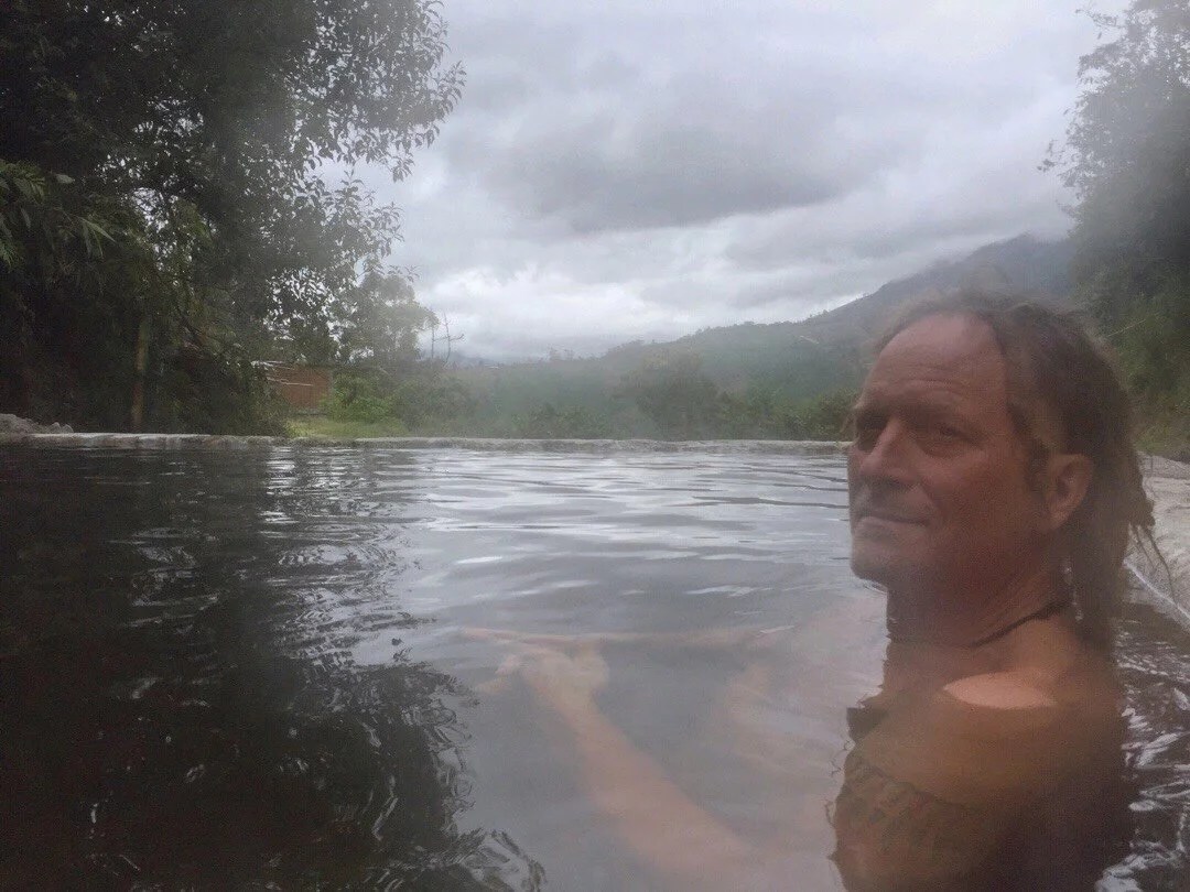
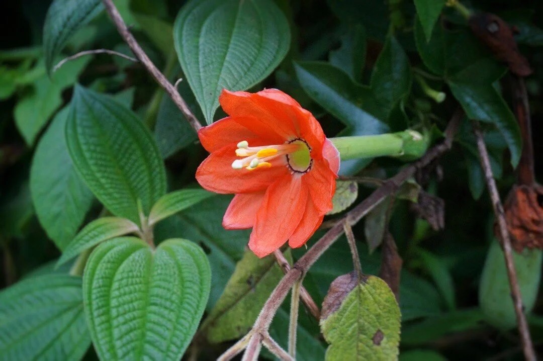 Shortly into the morning hours we stopped for a few supplies in the small town of Toche. Supplies were limited, but we found a place that served coffee and sweet bread, a small tienda that stocked potato chips and toilet paper (and potatoes and onions), and I even saw a sign for a hotel. It was a quiet, peaceful feeling town, but I wondered if we were missing a bigger store somewhere. A few kilometers after Toche we stopped for a soak in the warm springs, Termales Machin, before pressing on, back out to the highway at Ibague.
 ___Sacks of oranges, on the side of the road, waiting for pick up. We’ve seen this a lot with crops like oranges/tangerines and potatoes, where large sacks are left on the side of the road to be picked up, I’m guessing by someone who collects them from all the farmers and then takes them to a store or warehouse to sell.
 Lter in the afternoon we passed through another small Pueblo, Tapias. We had hoped to find a few more supplies or a restaurant, but the store didn’t have much we could use, and we had the unfortunate timing of arriving at the restaurant when all the tables were full of empty beer cans. We were heading in to see what the menu offered when one of the drunk men decided that we were very interesting and would not leave us alone. So we decided to skip lunch and push the last 30 kilometer before dark. After a bit of uphill, a fast series of downhills took us to the highway.As we got closer to the highway we saw several old tunnels, and rode through two long ones out to the highway. At first I thought they were old mining tunnels since several of them butted right up into the ridges, but the young man Neon spoke to (in the photo below) said the one in the photo is an old military bunker. I’m not sure what the real story is, but I think the ones we rode through out to the highway were old train tunnels.
 We had a short moment of panic when got to the highway; it looked like a pretty rough neighborhood and the sun was just about to set, and we didn’t see any hotels. But after a quick search we found a couple of hotels just a few kilometers further on the outskirts of Ibague. They were all sex hotels, sometimes referred to as “auto hotels”, that rent rooms by blocks of hours. They’re usually very nice rooms with lots of space. We found one for 24,000 COP (~8 US dollars) for 12 hours. It was a huge room and had an assortment of sex furniture in it. The best part was there was a restaurant on site with good prices and room service, and bottles of wine for the same price as a store. I love happy endings to long day…
 _____________________You can sign up to receive The Redheaded Nomad’s blog posts in your email inbox; sign up at the bottom of any page on my website: theredheadednomad.comFor more frequent updates, follow me on Instagram at: instagram.com/theredheadednomadYou can also find me on Facebook at: facebook.com/redheadednomad_____________________
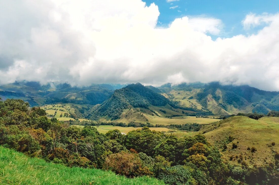
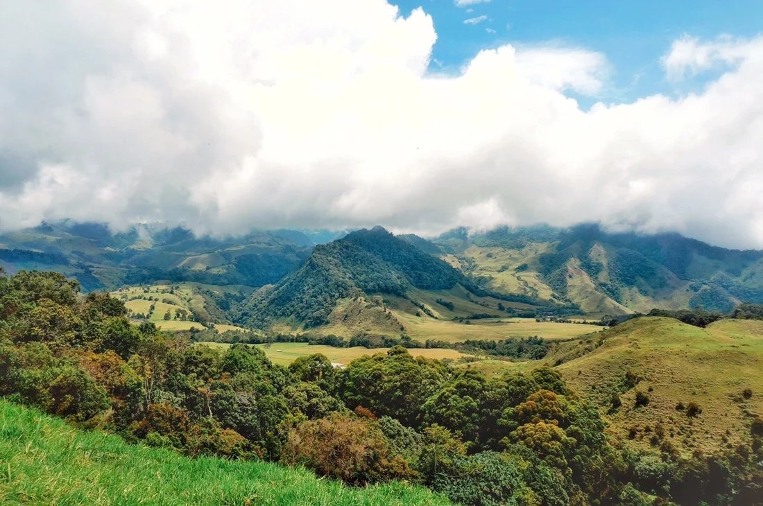
 We arrived in Bogota exhausted from the long, overnight, layover in Mexico City, but our hostel was in a great location, surrounded by coffee shops and eateries with good vegetarian options, including a Lebanese restaurant.
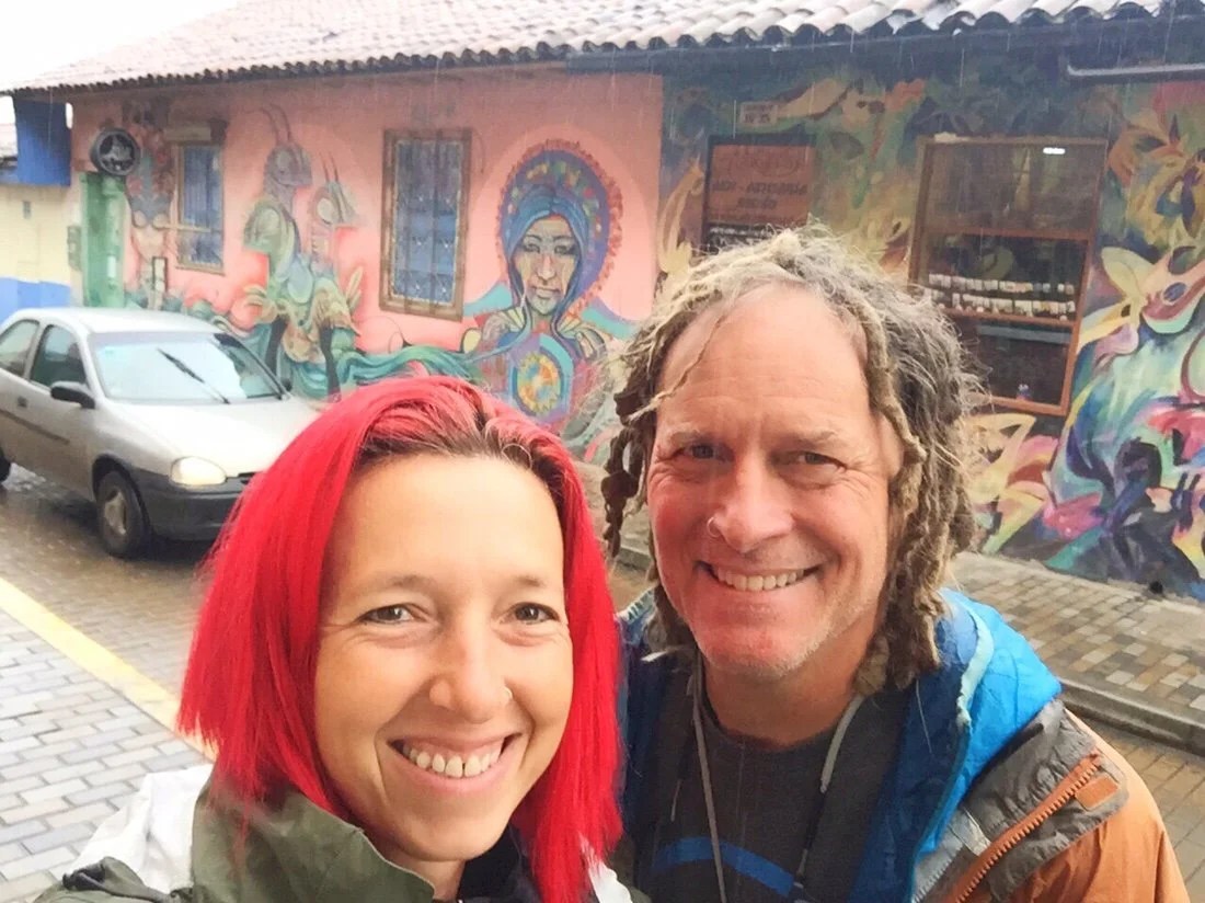
 It only took a couple of interactions for me to realize that the Spanish here was different. It’s fast with a different rhythm, and a little slurred together like French, making it so I can’t understand most of what people say. It almost feels like I’m starting all over again.We spent a couple of days exploring the Candelaria district and its endless street art and murals before heading west into the mountains.


 Before leaving Bogota we met up with two cyclists we had first met way back in Guanajuato, Mexico. We walked around the city, tried chicha, and exchanged the highs and lows of our journeys.[ you can find them on instagram at: instagram.com/enjoyingtherides ]

 The ride out of Bogota wasn’t too bad. The outskirts of the city are crowded, but all the cars, trucks, buses, motorcycles, and bicycles all seemed to flow in a chaotic knot of traffic that worked.
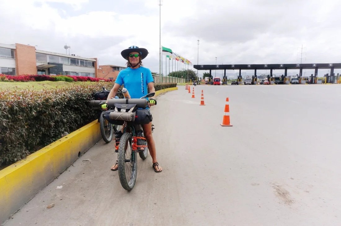 When we got further from the city, the highway turned into a divided toll highway, but motorcycles and bicycles were exempt from the toll and had free passage through a dedicated narrow lane on the far right, marked for “motos y bicis exclusivo”.
 After riding on the toll road for a few kilometers, a two-way bicycle and pedestrian only paved path bordered the highway, which we followed for nearly ~10 kilometers before arriving in Facatativá.So far, the food in Colombia is very different than in Mexico. It usually includes patacon (fried plantains/bananas), rice, arepa (a small, thick, corn patty/cake) and meat, though it seems there is often a veggie option if you ask.
 We stayed in Facatativá to visit Piedras del Tunjo Archeological Park. The park contains huge rock features and petroglyphs. Some of the rocks overhang and lean against each other so much that they form caves, which were inhabited by the Muisca people, I think around ~0 AD, but the information on site was a little unclear.
 The sign said this petroglyph (below) had drawings of tobacco leaves.
 …and this one (below) was of an anthropomorphized frog.


 On the walk back to our hotel, Neon bought some roasted corn. We were both surprised to see that the corn cob was pink. It was definitely the prettiest corn cob I’ve ever seen.

 We found a place that said they had “ensalada de fruta” (fruit salad) so we ordered a couple. It did contain a lot of mixed fruits, but it was also an interesting layering of fruit mixed with cream, then layered with grated cheese, and then topped off with slices of fruit, a couple of pieces of cookie, and a scoop of ice cream. It seems to be a pretty common thing here as we’ve seen them offered in almost every town we’ve ridden through.
 Our plan for the next day was to ride a historic camino out of Facatativá, the Camino Real Honda – Santafé de Bogotá, an old trade route that linked Bogota to the Magdalena River at Honda. But most of the old road didn’t seem to exist anymore, having become unused overgrown train tracks, a line of big power lines, or simply built over with buildings so we continued on the highway until we reached the town of Villeta, where the old camino was still in use.
 After turning onto a dirt road, the Camino Real Honda, we stopped at a creek crossing where the locals were swimming and cooling off from the heat of the day. It was too muggy and humid out for me, but Neon went in for a quick dip.
 Then we began a 1000 meter climb that turned out to be a six hour hike-a-bike. The old road was in good shape, but it was steep and relentless in its effort to ascend the old mountain pass. Just when I was at a low point in my desire to be here, we stopped for a break, I could see a family sitting not too far from us when one of the men walked down the road and handed us two cups full of “jugo de caña”. It was slightly sweet, and a bit fermented, and exactly what I needed to lift my spirits enough to tackle the rest of the climb. It turned out to be a sweet afternoon of bench-pressing our bikes up into the tropically-green mountainside, full of flowering trees, vines, banana trees, sugarcane and near the top—coffee plants as far as the eye could see.
 It was a long day but we made it to the next town, Guaduas, just as the sun was setting. It gets dark early here. The sun has been setting at ~6:00 pm, and it’s dark by 7:00 pm.
 I’ve really been struck by Colombia. Many of the towns we’ve ridden through have that old world charm, like places I’ve been in Europe, complete with umbrella covered seating, outside the cafes. Some places still remind me more of places in Mexico, but others feel more like I’m off the beaten path somewhere in Italy.

 When all else fails, beans and rice are still a favorite for me, though beans are much less common here. I’m still trying find my groove with the food in Colombia. Some towns have great vegetarian options, but others have been a challenge.
 Shortly after leaving Guaduas we climbed over a ridge and got our first view of Nevado Ruiz, way out on the horizon, peeking through the clouds.

 Down the other side we descended, steeply, into the Magdalena River valley where we were ~2500 meters lower than Bogota. It was much hotter, and a little drier too.


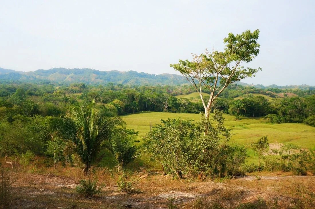
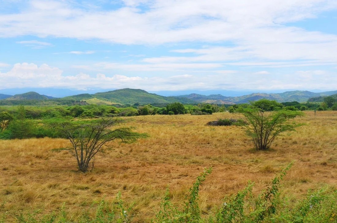 Even though it was drier, it was still quite humid, and I was still dragging a bit from all our plane travels, so we cut the day short when we found a cheap hotel with a pool in Camboa.

 The next day we crossed the Magdalena River and began the ~4000 meter climb up towards Nevado Ruiz.


 We spent the night at an ecotourist farm in Padillo. We both had our first taste of fresh sugar cane. It’s much more juicy than I imagined, and though quite sweet, it’s not as sugary sweet as I thought it would be.

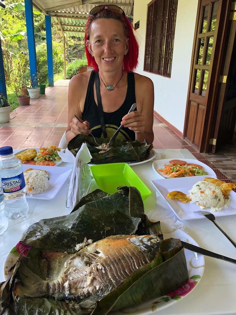
 They fed us sugarcane, tangerines, and fish, all grown on site. I do still occasionally eat fish, so it was a real treat to have whole fish, stuffed with vegetables inside, and cooked in a banana leaf.
 After dinner, we soaked in their fresh water pool and waterfall.

 It was an amazing little place that was surprisingly inexpensive, and a fun change from just another hotel.
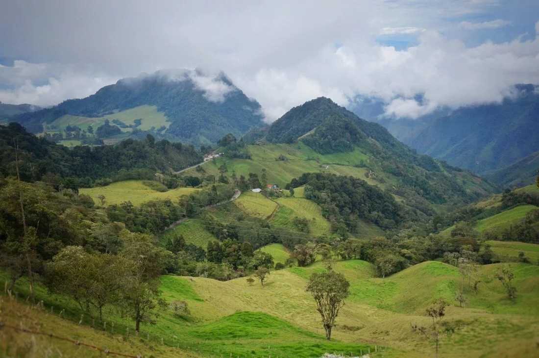
 We left early the next morning. The hills were all covered with coffee trees, up the steep slopes, and all the way down to the road.


 We made another short day of it, stopping early in the town of Libano, where I really began to notice just how many bicycles and motorcycles there are, everywhere we’ve been in Colombia. Seeing all the motorcycles here reminds me a lot of all the vespas in Italy.
 We haven’t found much espresso since we left Bogota, but Colombian coffee, most often referred to as “cafe tinto” is pretty good.

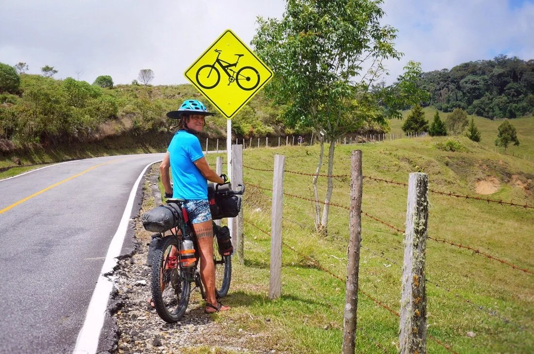 As we climbed up to Murillo, the last town before Nevado Ruiz, coffee plants gave way to more grazing land for cattle, and other plant crops like “tree tomato” and “lulo”.
 Tree tomato and lulo are both solanaceous plants in the nightshade family, like tomatoes, eggplant, and potatoes.Tree tomato (below) is usually prepared as a juice, but is also eaten fresh.
 Lulo (below) is usually prepared as a juice. It is also used as an ice cream flavor, and eaten fresh.

 The town of Murillo was a nice surprise. It’s very small and not fancy, but all the building are colorfully painted, even the toys in the park were very festive.


 We spent a couple of days in Murillo, resting, hanging out in the panaderias in the morning for coffee, and trying Agua panela, before continuing on to Nevado Ruiz._____________________You can sign up to receive The Redheaded Nomad’s blog posts in your email inbox; sign up at the bottom of any page on my website: theredheadednomad.comFor more frequent updates, follow me on Instagram at: instagram.com/theredheadednomadYou can also find me on Facebook at: facebook.com/redheadednomad_____________________
 We headed out of Oaxaca, eager for some miles. The road out of town was a bit crowded, but the landscape seemed to pass by as if we were floating on a “moving walkway”.
 We stopped for a short break in Santa María del Tule to spend a few minutes with the “Tule Tree”, a ~2000 year old montezuma cypress. It is said to be the largest tree in the world in terms of its width, measuring ~40 meters in circumference. I’ve always love old trees; sometimes I think I must have been a Druid in a past life.


 We made it to San Pablo Villa de Mitla, ~50 kilometers from Oaxaca, by lunchtime. We were in flow with time now, making miles like we were being transported by a time machine.
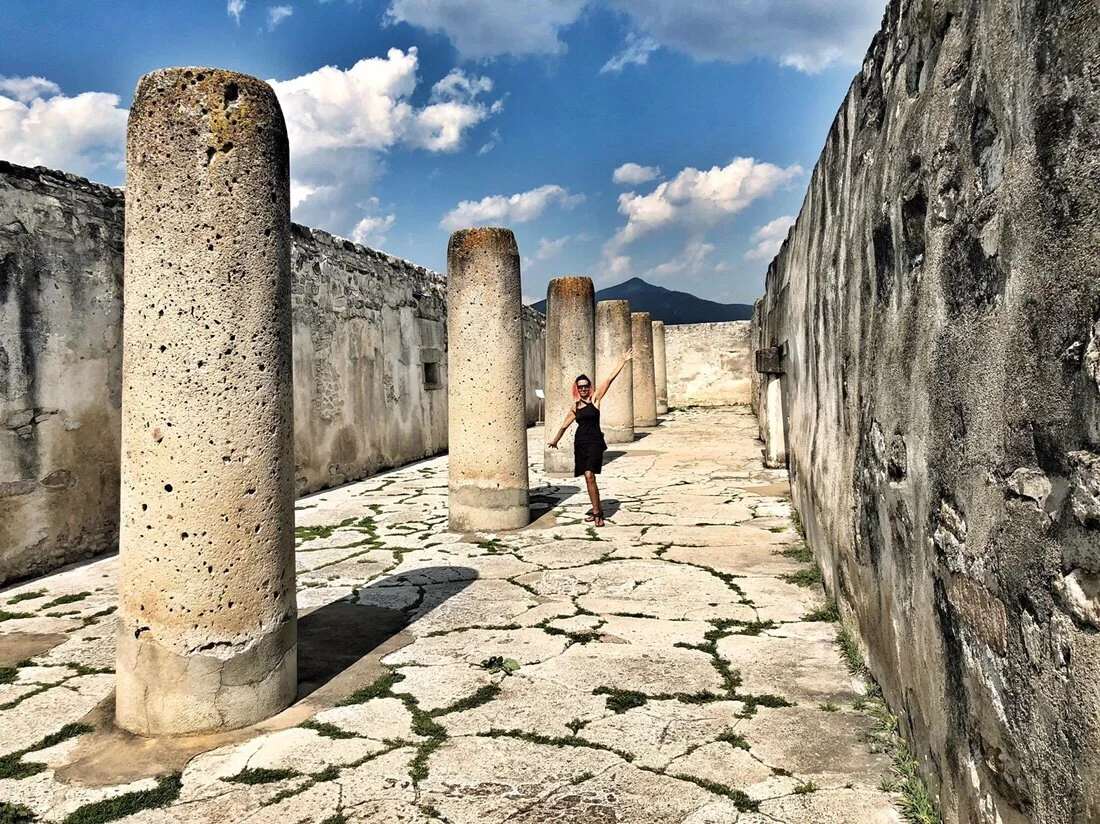
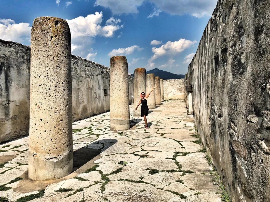
 Mitla is said to be the most important archeological religious site in Zapotec culture. The name Mitla comes from the Nahuatl word Mictlán (the place of the dead). The Zapotec name is Lyobaa (place of rest).
 What makes the Mitla archeological site unique (in terms of architecture) is its elaborate mosaics of cut and fitted stones (without the use of mortar). According to the sign on site, there is evidence of human inhabitance of Mitla as early as ~200 AD.


 Mitla was still occupied when the Spanish arrived in ~1520. The catholic temple was built in the 17th century in one of the courtyards of the Mitla site.


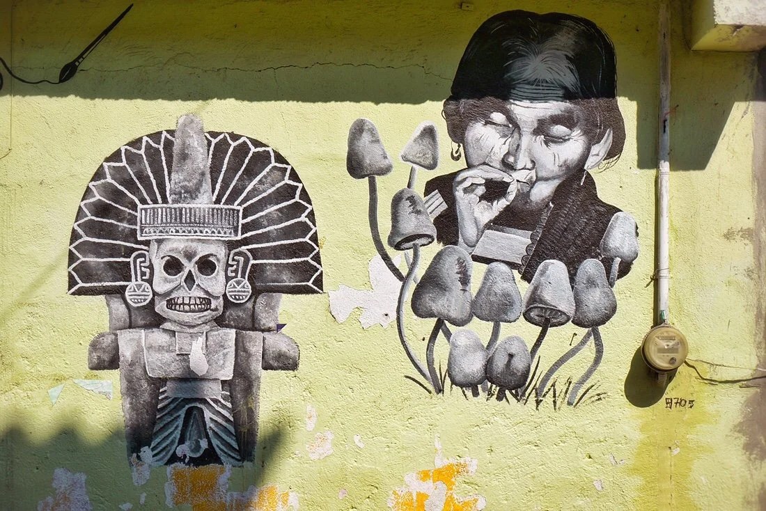
 Mural in San Pablo Villa de Mitla–presumably the woman is a portrait of Maria Sabina, a native shaman skilled in using mushrooms to communicate with god and heal the sick. She was the first contemporary Mexican “curandera” (native shaman) to allow outsiders to participate in the healing rituals.
 We took a day off in San Pablo Villa de Mitla and took a bus to visit Hierve el Agua. Hierve el Agua is Spanish for “the water boils”. The water isn’t very warm; it’s colder than body temperature, but pleasant enough for a short swim on a sunny day. But it sort of looks like its “boiling” where it bubbles up into shallow pools from small springs.
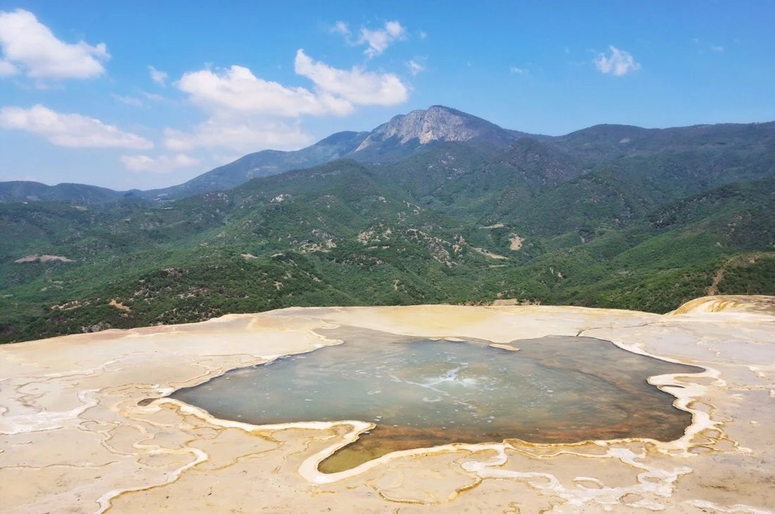

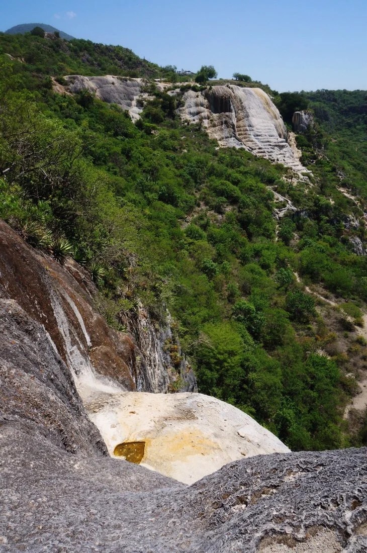
 The “waterfall” rock formations are created by mineral deposits (calcium carbonate, etc) left by the spring water that flows here, much the same way cave stalactites are formed. The area is also of archeological interest due to the ancient terraces and irrigation canals built by the Zapotecs ~2500 years ago. The canals are unique in Mesoamerican history because irrigation was uncommon in pre-hispanic Mexico, and because they are the only example of lined canals.

 Our route followed pavement out of Mitla, climbing higher and higher into the mountains. We made it to the small town of Ayutla by early afternoon. My legs felt like jello from the long fast climb so I was content to hang out in our hotel room for the remainder of the day.
 We rolled out of town early the next morning under overcast skies. The clouds gave way to bright sun sooner than I would have liked.

 The mountains were steep and dotted with small villages.


 We climbed deep into the mountains, then descended ~6000 feet into an even hotter, and steamier, ecosystem.
 Banana trees were abundant, and butterflies followed us as we rode. The green got greener, and the air was so humid that sweat ran down my face and bare skin.


 After a long fast descent, we climbed back up to the town of Quezaltepec where we got a room in a posada for the night. The town was pretty rough around the edges, but we were met mostly with smiles.

 We got an early start the next day, resupplying at a small tienda before continuing our climb deeper into the steep green mountains, covered with tropical vegetation and big trees, and deeper into the native Mixe villages.




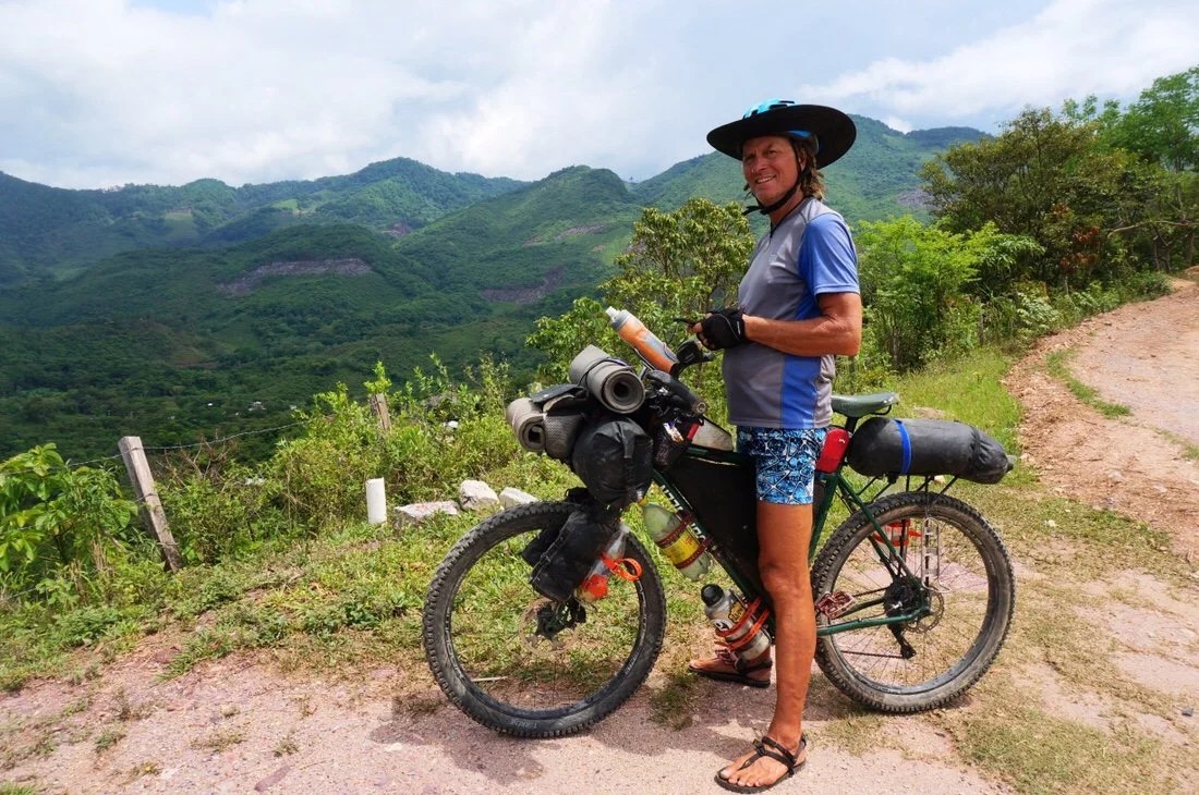 After the small town of Ixcuintepec, the tropical vegetation gave way to a dry-ish pine forest where we found a beautiful ridge to camp on. On our way up the ridge we saw the strangest insects. They flew like a little bird, had wings like a beetle, and walked like a grasshopper (and they were several inches in size). They’re the weirdest creature I’ve ever seen. I tried to get a video of them flying, but they wouldn’t have it. After some online inquiries, it seems they might be some kind of “flugorid planthopper” similar to a “rooster tail cicada”.


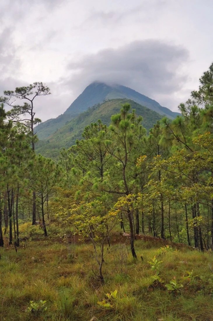


 We headed out early into the clouds. After a short ride on the dirt road we cut down onto singletrack that led down to a river in a steep valley.


 It was a steep hike-a-bike up the other side, which took the better part of the day.


 We made it to the small town of Malacatepec late in the afternoon, stopping at two different tiendas to resupply before heading out of town to find a place to camp.

 …looking back on Malacatepec and the ridge we had headed down, near the high peak in the back center of the photo, to cross the river valley, and where we re-emerged back up the ridge near the small peak behind the town. The fire smoke is from where the locals are burning small plots of land in preparation to plant food crops.
 We found a place to camp out of sight of the road, in tall, wet grass, bordered by dark jungle behind, and with a view of the ridge we had descended that afternoon.
 We woke to a misty cool morning. We spent the day climbing and descending ridges, riding between tropical vegetation and dry pine forests.

 We stopped early and camped on a dry ridge shaded by tall pine trees. By evening we were picking off tiny ticks, and even more by the morning hours.

 We stopped briefly in San Juan Mazatlan for water and a snack. Sara and Oscar chatted us up and fed us, while we cooled off in the shade of a small tienda.
 We had one last, long, hot climb before reaching the town of San Juan Guichicovi where there was a hotel. It had fast wifi and air-conditioning, so we took the next day off, streamed movies, and stayed cool in our tiny room.
 _____________________You can sign up to receive The Redheaded Nomad’s blog posts in your email inbox; sign up at the bottom of any page on my website: theredheadednomad.comFor more frequent updates, follow me on Instagram at: instagram.com/theredheadednomadYou can also find me on Facebook at: facebook.com/redheadednomad_____________________